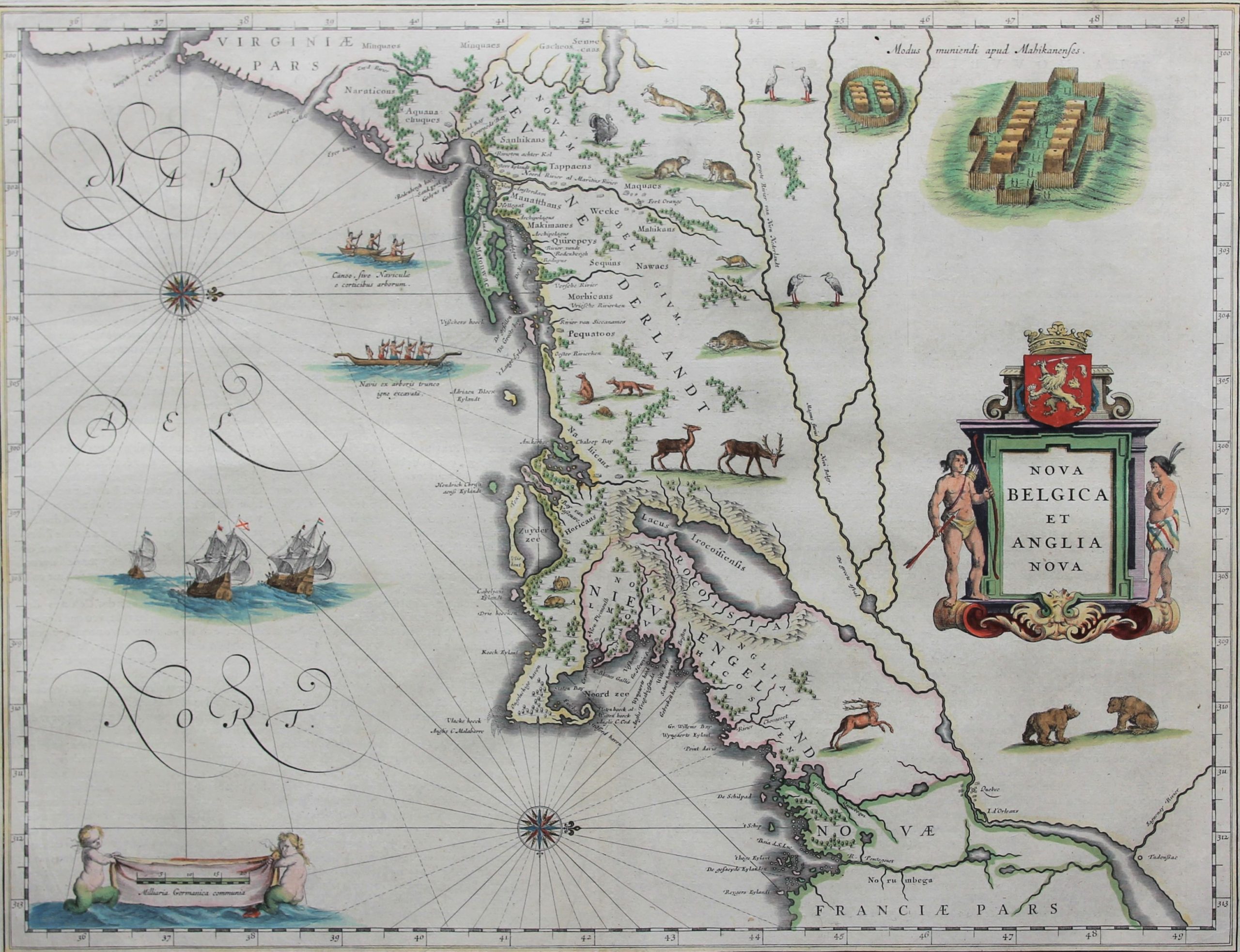
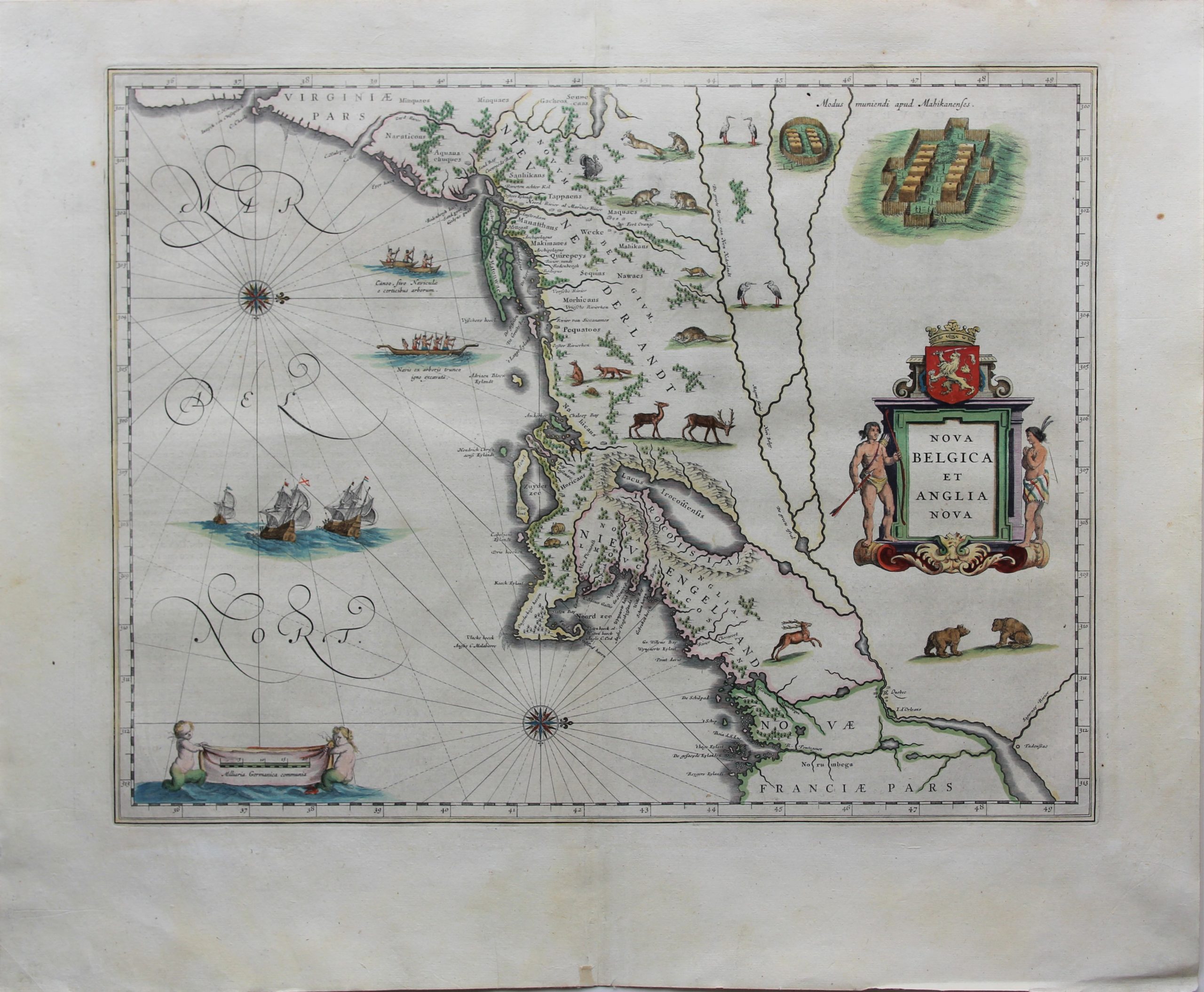
Nova Belgica et Anglia Nova
Nec plus ultra
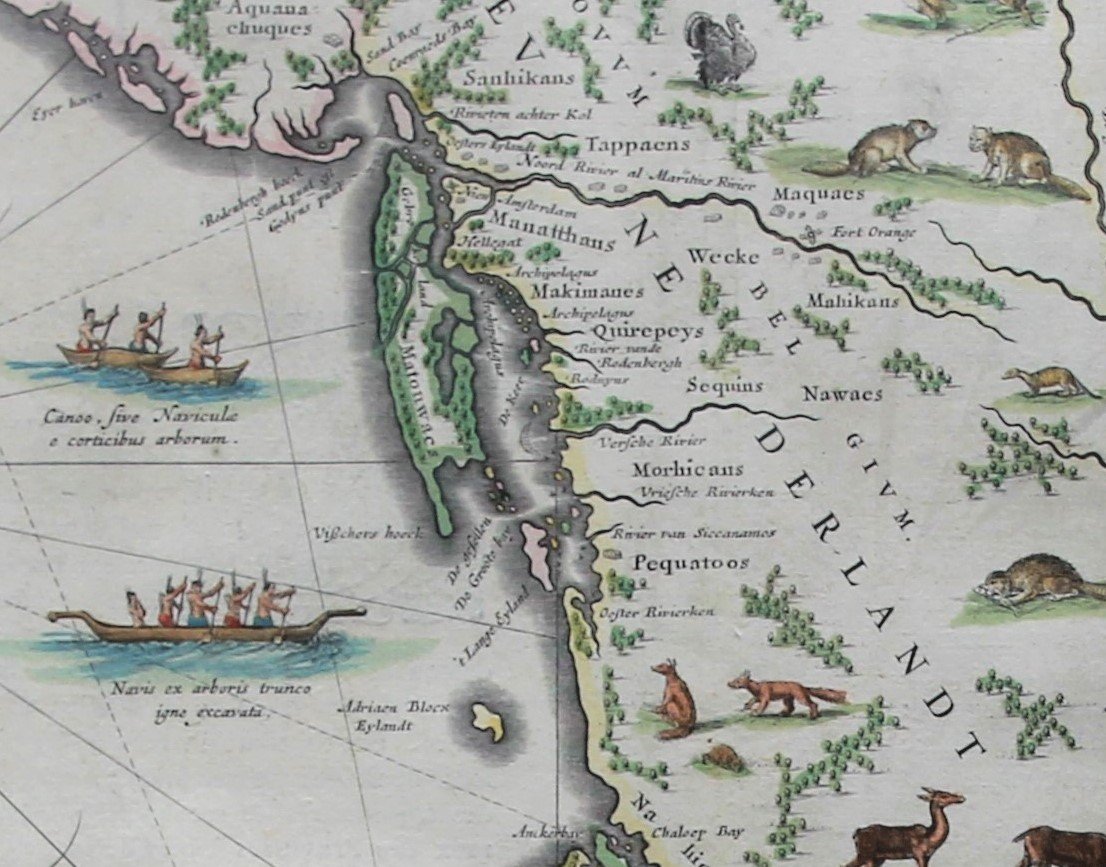
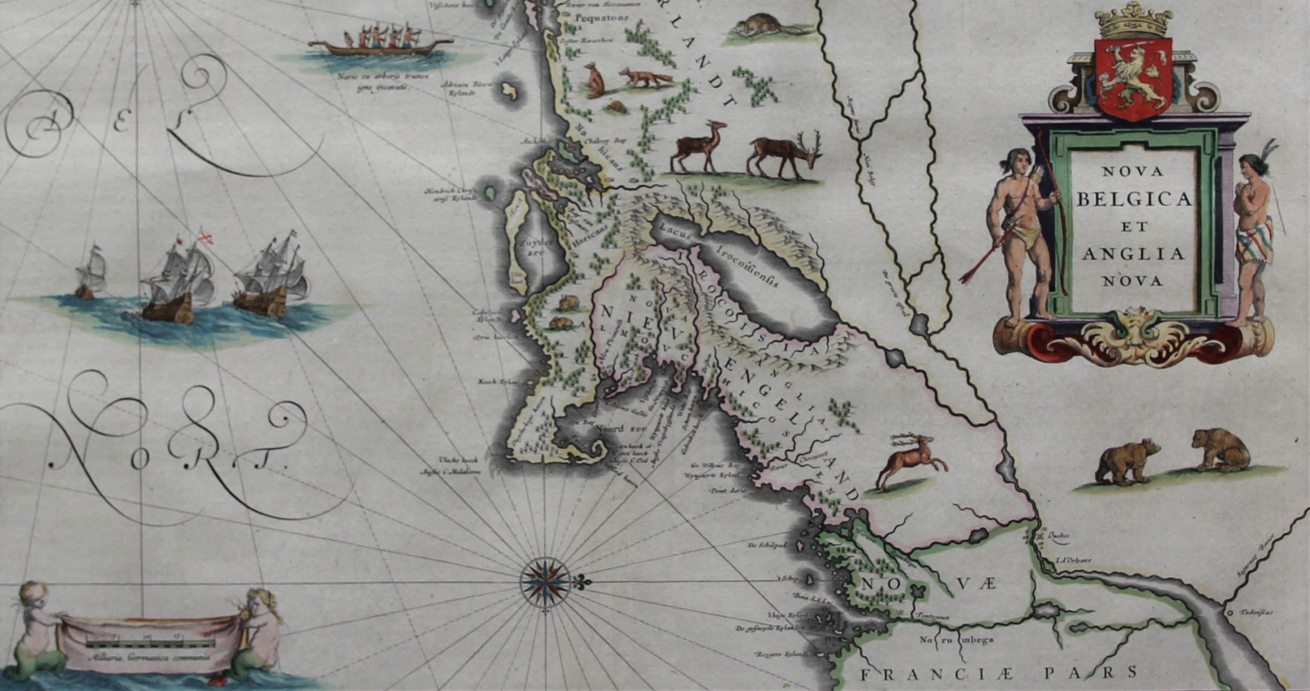
Detail
Date of first edition: 1634 (W. Blaeu)
Date of this edition: 1643-1650 (J. Blaeu)
Dimensions (not including margins): 39 x 50,5 cm
Dimensions (including margins): 51 x 62,7 cm
Condition: Very good. Sharp printing on hard paper. Centre fold as published with second vertical fold. Very wide margins with a few tiny professional repairs at the margin edges of the paper.
Condition rating: A
Verso: text in French
Map reference: Van der Krogt II, 9310:2; Burden 241; Goss (Blaeu) 164; McCorckle 635.1
From: Théâtre du Monde ou Nouvel Atlas; Van der Krogt 2:131:3, page 3
In stock
A unique treasure to discover
Willem Blaeu first published the important map of Nova Belgica et Anglia Nova in his German edition of the Atlas Novus of 1634. This map was published by his son Joan in 1643-1650.
The map has a double source: the map of Adriaen Block (1) from 1614 (2) and that of the Antwerp administrator of the WIC, Johannes de Laet, from 1630. In 1609 Henry Hudson had already explored the region with a view to finding a passage to China. This was followed by three expeditions under Adriaen Block. Ultimately, a permanent settlement would be built on Noten Eylandt (3, present-day Governors Island) under the name Nieuw Amsterdam in 1624, under the leadership of Cornelius Jacobsz May, the first governor of New Netherland. In this area located between the 38th (Cape Henlopen) and 42nd (Cape Cod) latitudes one notices:
- the Inwyck of Chesapeack in Virginiae Pars between C. Henry and C. Charles;
- the Zuyd River (now the Delaware River), where from 1631 the short-lived (not shown on the map) Dutch settlement of Swaanendael was located on the south bank. However, the population was completely exterminated in 1632 by the local Indians, after which the Dutch no longer dared to venture there. After that, the Zuyd River became the southern border of New Netherland with New Sweden for some twenty years (4);
- at the mouth of this river C. Hinlopen (5) (now Cape Henlopen) and C. May (with unchanged name), whose name is taken from Cornelius Jacobsz May;
- the island of Manatthans, named as an island for the first time, with Nieuw Amsterdam on it. In 1626, Peter Minuit “bought” the island from the Manhattan Indians for 60 guilders;
- closer to the ocean Oesters Eylandt, now Staten Island (6);
- the North River (now Hudson) with Fort Orange, built in 1624, which served as a trading post for the fur trade. The settlement of Beverwijck, later Albany, was created near the fort in 1647
- Gebroke Land, the Dutch translation from the Algonquian for “long island” (7, later Long Island);
- De Groote bay, today’s Long Island Sound;
- River of the Rodenbergh, now the river Quinnipiac;
- The Versche River, now the Connecticut River;
- Nieu Plemouth, where the Pilgrim Fathers landed in 1620 with their ship the Mayflower and established the Plymouth Colony (1621-1691) (8);
- on the ocean a canoe of the Pequots (9) (referred to as Pequatoos) who inhabited an area roughly equivalent to present-day Connecticut;
- inland flows the Sint-Laurensrivier, referred to as the Groote river van Nieu Nederlandt, with downstream the French fort Quebec (10) and the still called I. d’Orléans;
- Lake Champlain (referred to as Lacus Irocoisiensis) which is actually north of the Hudson River (so much more to the west); its estuary via the Richelieur River to the Sint-Laurens is correctly indicated;
- in the far north the Riviere Quinebequi (now Kennebeck River, which flows into the ocean just north of Portland), which formed the sparsely inhabited border between Nieu Engelandt and Novae Franciae Pars (11).
Footnotes:
1: He was the first European to draw Long Island (Long Island) and Manhattan as separate islands. He also used the term New Netherland for the first time on a map. In New York Bay he built De Onrust, a ship with which he explored the Hellegat, the East River and the Connecticut River. In 2009, a replica of the ship that is now in Manhattan was built. Blockeiland (off the coast of Rhode Island) was named after him, as the Adriaen Blocks Eylandt on this map.
2: Block, in turn, is obliged to the Champlain map from 1612.
3: The name Noten Eylandt comes from Block, given to it during his 1611 expedition.
4: New Sweden was a colony mainly around the Delaware River with several fortresses, founded in 1638 by Peter Minuit, the discredited third governor of New Netherland. In August 1655, the Swedish colony was captured by Peter Stuyvesant, who integrated the area into New Netherland.
5: After Thijmen Jacobsz Hinlopen, a grain merchant (with Russia), director of the North Company and business partner of Cornelius Jacobsz May for American investments.
6: The first European contact with this island was already in 1524 by the Italian explorer Giovanni de Verrazano under the French flag.
7: Not to be confused with the borough Brooklyn, which is obliged to name the Utrecht village of Breukelen.
8: In fact, the Pilgrim Fathers of the London Virginia Company had obtained a patent to settle at the mouth of the Hudson River. See also map V.5.4.
9: The Pequot War between 1634 and 1638 with the English Puritan colonizer from Plymouth ended their independence. There is a museum in Connecticut dedicated to this Pequot tribe.
10: In the struggle for independence, this fort played an important role in the unsuccessful attack of the American troops on the then British fort in 1775.
11: Only after the French and Indian War (1754-1763) did England gain control of areas north of the Kennebeck River at the Peace of Paris.
