Fossa Eugeniana
by
Willem and Joan Blaeu
A cartographic curiosity
Detail
Date of first edition: 1635 (Willem Blaeu)
Date of this map: ca. 1659-1672 (Joan Blaeu)
Dimensions (not including margins): 38,5 x 50,8 cm
Condition: excellent. Sharp copper engraving printed on strong paper. Old colouring, heightened in gold, minor age-toning.
Condition rating: A
Verso: Blanc
Map reference: Van der Krogt 2, 3790:2.2
From: Nuevo Atlas o Teatro del Mundo, … En Amsterdam, A costa en csa de Jaun Blaeu, 1659-1672. Van der Krogt 2, 641
Price (without VAT, possibly to be added): €400,00 (FYI +/- $444,00 / £356,00)
Unless otherwise specifically stated on this map page, we charge the following expedition costs in euro (unfortunatelly, gone up with Covid, but still too low in reality!):
– Benelux: 40 euro
– Rest of Europe: 60 euro
– Rest of the World: 100 euro
In stock


Fossa Eugeniana as a defense line
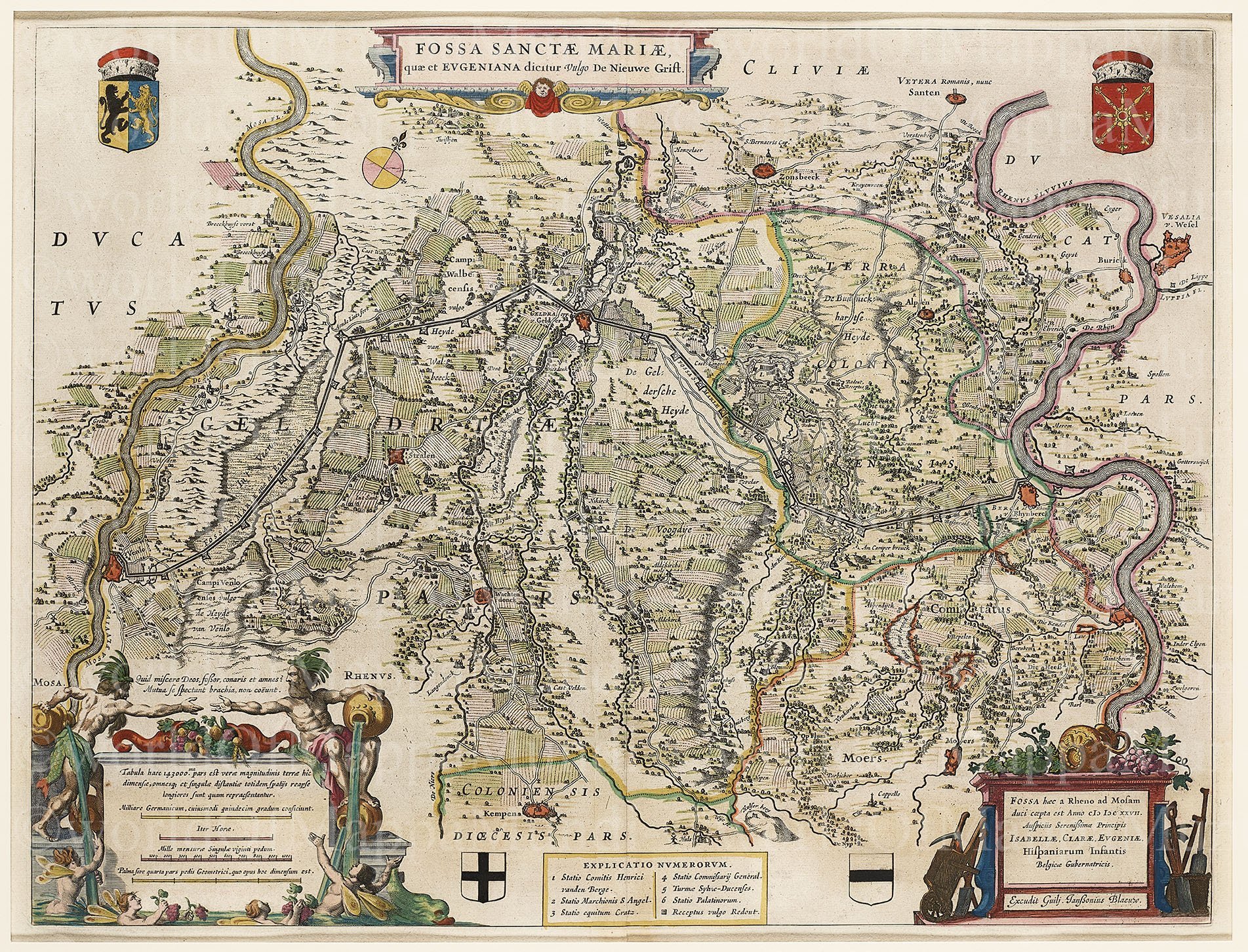
In its defence the Southern Netherlands began construction in 1626 of a defensive channel with 24 smaller fortifications (schansen), officially called the Fossa Sanctae Mariae, better known as the Fossa Eugeniana.
It was also the intention to divert Rhine trade and to provide ships with a safe voyage to Antwerp. The canal was to connect the Rhine and the Meuse at Venlo and was named after Isabella Clara “Eugenia”, Spanish regent; better known as the wife of Albert and daughter of Philip II. Already in November 1626 the fortifications Rheinberg and Gelderen were built and water flowed between the places.
Unfortunately for the Spanish Piet Hein plundered the Spanish “silver fleet” in 1628 and the work was temporarily halted. In 1632 and in 1633 the Staatsen (young Republic) captured respectively Venlo and Rheinberg, which meant the end of the project. One notices a strange deviation towards southern Venlo, which was not originally planned. The canal was supposed to link to the Meuse at Arcken. However, local political forces from Venlo could prevent this from happening.
A failed attempt at finishing the channel took place in 1804 under Napoleon. Late 1990s a walking and cycling route was constructed over 60 km along the old construction.
Full name: Fossa Sanctae Mariae, quae et Eugeniana Dictur vulgo de Nieuwe Grift