


The Eastern Hemisphere – Hemisphaerium Orbis Antiqui
Detail
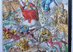
Map 13 of the atlas
Date of first edition: 1660
Date of this edition: 1660
Dimensions (not including margins): 42 x 52 cm
Dimensions (including margins): 51 x 59 cm
Condition: mint. Sharp copper engraving printed on hard paper. Superb original colouring. Wide margins.
Condition rating: A+
Verso: blank
Reference: Van der Krogt 1, HM13:1, state 1.
From: A Cellarius, Harmonia Macrocosmica sea Atlas Coelestis. Published by Johannes Janssonius, 1660. Van der Krogt I, 801A
In stock
Andreas Cellarius (Heidelberg, c. 1596 – Hoorn, 1665) and his Harmonia Macrocosmica sea Atlas Coelestis
Andreas Cellarius enrolled at Heidelberg University in 1613. Then, after several years as a schoolmaster in The Hague, he became the rector of the Latin School at Hoorn around 1637.
His connection with the Janssonius publishing firm dates from around 1645. In this year Jodocus Janssonius, Johannes’s son, published Cellarius’s Architectura Militaris, a work on fortifications. In 1652 the Amsterdam publisher Gillis Jansz. Valckenier published his Regni Poloniae … with 21 maps. These are views of fortifications of towns in Poland.
In 1660, Joannes Janssonius added a celestial atlas to his Atlas Major, the beautiful Harmonia Macrocosmica by Andreas Cellarius. In 1661 the atlas was republished as a separate publication. The plates of the Harmonia Macrocosmica were reprinted (without the Latin commentary) in 1708 by the Amsterdam publishers Valk and Schenk.
The Harmonia Macrocosmica is the most beautiful celestial atlas ever published and is one of the notable masterworks from the Golden Age of Dutch cartography. The first part of the atlas contains engravings depicting the world systems of Claudius Ptolemy, Nicolaus Copernicus, and Tycho Brahe. At the end are star maps of the classical and further constellations.
On this map: Cellarius shows additional small diagrams of climatic zones, armillary sphere, etc… A very decorative surround. This is map 13 of the atlas
Full original title: Haemisphaerium Orbis Antiqui cum Zonis, Circulis, et Situ Populorum Diverso
We also sell the facsimile reprint of this atlas.
Related items
-
Harmonia Macrocosmica, facsimile with commentary
by Andreas CellariusExclusive and complete facsimile with introduction and description of each map
-

Map of the Moon – Tabula Selenographica in qua Lunarium
by Johann Gabriel DoppelmayrPrice (without VAT, possibly to be added): €3 500,00 / $3 885,00 / £3 115,00The unique and famous first comparative chart of the Moon (with double competing nomenclature) from which the names of many lunar features have been derived.
You may also be interested in:

San Adrian (Navarre) – La Sierra de Sant Adrian en Biscaia

Edinburgh

Cuzco (Inca capital)
Rare first edition (block destroyed by fire)
