Menu
Mapping Biblical scenes
Date: 15/06/2021
A The historical context
It comes to no surprise that so many maps of the Holy Land show Biblical scenes.
Since centuries medieval monks were transcribing antique books. Most of these texts were religious and had some connection to Jerusalem and the Holy Land. It comes to no surprise that fantasy drawings were also added to illustrate the content.
This was soon to change. The keystone revolution in book production was the introduction in Europe of the movable woodcut letter to print a text replacing the cumbersome manuscript work. Gutenberg’s press in Mainz was in operation around 1450, but his first well known print, the Gutenberg Bible, was made in 1455: a modest 42-line document on 180 copies.
In the following decades bibles were produced by the thousands. The upcoming of Protestantism not only multiplied the demand for this product (in connection with the use of the local language), but this new Christian faith focused on placing maps as book illustrations and not on just descriptive scenes. In 1526 Jacob van Lieseveldt published the first entire bible in local (Dutch) language. The following themes were repeatedly covered: the Paradise with Adam and Eve, the Tribes of Abraham, the Exodus, Jerusalem, the Holy Land and the Travels by the Apostles.
And so, maps of the Holy Land and Jerusalem appeared in many versions of the bible from the 1520ies onward. Biblical maps became so important that their production was not limited to editors of bibles and religious works. General mapmakers, such as Baptista van Deutecum and Petrus Plancius, started producing biblical maps, which were incorporated in religious works.
However, the attraction to place ‘religious’ maps in other works than just bibles was too overwhelming. And so, they found their way to regular atlases; and so, biblical scenes also found their way to embellish the maps of the mainstream mapmakers. All the important Flemish and Dutch mapmakers incorporated biblical scenes as cartouches and insets on maps: Ortelius, Stoopendaal; van Adrichem, Blaeu and Hondius to name but a few…
B Old Testament
The Old Testament (= +/- Jewish Torah and) describes the Christian religion until the birth of Jesus Christ. Jerusalem plays a key role in the Old Testament. Symbols of the Torah and the Old Testament were then omnipresent on such city maps:
A well know pictures of the Exodus is the crossing of the Red Sea by Moses:
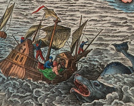
Likewise, Jonas, a prophet in the Old Testament was described in the New Testament where he was thrown overboard and lived for three days and three nights in the belly of a whale. This act is often depicted on the coastline of the Holy Land:
C New Testament
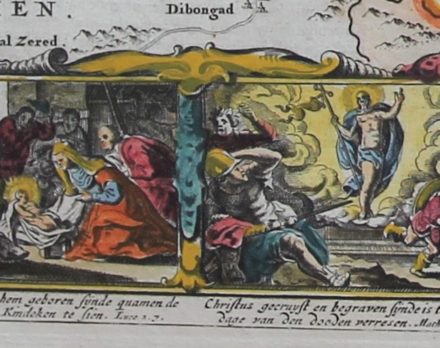
The New Testament describes the life of Jesus Christ: from his birth in Bethlehem to his crucifixion, bury and resurrection. The views are often underquoted with the references to the relevant book of the Bible.
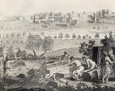
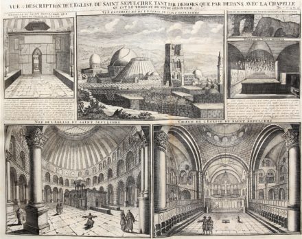
Not only BIblical scenes were ‘en vogue’, also (made up) views of buildings of the Holy Land. In his Atlas historique of 1751 Châtelain shows us, inter alia, Bethlehem and the Church of the Holy Sepulchre:
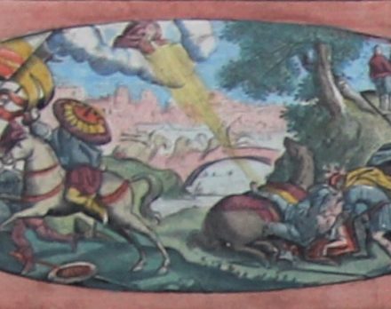
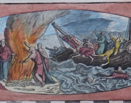
As for the New Testament, the Travels of Paul were a popular theme to be inserted in many books, bibles and atlases. In most cases these maps held engravings of the conversion of Saul and the shipwreck at Malta
D A suivre…
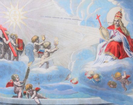
The history continues: The insertion of religious scenes and symbols also found their way. Putti, in all forms and shapes, usually the same format (!) became omnipresent in maps;
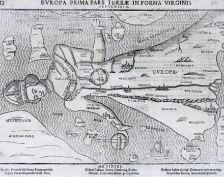
And Virgin Mary reigns over Europe: