Menu
Stunning China cartouches of the Atlas Maior
Date: 30/03/2021
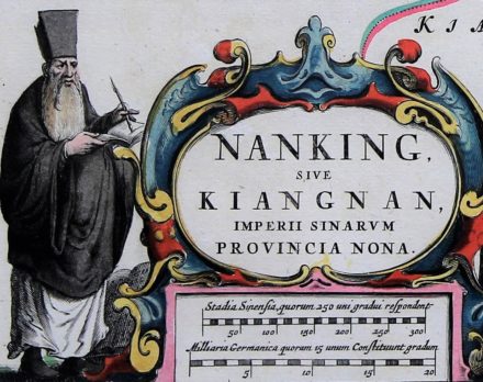
Martino Martini (Trento, September 20, 1614 – Hangzhou, June 6, 1661) was a Jesuit missionary in China. He arrived at the Jesuit residence in Hangzhou in Nanking province (now Hangcheu in Zhejiang Province) in 1643, where he became superior in 1648. During an intermediary period (1651-1657) he went back to Europe to defend the Jesuit point of view on the pro-use of the Chinese Rites in the Catholic Church. When he returned, he started building a church in Hangzhou, where he died in 1661. But on his trip to Europe in 1651, he brought with him sketches of the Chinese mainland and provinces. They would later form the basis of Joan Blaeu’s Asia part of the Atlas Maior. His maps are the first comprehensive geographical information of China in Europe. These accurate maps are full of details on cities, mountains and waterways. Notice the Jesuit on the Nanking map, where Hangzhou was the local HQ of the order.
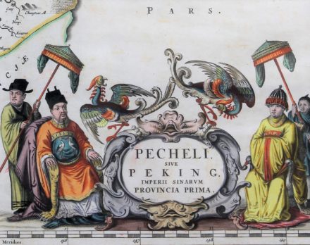
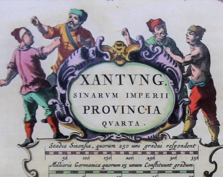
But they also contain some amazing cartouches. In general, map cartouches may contain the title, the printer’s address, date of publication, the scale of the map and legends, and sometimes a dedication. In his case Martini provided supplementary information on the relevant province for his western audience. Imagine the effect in the 17th century on the European bourgeoisie who had never travelled far from home. A new world opened! Each map is embellished with characteristic drawings of the relevant province. Take for example Xantung, the Northeastern province: Martini showed a few strong workmen. Surprisingly, this region still forms China’s industrial powerhouse.
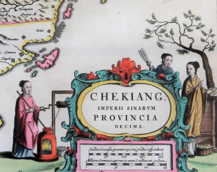
Chekiang was famous for its textile industry. Martini’s vivid interest in the Chinese people and his ability to observe this culture becomes apparent in one of the earliest Western depictions of Chinese cotton-making. The figure to the left winds a cotton thread onto a spindle whilst guiding it out of the top of a small burning furnace with a long stick. On the other side of the cartouche are two female persons who handle small wads/buds of raw cotton – laid out on what looks like circular trays, baskets & drums. One woman appears to be pointing to the branch of what one assumes is a cotton plant in the background.
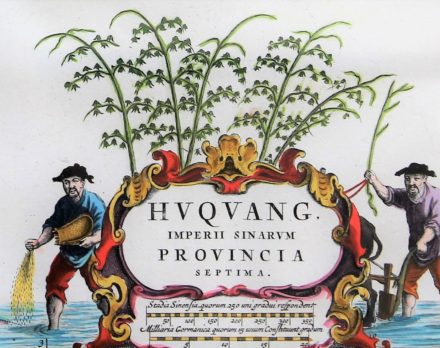
The interior province of Huquang is dominated by Lake Dongting, now relegated to second position in terms of size of Chinese lakes. As the Qing Dynasty split Huquang Province in 1664, the names of new provinces referred to the majestic lake: Hubei meaning “north of the lake” and Hunan meaning “south of the lake”. Dongting is still a flood-basin of the Yangtze and may increase in the flood season by factor 7. The climate shed in China is traditionally marked by the Huai River, south of which lies the Yangtze. The climate here is wet and warm. No wonder that rice is the main agricultural product in this region. Mao grew up near Lake Dongting, where his father was … a rice farmer.
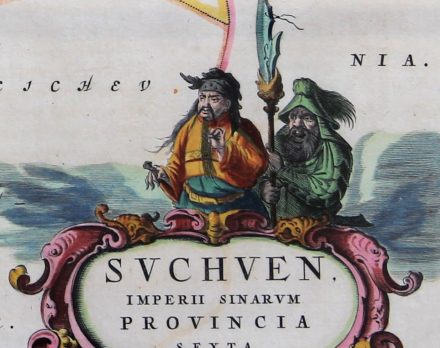
Suchuen formed the western border of Ming China, today also called Proper China. This province is littered with castles and fortresses against possible enemies, shown on the provincial map. Logically, Martini presents some fearsome fighters.
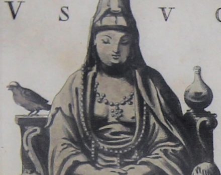
The top left corner of the Iunnan map holds a depiction of Kuan Yin, the Chinese female personification of the Avalokiteshvara, the bodhisattva (future Buddha) of goodness, mercy and compassion, who is venerated more in general by East Asian Buddhists. From the T’ang Dynasty (618 – 907) on, the originally male bodhisattva was often depicted as female. Maybe Martini saw in this female figure a Chinese analogue to Virgin Mary.
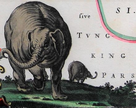
On the same map Martini shows in the bottom right corner two elephants and, surprisingly, the equatorial forest of this region is still home of and renowned for the native Chinese wild elephant. Since 1958, Yunnan has established 11 nature reserves in the tropics. China’s elephants are only found in the extreme south of this province, bordering Burma and Laos.
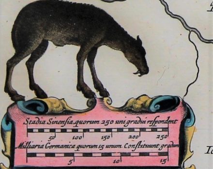
Finally, a wonderous story: on the Xensi map, Martini shows a grazing animal, unknown to him. We are in the mid 17th century! This deer which is characterized by a long tail, wide hooves, and branched antlers, originally lived in northeastern and east-central China. The animal was raised and hunted for imperial use: it was believed that the oil under its skin could prolong the live of the Emperor. Hence it was killed on a massive scale and almost extinct. In the 1800’s a French missionary and naturalist, Father (“Père”) Armand David, observed the animal in one of the last remaining Chinese herds. A number of them (now called Père David deer) were sent to European parks while they perished in China in the early 1900’s. The 11th Duke of Bedford started a special breeding program. In the late 1980’s, his great-grandson donated several deer to China. As of 2015, the wild population in China was about 700 individuals. All Père David’s deer alive today in China descend from the 11th Duke’s original herd.
Cartouches, how nice they are, often learn about life in the past and allow to make comparisons with the present. You can admire all the Martini-Blaeu China maps in full size and detail in our webshop.