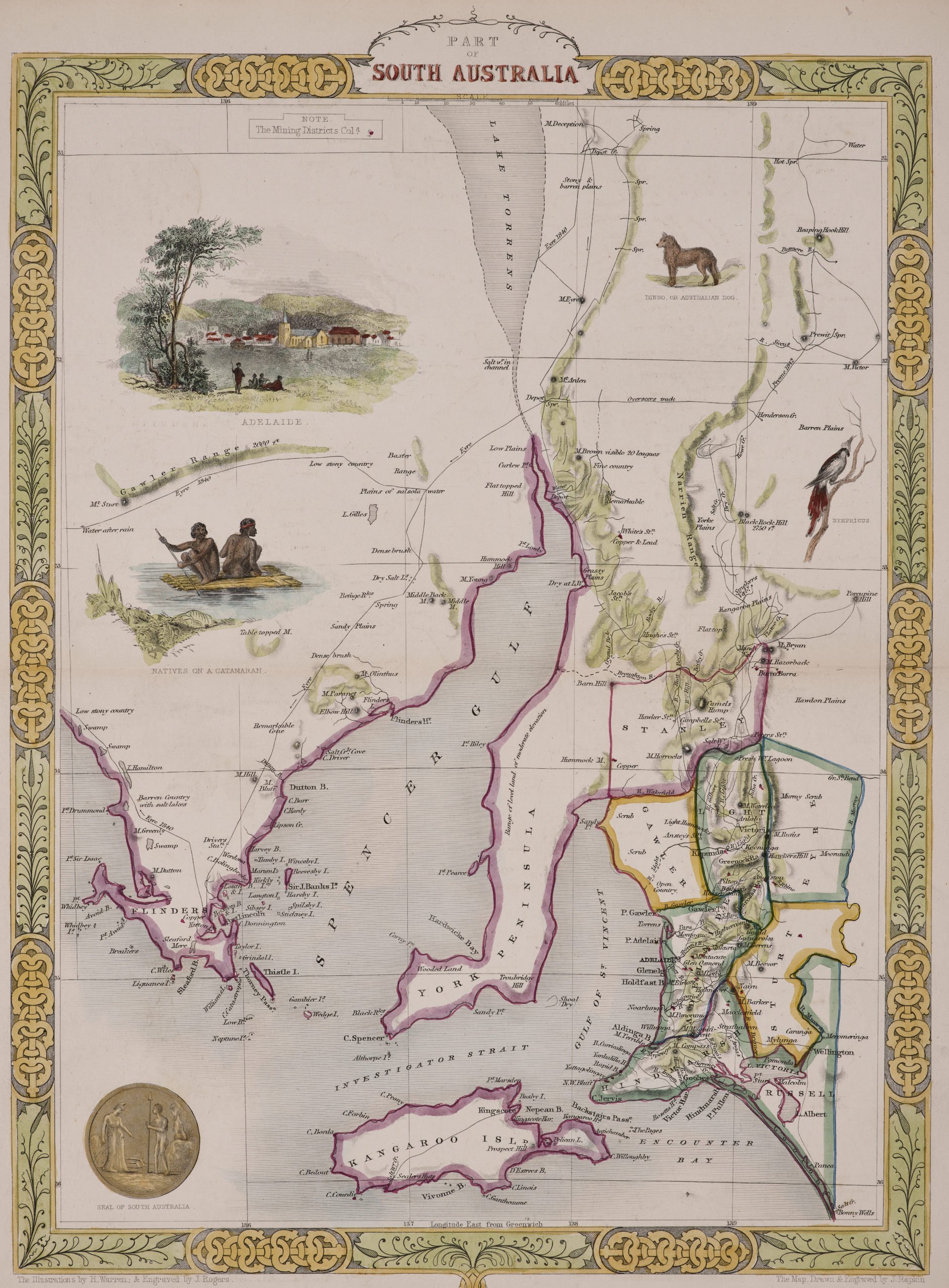
Part of South Australia with Adelaide
by
John Tallis
Detail
Date of first publication: 1851
Date of this map: 1851
Dimensions (not including margins): 28 x 36 cm.
Condition: Original old colouring, excellent. Steel engraving on paper.
Condition rating: A+
From: The Illustrated Atlas, And Modern History Of The World Geographical, Political, Commercial & Statistical. Edited By R. Montgomery Martin and published; John Tallis London, New York, Edinburgh & Dublin. 1851. The illustrations are by J. Marchant and engraved by J.B. Allen. The map is drawn and engraved by J. Rapkin.
Verso: blank
Price (without VAT, possibly to be added): €300,00 (FYI +/- $333,00 / £267,00)
Unless otherwise specifically stated on this map page, we charge the following expedition costs in euro (unfortunatelly, gone up with Covid, but still too low in reality!):
– Benelux: 40 euro
– Rest of Europe: 60 euro
– Rest of the World: 100 euro
In stock


Tallis and Australia
The maps by Tallis are highly valued in Australia, especially the series of the individual colonies. They were the only decorative maps produced of the early colony showing internal detail: the map of Victoria depicts the substantial areas of gold mining, hand coloured in yellow, for example.
The choice of images for each colony was dictated by the “Victorian values” of the day-whilst there was a penchant for the exotic among Europeans and Britons a completely “un-tamed” land was not acceptable to their tastes. The images of Kangaroos and “natives satisfy the exotica” but images of European civilization served as an invitation to the “New Britannia”. Political correctness changes over time!