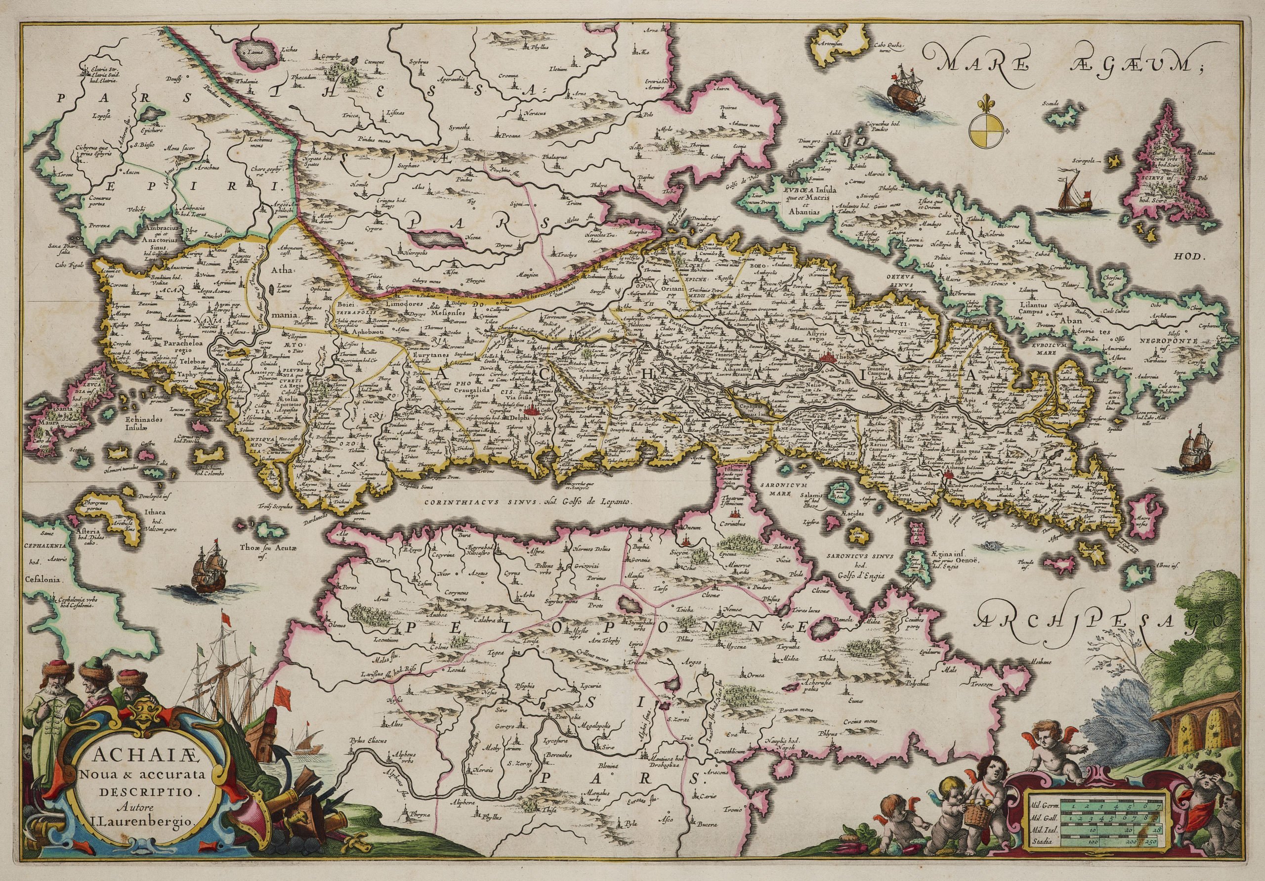
Achaia, Attica and Gulf of Corinth
by
Johannes Janssonius
Detail
Date of first edition: 1650
Date of this edition: 1650
Dimensions (not including margins): 39 x 57 cm
Condition: excellent. Sharp copper engraving printed on hard paper. Centre fold is as published: two small tears (top and bottom) on centre fold not affecting the map. Superb old colouring. Very wide margins.
Condition rating: A+
Verso: blank
Reference: Van der Krogt 1,7835:1. Koeman, Atlantes neerlandici, part II, p. 494, entry [674]; Zacharakis 1982, item 1193.
From: Atlas Novus. Van der Krogt 1:404
Price (without VAT, possibly to be added): €450,00 (FYI +/- $499,50 / £400,50)
Unless otherwise specifically stated on this map page, we charge the following expedition costs in euro (unfortunatelly, gone up with Covid, but still too low in reality!):
– Benelux: 40 euro
– Rest of Europe: 60 euro
– Rest of the World: 100 euro
In stock


Achaia and the Gulf of Corinth by Janssonius
This map was prepared by Johann Lauremberg, a German scholar, mathematician and author of satirical works, who also published under the pseudonym of Hans Wilmsen L. Rost. Lauremberg studied medicine and literature (1613-1616). Lauremberg owes his fame as cartographer principally to his maps of ancient Greece, several of which were incorporated in the Atlases by J. Janssonius (1651), Blaeu (1662), Visscher (1717) and G. Horn (1740). His work in cartography was influenced by the maps of A. Ortelius and G. Mercator, as well as the editions by G.Fr. Camocio, (1571) και Τ. Porcacchi (1572).
The excellent engraving was realized in Janssonius’ press, where engravers D. Van Brenden and S. Rogies worked. The maps are usually accompanied by historical and geographical texts written by Lauremberg himself, in which his erudition shines through.