
The Americas – Americae nova tabulae
The most beautiful map of the continent: the absolutely top unique carte-à-figures …. in time and place
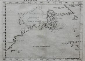
Detail
Date of first edition: 1630
Date of this edition: 1635
Dimensions (not including margins): 41 x 56 cm
Condition: excellent. Sharp copper engraving printed on hard paper. Centre fold is as published. Superb old colouring. Wide margins. This map is framed!
Condition rating: A+
Verso: text in Dutch
Reference: Van der Krogt 2, 9000:2; Burden, 189, State 5; Schilder VI, 16.3a; Campbell, Early Maps, p.24, pl.8.
From: “Toonneel des Aerdriicx Ofte Nieuwe Atlas”. Willem and Joan Blaeu, 1635, Amsterdam. Van der Krogt 2:121
In stock
The Americas in carte-à-fugures by Blaeu
In 1616-1617 the results of Jacob le Maire and Willem Cornelisz Schouten’s voyage around Cape Horn became known. They showed that Tierra del Fuego was an island and not connected to the unknown southern continent. Owing to law suits that were filed between the Australian Company and the Dutch East India Company, Blaeu was legally barred from incorporating this new information on his maps and globes in July 1617. This restriction was not lifted until August of the following year. Blaeu immediately updated this work to include Fretum le Maire and State landt. He also removed the coastline of TERRA AUSTRALIS INCOGNITA east of the title cartouche, mysteriously leaving the name behind. Therefore state 1 of the plate, having a life of at most about eighteen months, is extremely rare. Indeed, as late as 1955 only one example was known.
A third state appeared with a revision changing the name to Blaeu in 1621. Keuning wrote in detail about this period of time and the various forms in which we find his name. The change was as a result of the competition of Jan Jansz and the obvious similarities of their names.This state was to appear through to 1630 without text on the reverse. It also appeared in this form in the Atlantis Appendix. This was Bleu’s first attempt at a world atlas, largely instigated by his purchase in 1629 of a number of Jodocus Hondius’ plates, and in the following years he would experiment with various formats.” (Burden)
Related items
You may also be interested in:

Toledo (Castile) – Toletum

Portrait Abraham Ortelius, by Galle

[Untitled] Japan
Very rare: oldest map of Japan, and … based on Polo’s description

Avignon
Papal city²