Northeastern Coast of America – Tierra Nueva
Detail
Date of first edition: 1561 (Gastaldi 1548)
Date of this edition: 1561
Dimensions (not including margins): 18,5 x 24,5 cm
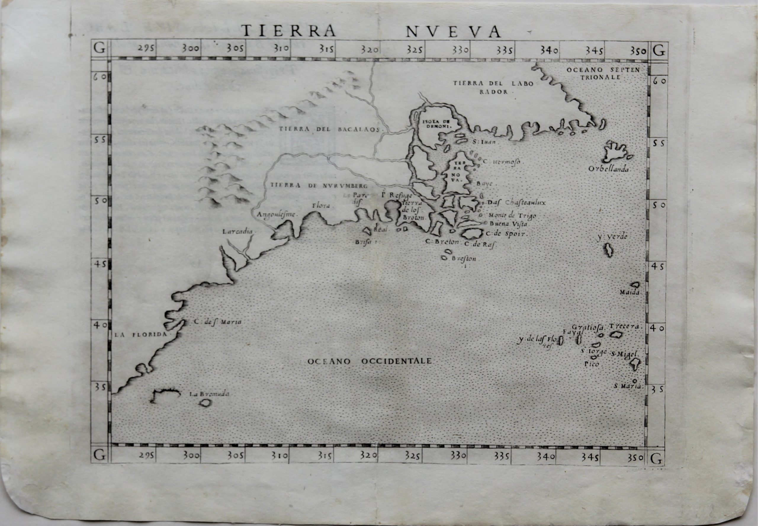
Condition: Very good. Sharp copper engraving printed on paper. Centre fold as published. Wide margins. Rounded bottom corners
Condition rating: A
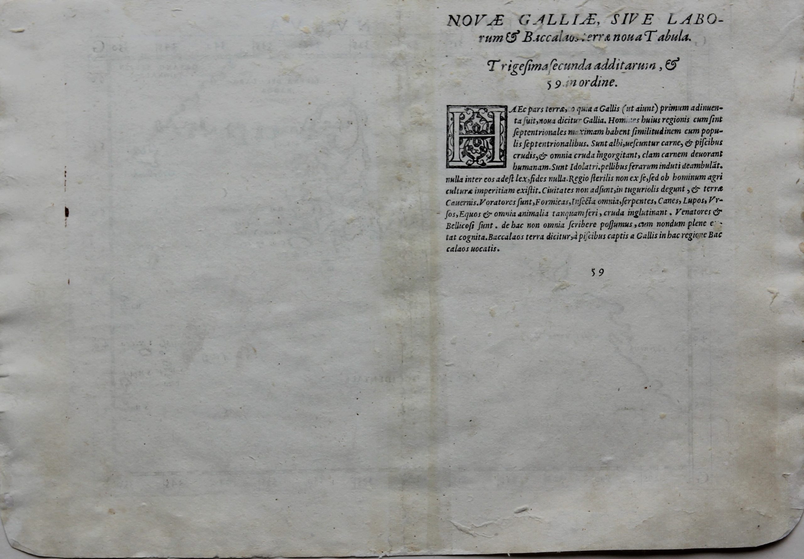
Verso: text in Latin
Map reference: Burden, The Mapping of North America, #16 (Gastaldi) and #30 (Ruscelli); McCorkle, New England in Early Printed Maps, #548.1; Morison, The European Discovery of America: The Northern Voyages, pp. 277-338; Stokes, The Iconography of Manhattan Island, vol. 2 pp. 11-29 and vol. 4 pp. 14-20; Wroth, The Voyages of Giovanni da Verrazzano, pp. pp. 1-216 and plates.
From: La Geografica di Claudio Tolomeo
In stock
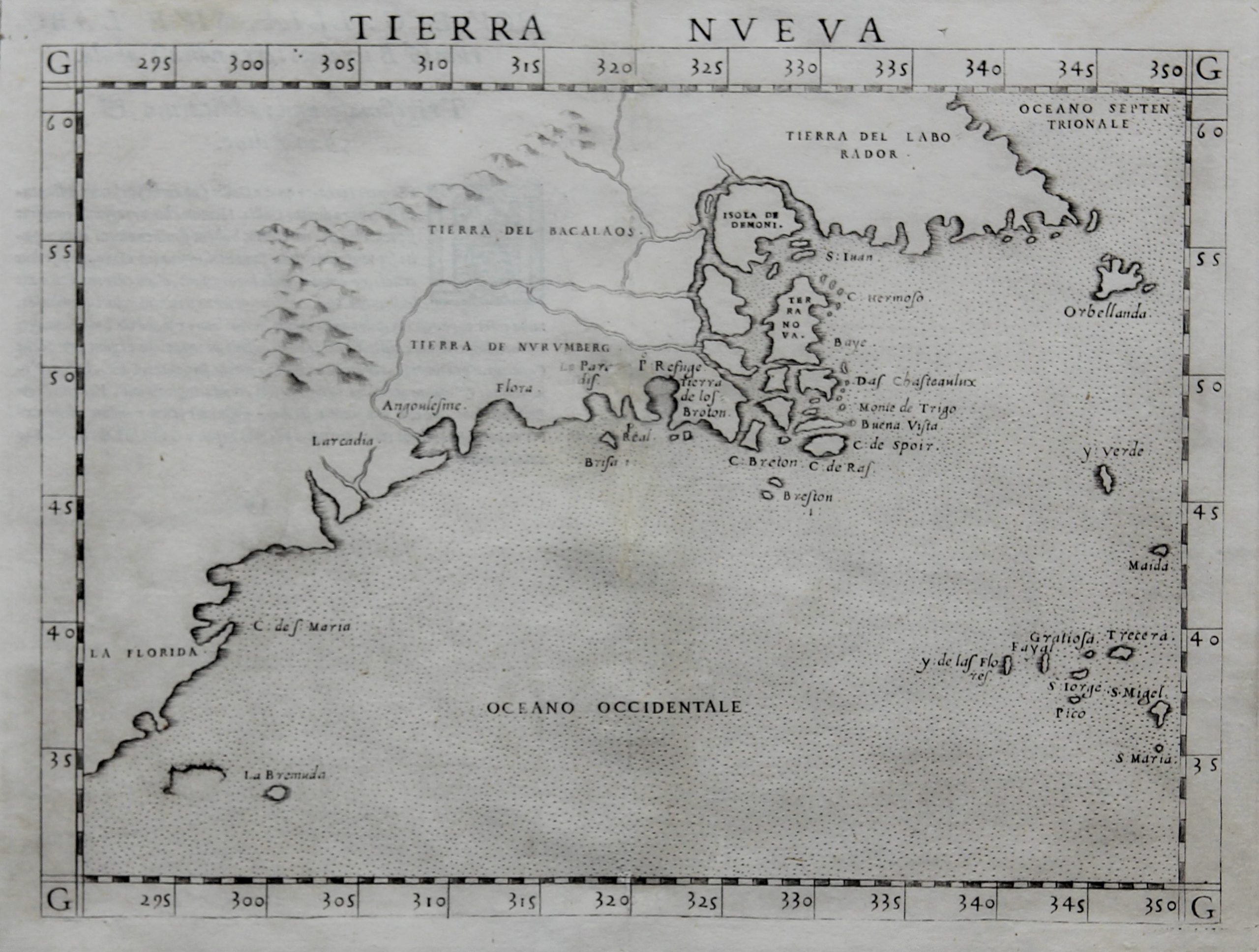
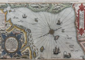
Tierra Nueva by Ruscelli
BURDEN: “Ruscelli’s edition of Ptolemy’s ‘Geography’ included newly engraved copper plates by Giulio and Livio Sanuto. This map of the east coast is an enlarged version of Giacomo Gastaldi’s published in 1548. The nomenclature and cartography are unchanged, with the exception of the depiction of the rivers. Here he borrowed the assumption of Ramusio that the Hudson and St. Lawrence Rivers, as we know them today, were connected upriver. […]
It is one of two [maps] that were engraved on the same plate, printed and then separated for the book. Evidence can be seen from the fact that plate mark of the maps runs off the top of the page.”
ARKWAY: “One of the first obtainable maps to concentrate on the North East coastline of North America and one of the first to name Bermuda.”
SUÁREZ: “Gastaldi has combined data from the Verrazano and Cartier voyages to create this the first printed map devoted to the East Coast of North America. Originally published by Gastaldi in 1548, it is here re-engraved about twice the size by Ruscelli.
When Verrazano scouted the East Coast of North America, he cautiously headed out to sea after Narragansett Bay to avoid treacherous shoals, but in doing so missed Cape Cod and much of the New England coast. Cartier, on the other hand, did not venture further south than Cape Breton. As a result, Gastaldi grafts eastern Canada onto southern New England, with Cape Breton Island sprouting directly from Narragansett Bay. Mercifully, Gastaldi ignores Verrazano’s famous Outer Banks “isthmus” report and spares the coast the distortion that arose therefrom; unfortunately, though, he does not incorporate data from Cartier’s exploration of the St. Lawrence on his second voyage.
Fresh influence from Verrazano is seen in the Northeast, where a new domain makes its debut on a printed map: along with the familiar regions of Laborador and Bacalaos lies Tierra de Nurumberg.The term originated with the voyage of Verrazano, or at least it first appeared on the portolan made by his brother Girolamo. It appears as “Oranbega” on the Girolamo Verrazano portolan (manuscript, 1529). Although Gastaldi’s spelling suggests that he associated it with the German city, it was more commonly spelled “Norumbega” and was probably derived from an Algonquian Indian word which meant something on the order of ‘quiet place between two rapids.’ The term soon came to denote the region of New England. Further south is New York, calibrated about 5 degrees too far north, and called Angoulesme after Verrazano’s designation, Angoleme. The flat shore just up the coast from it, near the name Flora, is Long Island but without Long Island Sound. Near Larcadia are two inlets, probably the Chesapeake and Delaware Bays.”

Northeast America: a place to visit in time by Ruscelli
Ruscelli’s enlarged edition of a crucially important map first issued in 1548 by Giacomo Gastaldi. The Gastaldi prototype was the first printed map to report in any detail the results of Verrazzano’s seminal 1524 voyage, which shaped the modern conception of North America by demonstrating a contiguous coast from Florida to Nova Scotia. It was also the first to attempt to reconcile Verrazzano’s findings with those of Cartier’s voyages to the Maritimes and Gulf of St. Lawrence in the 1530s. As such, it was the first attempt at a regional map of the East Coast.
Ruscelli has retained Gastaldi’s geography and toponymy, with a few exceptions: The Hudson and St. Lawrence Rivers have been extended and joined, a range of mountains has been introduced inland, and hitherto unnamed islands in the Gulf of St. Lawrence have been assigned the names “Isola de Demoni” (“Isle of Demons”) and “Terra Nova.”
This map is most remarkable for its depiction of “Tierra de Nurumberg” (more commonly, “Norumbega”) extending over the region we now know as Nova Scotia, New England and the mid-Atlantic. Eight locations are identified named, and we give these names and likely modern identities below, running roughly from southwest to northeast.
While the map presents some of the most advanced geographic knowledge of its time, it can hardly be called accurate. Most striking is a massive sin of omission: Narragansett Bay (“Refugio”) is shown adjacent to Cape Breton, with no sign of the coastline of Massachusetts and Maine.
This is the first state of the Ruscelli edition, with the plate mark extending off the top of the sheet.
The map’s place in the history of cartography: Gastaldi’s dueling protoypes: In 1525 the Portuguese Estevan Gomez sailed along the East Coast in the service of Spain, seeking like Verrazzano a passage to Asia. Reversing Verrazzano’s route, however, Gomez sailed north-south, traversing the Maine coast and circumnavigating Massachusetts Bay-the very region missed by Verrazzano as he stood off from the shoals off Cape Cod. For his part, after rounding the Cape Gomez was forced by these same shoals to give the coast a wide berth and sailed straight from thence to a point south of New York–thereby missing the coast Nantucket to New York and probably well beyond.
The results of the Gomez voyage appeared on the Universale, a world map published in 1546 by none other than Gastaldi. Contra the Tierra Nueva, the Universale omits any sign of Verrazzano’s discoveries, in particular the ” Lost Coast” between Nantucket and New York. The Universale also shows-again, unlike the Tierra Nueva–the long sweep of the Maine and Massachusetts coastline, culminating in the unmistakable promontory of Cape Cod ( “C. de S. Maria”). According to Wroth, the two maps were produced concurrently. If so, Gastaldi was clearly a man untroubled by the hobgoblin of consistency.