


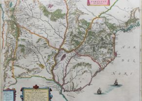
Guiana sive Amazonum Regio – Guyana, Suriname, Trinidad and Tobago, Mouth of the River Amazon
with Lake Parime
Detail
Date of first edition: 1630 (Willem Blaeu, Atlantis Appendix)
Date of this map: 1634
Dimensions (without margins): 37,2 x 49,2 cm
Dimensions (including margins): 45,3 x 57,6 cm
Condition: Excellent. Sharp copper engraving. Centre fold as published. Very wide margins. Old bright coloured.
Condition rating: A+
Verso: text in German
Map reference: van der Krogt, 9830:2.2
From: Atlas Novus; Van der Krogt 2:131
In stock
Guiana (Guyana, Suriname, Trinidad and Tobago)
This decorative map of the Guianas , Lake Parima (Parime Lacus), and the route to El Dorado was Initially issued in 1630 (with some variants were published well in to the 1660s). The map covers from Isla Margarita and the Orinoco Delta eastward as far as Tampico and southwards as far as the Amazon River.
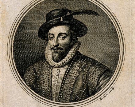
This region of South America generated considerable European interest in the early 17th century following the publication of Sir Walter Raleigh’s fascinating ‘Discovery of the Large, Rich, and Beautiful EMPIRE Of GUIANA .’ Raleigh’s expedition traveled down the Orinoco River in search of the Kingdom of El Dorado. Today we know that El Dorado did not exist, but was rather an amalgam of very real tribal traditions and the European lust for gold. Nonetheless, in the 16th century, tales of El Dorado were common conversation along the port cities of the Spanish Main. Having explored a considerable distance down the Orinoco, Raleigh’s expedition found itself mired in a remote tribal village at the onset of the rainy season. While waiting for an opportunity to return north, a trading delegation arrived. At this time the dominate trading empire in the Amazon were the Manoa, who, though based near modern day Manaus, pursued trade routes to from the foothills of the Andes to the Amazon and Orinoco Deltas.
While the rainy season prevented Raleigh from moving forward, for the Manoa it had the opposite effect. The heavy rains inundated the vast Parima flood plain creating a great inland sea, consequently opening an important trade connection between the Amazon and Orinoco Rivers. When the Manoa arrived, Raleigh and his men noticed that they had various golden trinkets for sale. This was apparently enough for Raleigh to deduce that they must indeed be from the hidden kingdom of El Dorado. When Raleigh asked where the traders came from, the locals, with no common language with which to engage Raleigh, could only explain that they traveled across a great water and were from Manoa. Raleigh’s presumptuous narrative inspired many early cartographers to map this massive lake, with the city of El Dorado or Manoa on its shores, in the unexplored lands between the Orinoco and Amazon River basins.
Please also note (clearly visible on the third picture) the Duyvels Eylanden, off the coast of (French) Guiana. This was Devil’s Island, the French penal colony of Cayenne. Its most famous prisoner was Alfred Dreyfus, unjustly convicted of treason on 5 January 1895. Émile Zola’s “J’accuse” was based on the Affaire Dreyfus.
Related items
You may also be interested in:

China, Tartary and Japan
The first modern map of China printed in Europe

Chester – Cestria vulgo Chester, Angliae Civitas

Toledo (Castile) – Toletum

Avignon
Papal city²