


Typus Orbis Universalis 1550
Detail
Date of first map in Cosmographia: 1550
Date of this map in Cosmographia: 1550
Dimensions (without margins): 28 x 38 cm
Condition: Very good copper engraving. Clean and attractive colouring. Nicely framed in mahogany. Left bottom corner: initials DK, of David Kandel, the German Renaissance engraver of this map.
Condition rating: A+
Map reference: Shirley # 92
From: Cosmographia
Comment: as mentioned above, at this moment still in nice Mahony wood framed
In stock
Typus Orbis Universalis, an iconic map of the world
Fine example of the second edition of Münster’s map of the world, one of the most recognized and influential world maps of the sixteenth century. Today, it is one of the earliest obtainable world maps. This example is from the second woodblock, which featured in editions of Cosmographia from 1550 with significant revisions from the first edition.
Münster here adds to the contemporary confusion over Taprobana and Ceylon. He depicts a Sumatra-shaped Taprobana on the west side of the Indian subcontinent, while Java is in the approximately correct size and position of Sri Lanka. Taprobana was what the Greeks had called Sri Lanka, but late-medieval and early modern geographers also applied the toponym to Sumatra and a phantom island. To add further to the confusion, farther south is Calensuan, which is spelled as Callenzuan on Waldseemüller’s 1507 world map and Calensuan on Juan Vespucci’s 1524 world map. The origin of this island is unknown, but it may too be a corruption of Ceylon, or Sri Lanka.
Münster seems to have hedged his bets and combined the various hypotheses while also placing the East Indies farther west than they really are. He also includes Gilolo, today known as Halmahera, the largest island in the Maluku Islands in Indonesia. The triangular island Porne denotes Borneo.
North America is broken up, with the bulk of the continent at the left and the west coast appearing briefly on the right side of the oval projection. Münster is non-committal as to the continuity of North and South America; an unbroken Central America is implied but is not clearly shown thanks to the curve of the projection.
Interestingly, all of North America is called Terra Florida. Also of interest, one of the main differences between this second state and the first is a lack of labels in North America. The first edition included Francista, a reference to the French efforts in the northeast, and the island of the Bacalhos, i.e. bacalao or salt cod, a reference to the Basque fisherman seeking cod in the area. Finally, a note in the northwest on the first edition explained that here lies a strait to the Moluccas, a hopeful reference to the Northwest Passage. No such ideas are shared on this second edition.
The map is richly embellished with a dozen wind-heads blowing their gales from a cloud border. The blowing cherubs do not intrude into the oval of the projection, as they did in the first state. The other easily noticeable change is the inclusion of the letters DK in the clouds in the lower left corner. These are the initials of the engraver, David Kandel.
Sea monsters frolic in the southern oceans, where no large continent is hypothesized to hide. Instead, a small unlabeled landmass lies south of the Straits of Magellan, which were discovered less than two decades before this map was produced. Each ocean is labeled with a text block, made by inserting metal type into the woodblock, and this map contains one of the earliest naming of the Pacific Ocean (Mare Pacificum).
Related items
-
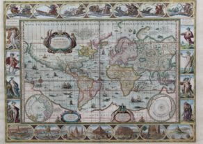
Nova Totius Terrarum Orbis Geographica ac Hydrographica
by Willem BlaeuPrice (without VAT, possibly to be added): €15 000,00 / $16 650,00 / £13 350,00Magnificent carte-à-figures
The most beautiful atlas worldmap ever
-
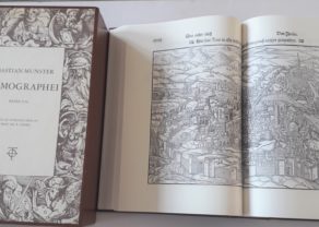
Cosmographei by Münster, facsimile with commentary
by Sebastian MünsterA nice working tool on Münster’s Cosmographei
You may also be interested in:

Edinburgh

Chart of the Gulf of Finland

Scotland – Nova Scotia
A nice map of Scotland

Münster’s Geographia
The first edition of this map debuted in Münster’s revised edition of Ptolemy’s Geographia published in 1540 (with later editions in 1542, 1545, and 1552). Münster wished to improve on the Latin translation of Willibald Pirckheimer with corrections by Servetus from 1535. Rather than work from Latin, Münster translated freshly from a Greek edition. The work contained 27 maps of Ptolemy’s world, the ancient, and 21 of Münster’s, the modern.
The work is known especially for the world map, as well as for the influential decision to feature a map for each continent, a concept later adopted by most atlas makers. The world map, made from a woodblock, was used in the four editions of Münster’s Geographia and the pre-1550 editions of his Cosmographia.
Münster’s Cosmographia and this map: editions
This second edition, from a new woodblock, featured in editions of Cosmographia from 1550. All of these editions were printed in Basle, with the exception of two Italian editions printed in Venice (1571) and Cologne (1575), but using the same block. The map featured in the following editions:
1550 Latin and German
1552 Latin and French
1553 German
1554 Latin
1556 German and French
1558 German and Italian
1559 Latin
1560 French
1561 German
1564 French
1567 German
1568 French
1569 German
1571 Italian (Venice)
1572 German and Latin
1574 German
1575 Italian (Cologne)
1578 German
The Basel editions from 1588 onwards contain a new world map, published by Sebastian Petri. Petri was the son of Heinrich Petri, who was Münster’s son-in-law and the publisher of the Cosmographia from 1552.