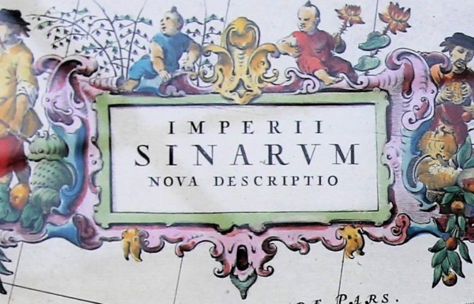
Stunning China cartouches of the Atlas Maior
Read more
SOUTH EAST ASIA by Jodocus Hondius
In 1606 Jodocus Hondius produced two splendid maps of South East Asia.
Insulae Indiae Orientalis
The sea-map shows the islands of Southeast Asia: from the Philippines to Timor and from Sumatra to New Guinea. The title cartouche in the upper right corner covers part of Indochina. It refers to both Marco Polo and Francis Drake!
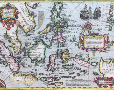
The map was first published in the so-called Mercator-Hondius atlas of 1606, but it was Hondius’ own creation (Mercator had died in 1594). The map is famous for being one of the few to refer to Francis Drake’s presence in these regions during his world circumnavigation. In 1584 Hondius had left the Southern (later Spanish) Netherlands for London where he met Drake. On the south coast of Java he mentions “Huc Fransiscus Dra. appulit”. It is one of the few regional maps to mention Drake’s landings here. The major city on this island is Bantam. Batavia is not listed because it did not exist yet.
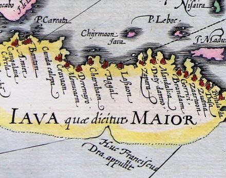
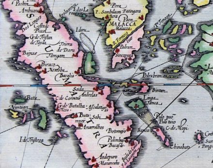
Marco Polo had discussed Iava Maior (Jave la Grande) and Iava Minoris (Jave mine) in his travelogue. These islands were identified as Java and Sumatra, respectively.
In his Travels Polo calls Iava Maior (Java) the largest island in the world. We know, of course, that Sumatra (Iava Minoris) is larger than Java. And actually, Hondius more or less shows this on the map. However, in the previous geographical discussion about the mythical Southland, Java was supposed to be literally linked to it … and it was therefore considered as being much larger than Sumatra. Hence, old and confusing naming! But Hondius doubts this idea and he makes a fuss by depicting the south coast of Java with dots.
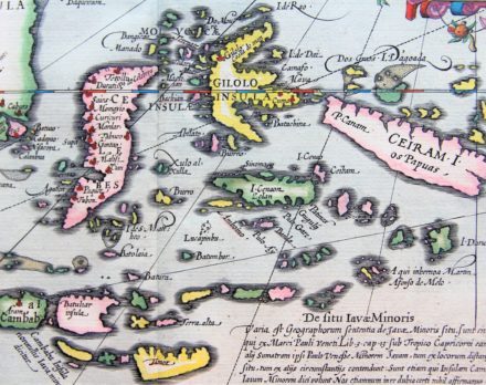
The Indonesian archipelago has more than 13.000 islands. Errors on this old map are therefore quickly forgiven. Just east of Java Hondius places Bali. At the bottom (centre fold) Hondius marks Timor. Logically, Hondius clearly struggled with the shape of Celebes (Sulawesi) and Gilolo (Halmahera) and with the location of Ceiram.
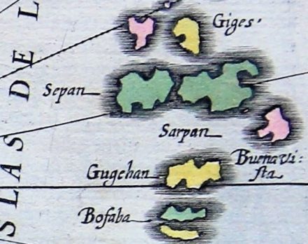
A quarter compass rose is tucked into the lower left corner, which is connected with rhumb lines to a complete compass rose in the eastern portion of the map. Notice the small islet of Saia Vedra just east of the full wind grid. This name refers to the crossing of Álvaro de Saavedra Cerón who, on the orders of his uncle Hernán Cortés, made a sea voyage from Mexico to the Moluccas in 1527. At the top right, a Dutch warship fights a rubber with an English counterpart. To the right of this sea-battle it is the huge archipelago of Islas de las Velas (now called Mariana Islands). During WW II fierce fighting took place on its islands of Saipan (Sepan) and Guam (Gugehan).
The Philippines, which the Spanish claimed as a colony in 1565 are clearly shown. In line with then existing cartography, Nova Guinea is depicted far too large.
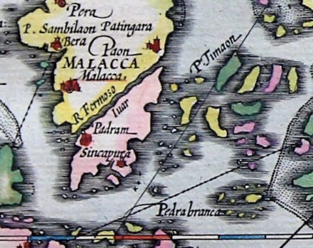
On the Asian mainland, Camboia and Malacca are noticed. The epitome of early seventeenth-century cartographic quality testing: separated from Malacca by the R. Fermoso (now the Strait of Johor) lies a place called Sincapura.
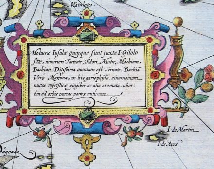
Rush for the spices: The cartouche mentions The Moluccas or The Spice Islands. In addition to a list of the major islands trade goods are also mentioned, such as pepper, nutmeg, cinnamon, ginger and myrrh. In 1512 the Portuguese had built the first European base to control the spice route. It was not until 1663 that this came into Dutch possession.
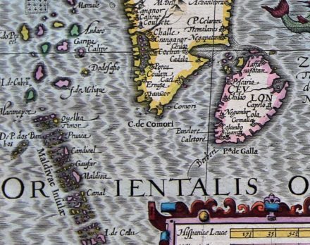
India Orientalis
The land-map showing mainland Southeast Asia, was first published in the Mercator-Hondius Atlas of 1606, and also a product of Jodocus Hondius.
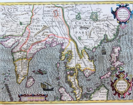
It followed a traditional misconception and shows a large Asian lake. The ‘existence’ of the illusory more Chiama lacus, just outside China Pars, comes from Marco Polo’s travel information and then lived a life of its own. The literature took it for centuries, cartography followed. This imaginary lake would also be the source of five rivers, including the Ganges, the Red River and three Burmese rivers, which would lead to the river Chao Phraya and Mekong. Fair to say that in Iunnan three rivers run parallel: the Yangtze, the Mekong and the Salween. If one would take the Irrawaddy in nearby Myanmar (Burma)one counts four majestic rivers flow in a width of a few hundred kilometer together.

One also notices to the west of Burma the crystallized Merguiarchipel and to the southeast of India, the Maldives. Located in the northeast lies I. Formosa, already visited by the Portuguese in 1583; so-called thanks to its splendor. In 1624 the VOC built Fort Zeelandia on the island. On the Chinese mainland Hondius names Macao and Cantoa. A few Dutch VOC settlements such as Crangagoor, Coulam Iaffanapatanare also named.