


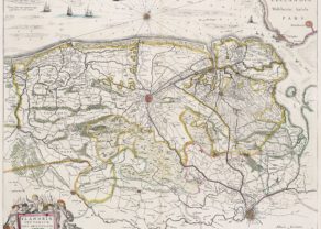
Flandriae pars occidentalis
A rare map published in one edition only
Detail
Date of first map: 1680-1683
Date of this map: ca. 1680-1683
Dimension (not including margins): 39,9 x 49,6 cm
Dimensions including margins 52,3 x 67 cm
Condition: Good. Sharp copper engraving with very wide margins. Centre fold as published. Old colouring. In left margin a few minor tears of a few mm.
Condition rating: A
Verso: blank
Map reference: Van der Krogt 3201:1.3
From: The English Atlas
This item is sold
Flandriae pars occidentalis Janssonius, van Waesbergen and Moses Pitt
The Atlas Maoir by Johannes Janssonius served as a basis for an atlas with English text, undertaken by Moses Pitt of London in 1680-1683, with co-publishers Johannes Janssonius and can Waesbergen and his sons and Steven Swart.
The rare edition of this map can be identified by:
- the addition of a graticule
- the mention of “XXXVII” in the top right of the map.
Related items
You may also be interested in:

San Adrian (Navarre) – La Sierra de Sant Adrian en Biscaia

The Eastern Hemisphere – Hemisphaerium Orbis Antiqui

Map of the Moon – Tabula Selenographica in qua Lunarium
The unique and famous first comparative chart of the Moon (with double competing nomenclature) from which the names of many lunar features have been derived.
