


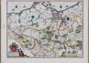
Mecklenburg – Meklenburg ducatus, auctore Ioanne Laurenberg
by
Willem and Joan Blaeu
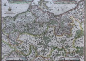
Detail
Date of first edition: 1630 (Willem Bleu, Atlantis Appendix)
Date of this map: 1635 (Willem and Joan Blaeu)
Dimensions (without margins): 36,5 x 48,3 cm
Dimensions (including margins): 49,3 x 57 cm
Condition: Very good. Sharp copper engraving. Centre fold as published. Very wide margins.
Condition rating: A+
Verso: text in Dutch
Map reference: van der Krogt, 2210:2.2
From: Tonneel des Aerdrycks; van der Krogt, 2:121
Price (without VAT, possibly to be added): €320,00 (FYI +/- $355,20 / £284,80)
Unless otherwise specifically stated on this map page, we charge the following expedition costs in euro (unfortunatelly, gone up with Covid, but still too low in reality!):
– Benelux: 40 euro
– Rest of Europe: 60 euro
– Rest of the World: 100 euro
In stock
The Duchy of Mecklenburg
Finely engraved map with a very decorative title cartouche adorned with a chain of fruits. A ship is sailing on the Baltic near a wind rose. In the left-hand upper part, a coat of arms.
Related items
-
Brandenburg, Pommern, Mecklenburg
by Willem and Joan BlaeuPrice (without VAT, possibly to be added): €350,00 / $388,50 / £311,50 -
Northeast Germany – Tabula Electoratus Brandenburgici, Meckelenburgi et Maximae Partis Pomeraniae
by Claes Janszoon VisscherPrice (without VAT, possibly to be added): €3 200,00 / $3 552,00 / £2 848,00Rare and exceptional
You may also be interested in:

Lucca
by
Georg Braun and Frans Hogenberg
Price (without VAT, possibly to be added): €700,00 / $777,00 / £623,00

Portrait Abraham Ortelius, by Galle
by
Philip Galle, Abraham Ortelius
Price (without VAT, possibly to be added): €800,00 / $888,00 / £712,00

Edinburgh
by
Georg Braun and Frans Hogenberg
Price (without VAT, possibly to be added): €1 700,00 / $1 887,00 / £1 513,00

Algiers – Algerii Saracenaorum Urbis Fortissimae…
by
Georg Braun and Frans Hogenberg
Price (without VAT, possibly to be added): €800,00 / $888,00 / £712,00