
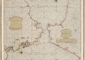
Strait of Gibraltar – Carte nouvelle de l’Isle de Cadix…
by
Homann Heirs
Just to enjoy
Detail
Date of this map: 1757
Dimensions (not including margins): 55,2 x 47,6 cm
Dimensions (with margins): 61,9 x 53,3 cm
Condition: Excellent sharp engraving on strong paper and wide margins. Horizontal centre fold as published.
Condition rating: A+
Verso: blank
Price (without VAT, possibly to be added): €400,00 (FYI +/- $444,00 / £356,00)
Unless otherwise specifically stated on this map page, we charge the following expedition costs in euro (unfortunatelly, gone up with Covid, but still too low in reality!):
– Benelux: 40 euro
– Rest of Europe: 60 euro
– Rest of the World: 100 euro
In stock
Related items
You may also be interested in:

Veere – Vere
by
Ludovico Guicciardini
Price (without VAT, possibly to be added): €420,00 / $466,20 / £373,80

Avignon
by
Georg Braun and Frans Hogenberg
Papal city²

Map of the Moon – Tabula Selenographica in qua Lunarium
by
Johann Gabriel Doppelmayr
Price (without VAT, possibly to be added): €3 500,00 / $3 885,00 / £3 115,00
The unique and famous first comparative chart of the Moon (with double competing nomenclature) from which the names of many lunar features have been derived.

Michiel de Ruyter, a super collection by Stoopendaal
by
Daniël Stoopendaal
Maybe the greatest admiral of all times
Just to enjoy
A very decorative map of southern Spain and the northern tip of Morocco, including Gibraltar, Cadiz, Malaga, Marbella, Algezira, Tetuan, Ceuta, Tangiers, Larache, etc. Highly detailed regional map, with interesting depictions of the mountains, and farming areas. Even local roads are put on!
Three ornate sailing ships in the Atlantic and a large compass rose. Attractive wash coloring. Several short printer’s creases, none of which significantly detracts from the image. A nice example of this scarce map.
This map was made by J.F. Weidler after J. de Petit, engraved by R.A. Schneider and published by the Homann Heirs in Nuremberg.