Alaska and California
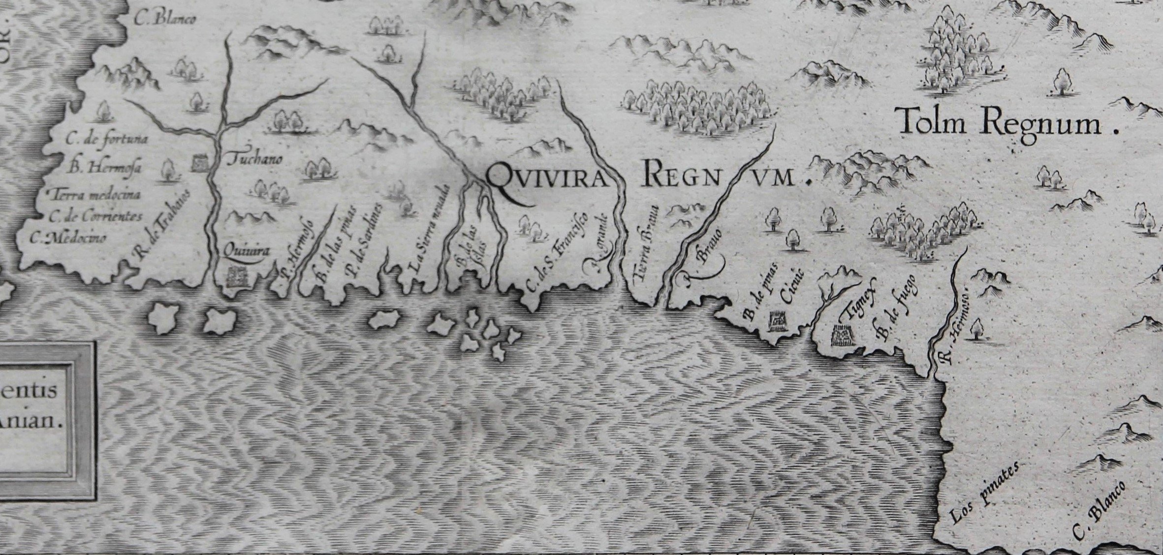
Detail
Date of first edition: 1597
Date of this map: ca. 1597
Dimensions of the map (not including margins): 23,5 x 29,2 cm
Dimensions (including margins): 29,2 x 34,5 cm
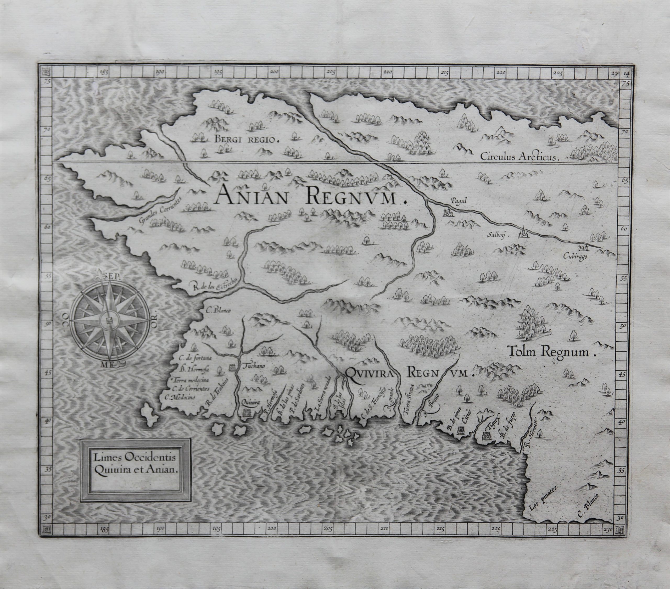
Condition: Excellent. Centre fold as published. Wide margins.
Condition rating: A+
Verso: blank
Map reference: Van der Krogt 2, 9190:371:1, page 19 (top right); (Burden 107, 2 states)
From: Descriptionis Ptolemaicae Augmentum; Van der Krogt 371:01-13 (top right 14)
In stock
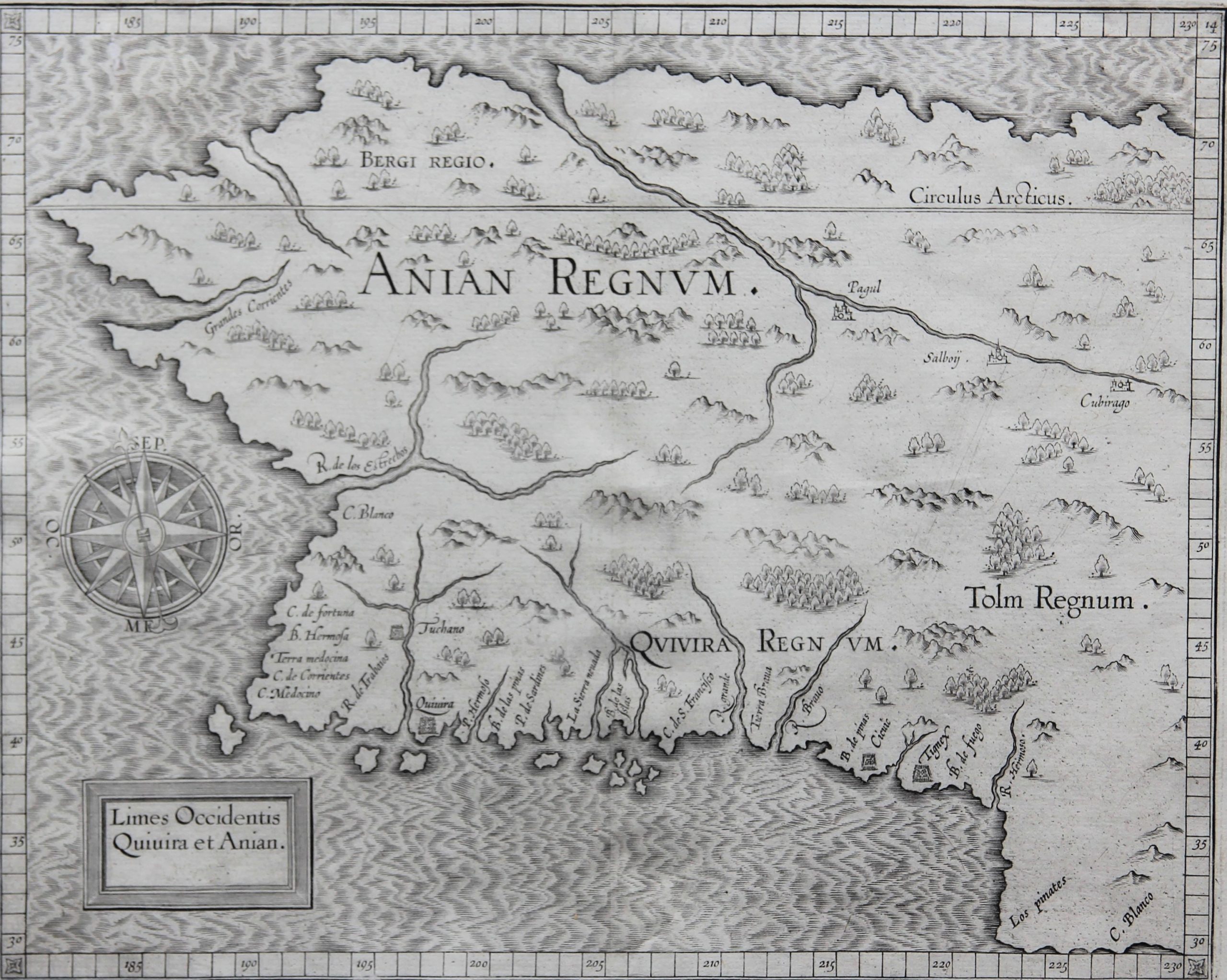
West coast from Alaska to California by Wytfliet
“Limes Occidentis Quivira et Anian”
The Limes Occidentis Quivira et Anian represents the coastline of present-day Oregon and California rather than Alaska (note the Circulus Arcticus). Cornelius de Jode made a similar and better map Quivrae Regnu in 1593, which clearly inspired Wytfliet. The coastline above Cape Mendocino (correctly depicted around 40 ° N latitude) may have been explored by the Portuguese João Rodrigues Cabrilho in 1542-1543 under the Spanish flag, but many place names and topographical features are imaginary. Beyond the east-west distortion of the coastline itself, some places are recognizable and more or less correctly depicted: R. de los Estrechos (Columbia River?) And C. Blanco in Oregon and C. Mendocino, Sierra Nevada C. de S. Francisco (at latitude 38 ° N), and further south C. Blanco in California. Other names refer to completely different areas in the United States: Quivira (also a mythical name), an area explored by Coronado, is too far to the west. The exact location of this Quivira is unknown, but historians speculate on an area around Kansas. The map shows some Native American settlements such as Tuchano, Cicuic and Tignex (probably located in New Mexico).
The other title name is Anian: the Street of Anian (Anian Fretum) first appeared on Gastaldi’s woodcut world map from circa 1561. He had found the name Ania or Anian in the travelogues of Marco Polo, whose work had been republished by Giovanni Battista Ramusio. However, Polo’s Ania was probably Annam or Tonkin (Vietnam), but Gastaldi misplaced the toponym as the supposed street between Asia and America. The name stuck, starting with Zaltieri, Mercator and Ortelius, and was therefore useful for a full century. The continent’s northern Arctic delineation is intriguing: the east-west coastline is correct, but it was not explored and mapped until much later. Or is Wytfliet simply following Mercator’s vision of the North Pole, placing the point symmetrically opposite the northern continent? Without a doubt, Wytfliet confirms the wishful thinking of the northwestern passage; only it would occur centuries later and under different climatic conditions. The northwest passage has meanwhile led to an international dispute.

Cornelius Wytfliet (? – 1597)
Cornelius Wytfliet was a geographer from Leuven. After graduating Licentiate in Laws from the University of Leuven, Wytfliet moved to Brussels and became secretary to the Council of Brabant.
In 1597 he published the first atlas of America: the Descriptionis Ptolemaicae Augmentum (Augmentation to Ptolemy’s description). He named his work an augmentation to Ptolemy’s Geography because it covers the Americas, a part of the world unknown to Ptolemy. However, there is no other connection between the works of Ptolemy and Van Wytfliet. Dedicated to Philip III of Spain it is a history of the New World to date, recording its discovery, natural history, etc. It provides a history of exploration and the voyages of Christopher Columbus (1492-1502), John Cabot (1497-98), Sebastian Cabot (1526-28), Francisco Pizarro (1527-35), Giovanni de Verazzano (1524), Jacques Cartier (1540-42), and Martin Frobisher (1576-78). Most of Van Wytfliet’s maps are the first or among the earliest of specific regions of North and South America.
For the book, Wytfliet had engraved nineteen maps, one of the world and eighteen regional maps of the Americas. The book was an immediate success and ran to several editions.
Two editions of the Descriptionis Ptolemaicae were published et Leuven in 1597 and 1598. In 1603 appeared the first Douai edition with later editions with French text. The last edition was published in Arnhem in 1615.