


La Terra de Hochelaga nella nova a Francia or Montreal
Second edition of first printed city map of North America: rare and historical
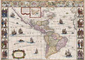
Detail
Date of first edition: 1556
Date of this map: 1565
Dimensions (not including margins): 27 x 36 cm
Dimensions with margins: 31,7 x 43 cm
Condition: Very good. Strong woodcut print and clear image. Wide margins. Centre fold as published. Bottom right corner: tiny edge of margin missing.
Condition rating: A
Verso: blank
Map reference: Kezrshaw #17a; Schwarz & Ehrenberg plt. 28; Ganong, Crucial Maps p. 303-314; Goss, The Mapping of North America #7.
From: Delle navigationi et viaggi (part III), first edition 1556; this one 1565.
This item is sold
Montreal – Hochelaga by Ramusio
Montreal, the first printed plan of a town in North America. Jacques Cartier, the great French explorer, visited the village of Hochelaga on the island of Montreal in 1535. The village was near a mountain the explorer named Mount Royal or Monte Real. His account was published in the third volume of Ramusio’s Delle navigationi et viaggi in 1556.
The map, which was drawn by Gastaldi, includes many of the things described by Cartier. The mythical large welcome is depicted (bottom of the view) in the clasping of hands by a Frenchman (presumably Cartier) and a native chief (maybe of the local Iroquois Indians), and the advantage of two-story fortifications is demonstrated. The lodges within the fort are exceedingly symmetrical, but with each family unit indicated by a fire, they were probably intended to indicate that they were both single family and multiple family or extended family dwellings. It is not clear who the Hochelagans were, although most likely either Huron or Iriquois. The village was gone by the time Champlain arrived.
The uncommon first edition, which can be quickly identified from the second edition by the shape of the tree near the top extreme right
Giovanni Battista Ramusio (1485-1557) was an Italian geographer who worked within the Venetian Empire. His father had been a magistrate and he himself served as a civil servant to Venice. He served throughout Europe, allowing him to build up a network of informants and a collection of travel materials. He compiled this information into his enduring masterpiece, Navigationi et Viaggi, in 1555 (first volume) and 1556 (third volume).
Second edition
The second edition has easily distinguishable changes compared to the first edition:
- there is weeping willow tree in the upper right corner;
- the letter ‘F’ corresponding to the key’s map is missing on the map;
- the opacity of the smoke from the fire by the entrance of the stockade;
For the third and final edition of 1606 the same blocks were used. However, by then all the woodblocks used for printing were worm-infested. so that small worm-shaped blank areas become visible on the map.
Related items
You may also be interested in:

Bristol – Brightstowe, Vulgo; Quondam Venta, Florentissimum

Map of the Moon – Tabula Selenographica in qua Lunarium
The unique and famous first comparative chart of the Moon (with double competing nomenclature) from which the names of many lunar features have been derived.

[Untitled] Japan
Very rare: oldest map of Japan, and … based on Polo’s description

Cartier in Canada
The third part of Ramusio’s Delle Navigationi et Viaggi was dedicated to America and featured stories and descriptions by Peter Martyr d’Anghiera, Fernandez de Oviedo, Cortes, Ulloa, Verrazzano and Jacques Cartier (1491-1557). This captain from Saint-Malo made three expeditions to the current Canada between 1534 and 1541 on behalf of the French king.
During his second voyage (1535-1536) he sailed the Saint Lawrence, hoping to find the mythical kingdom Seguenay, which the Iroquois and Hurons had described as a region rich in precious metals. He reached the Iroquois Stadacone, later Quebec, sailed further upstream and ended his journey on October 2, 1535 in Hochelaga. This was the first major contact between Europeans and native Americans. Cartier mentioned about their settlement: Et au parmy d’icelles champaignes, est scitué (e) et assise ladicte ville de Hochelaga, pres et une joignant montaigne, qui est à l’Entour d’icelle, Labouree et fort fertille, the dessus laquelle on voyt fort loing … Nous nommasmes icelle montaigne, le Mont Royal. This first modern name of Montreal is mentioned left center. Cartier further to the wooded nature of the area with oak, elm, walnut trees, cedars, firs and willows.
Concerning the houses he wrote: Dance chacune d’elles, il ya plusieurs Atres et plusieurs chambres. The systematic structured location of the buildings inside the fence raises questions. The western artist got probably influenced by the urbanistic principles of the Renaissance with their symmetry and right angles (which also incorrectly appeared in Ramusio’s town plan of Cuzco). Current archaeology contradicts the design. In comparison: the small Huron village of Draper (further near Toronto), has a circular core, but its long houses are placed without any order.
A second problem is the use of well-cut piles for the fence. Local excavations have shown that this little debarked logs and beams were used, confirming the criticisms raised by Samuel Eliot Morison.
Giovanni Ramusio shows cornfields see on the other side of Montreal, which was also repeatedly mentioned by Cartier.
An image in the lower left corner shows that the Indians already were inferiorly treated at the first contacts: some natives lift Frenchmen on their shoulders (centre left).
Today, a stone marker recalling the former village is placed on land adjacent to McGill University, believed to be in the vicinity of the location of the village visited by Cartier in 1535. The site of the marker is designated a National Historic Site of Canada.