Zantvliet
Top war map
Detail
Date of first edition: 1630
Date of this map: 1630
Dimensions (not including margins): 28 x 42 cm
Condition: Good. Strong paper with minor browning. Wide margins. Centre fold as published. Stains in upper let and right corner. In passe-partout
Condition rating: A
Verso: blank
From: Atlantis Maioris Appendix, Sive Pars Altera, . . . Amstelodami. Sumptibus & typis aeneis Ioannis Ianzonii. MDCXXX; Van der Krogt 1,1:202
In stock
The River Scheldt during wartime: 1630
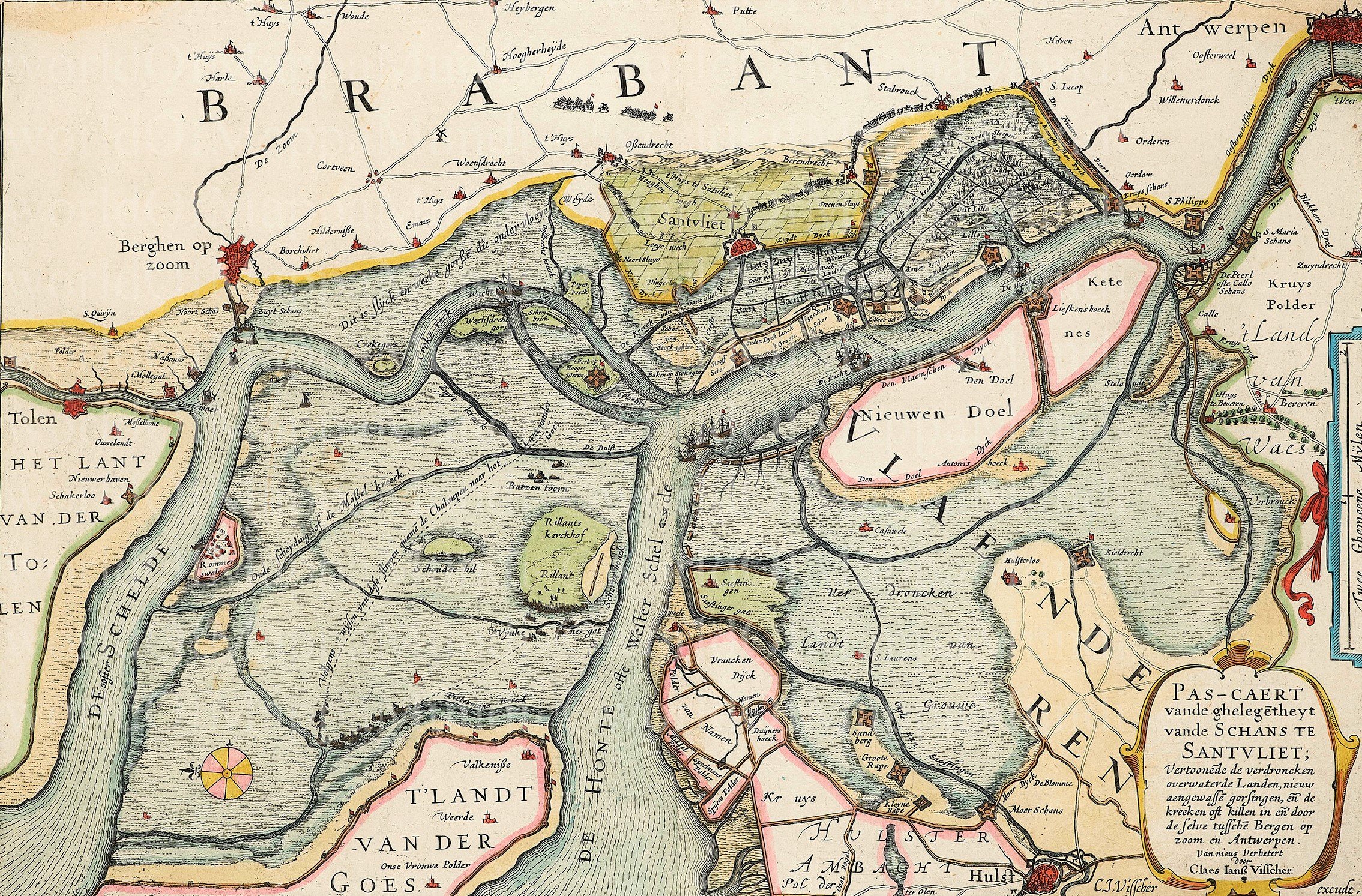
This map should be viewed with the zoom function: it is all about the flags on the forts.
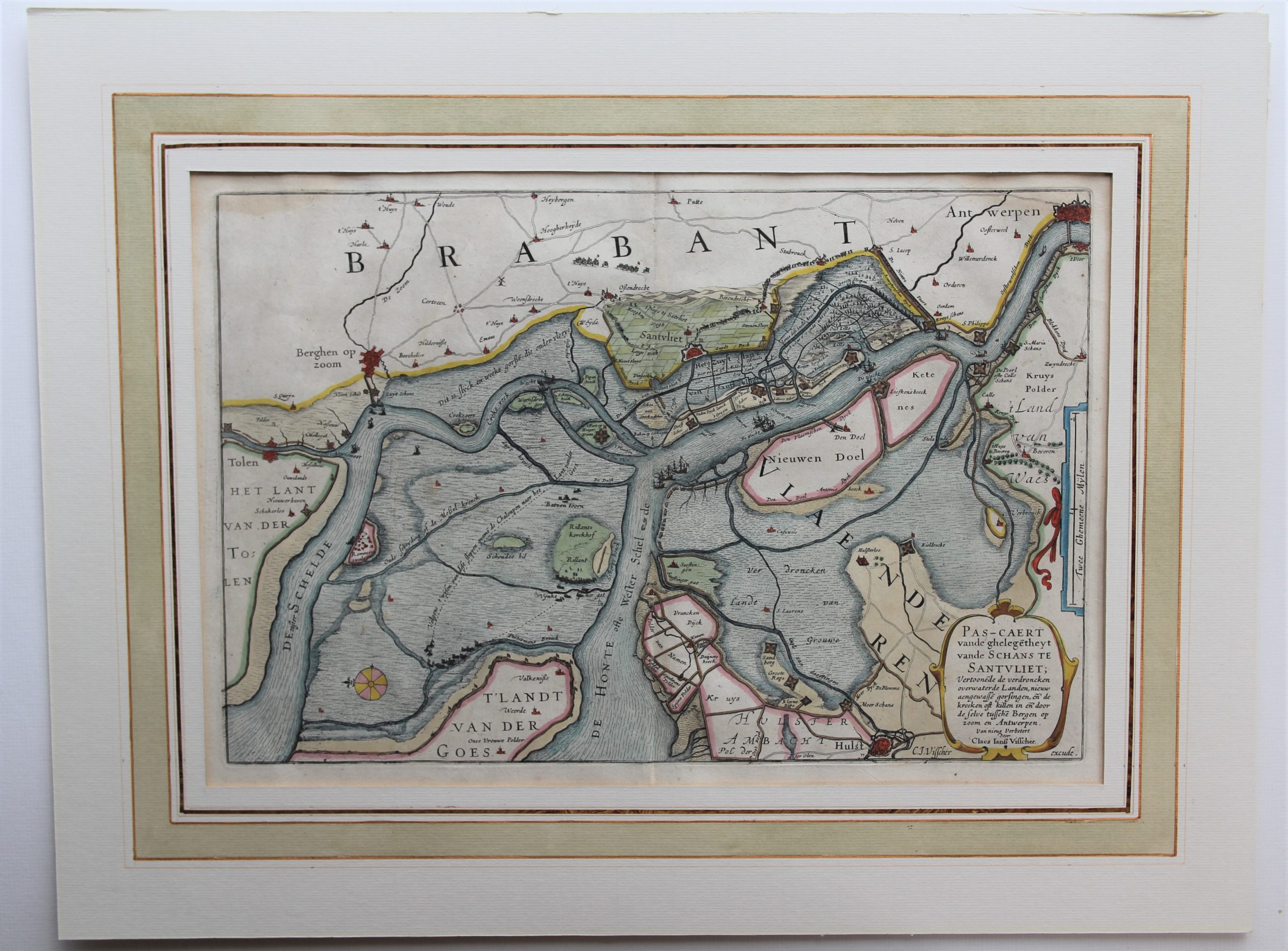
Several maps have been made of the Scheldt area between Antwerp, Bergen-op-Zoom and Hulst. Versions by Visscher, Blaeu and Janssonius are known. All these maps represent military positions of the fighting opponents. This map of 1630 is the first one of the series.
Spanish fortresses (such as Santvliet and Ossendrecht) are indicated with a cross flag. Most fortresses, marked with the Dutch flag, however, are in the hands of the young state: for example Lillo and Liefckenshoek. The S Iacop and Kruysschans were still in Spanish possession: they will be in 1632 taken by the Dutch in 1632. After these conquests, they will pierce the dikes towards Antwerp so that Ordenen, Wilmerdonck and the entire area towards Antwerp was flooded. On the 1630 map these villages are still on solid ground (top right).
Since the Dutch controlled the Scheldt (see ships with flag), the Spanish had to use an escape route (thin dark blue waterway) from De Peerl or Callo Schans towards Saeftingen to then continue to the Oosterschelde (left with Rommerswael) sail. This Spanish escape route is better shown on Janssonius’ map of 1635. S. Philippe and De Peerl were the last Spanish bastions.
Title: Pas-Caert vande ghelegetheyt vande Schans te Santvliet; Vertoonede de verdroncken overwaeterde Landen, nieuw aengewasse gorsingen, . . .


