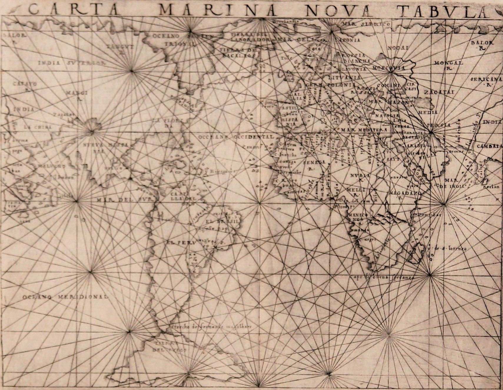
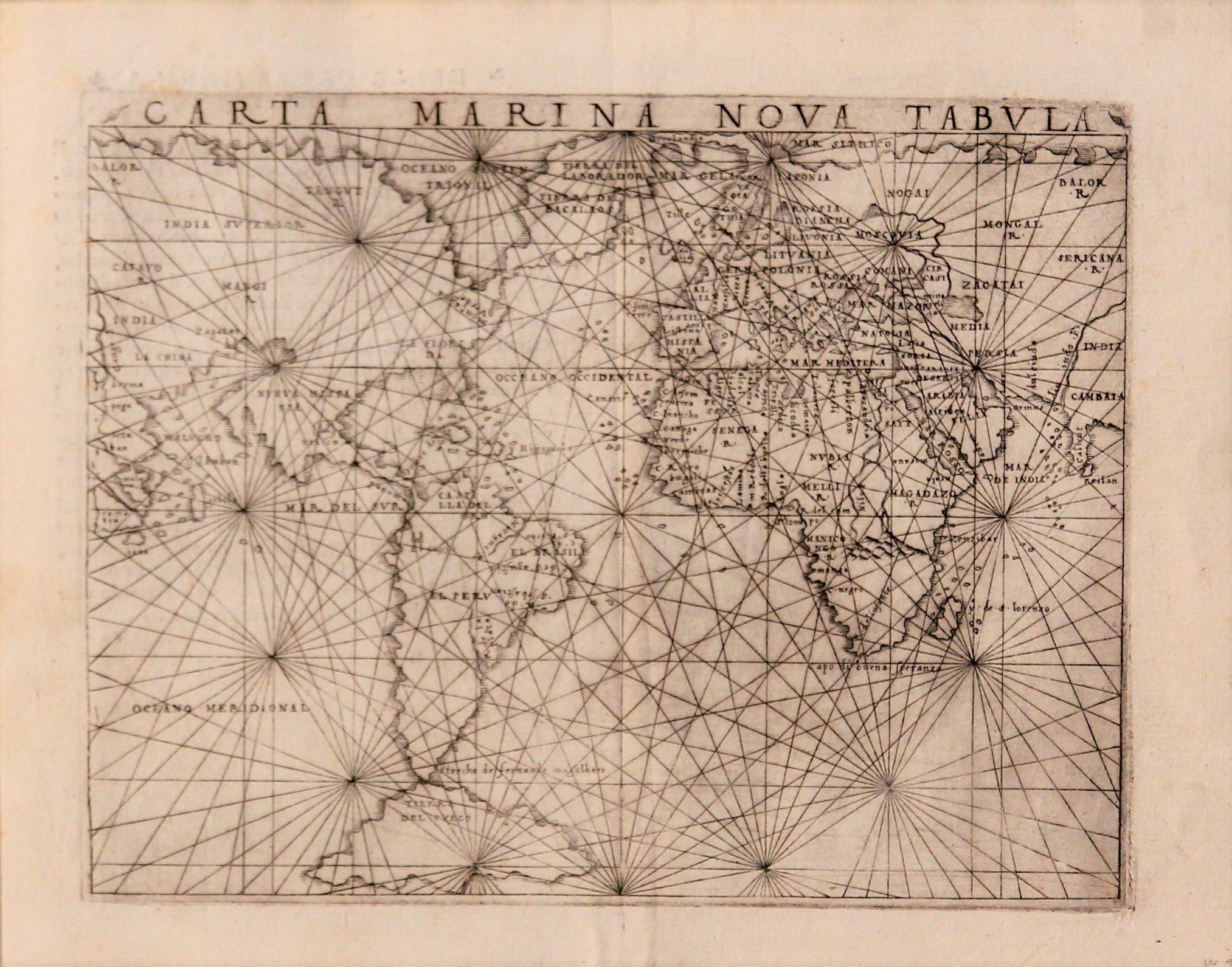
Carta Marina Nova Tabula
A unique map: the world in 1548
Detail
Date of this map: 1548
Dimensions of the map (not including margins): 17 x 13,5 cm
Dimensions of the sheet: 20,5 x 16,5 cm
Condition: Very good. Wide margins. Centre fold as published.
Condition rating: A
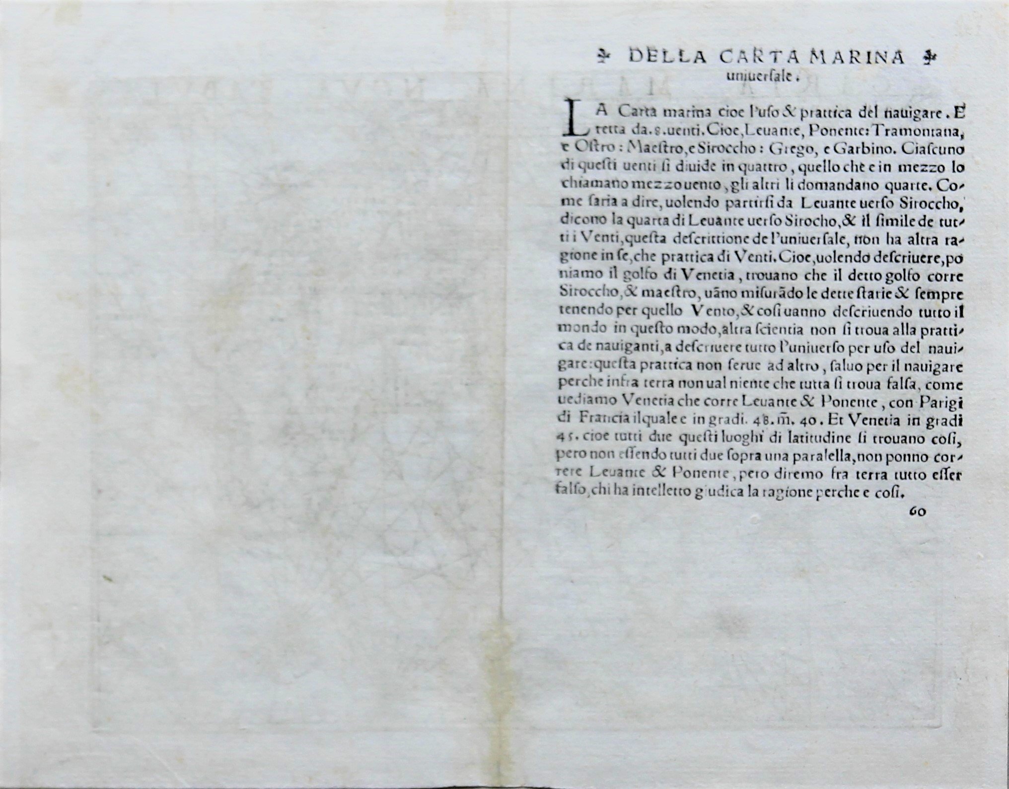
Verso: text in Italian
From: Geographia, 1548; Suarez, T., Shedding the Veil, #24, pp. 86-87
In stock
A unique map showing the world in 1548
Giacomo Gastaldi’s rare marine chart of the world, published in Venice, is based upon early sixteenth-century portolan charts of the period. The map is rich with coastal detail, much more so than Gastaldi’s other world map from the same volume, his important Geographia of 1548.
Gastaldi connects Europe and North America via a long land bridge. The bridge passes from North American to Tierra Del Bacalaos, Tierra del Laborador and Gronlandia, places known to Europeans at this time thanks to fishing operations, especially those of the Portuguese. This map’s linking of North America and Europe is highly unusual, however, but was a natural consequence of two errors: on the east, Gastaldi depicts Greenland as an elongated eastwest outgrowth of Scandinavia, a peculiar pattern used by Waldseemüller (#310) earlier in the century; on the west, he adopts the Verrazanian model for North America which had been sanctioned by Sebastian Münster in 1540 (#347) and many others before and subsequently. In combination, these two flawed elements stretched out over the North Atlantic and, quite logically, joined.
The chart also includes an unusual configuration of North America. The continent merges with Asia to the west, forming a massive land mass. A large bay is carved far into what is today the American Pacific Northwest, with California emerging as a peninsula. In the east the name Montagna Verde appears in what is now New York State. Mexico City and several other settlements are marked in North and South America.
In Asia, Gastaldi highlights the Malucho, or the Moluccas or Maluku islands in Indonesia. Arab merchants had arrived here as early as the fourteenth century to trade for spices, but Europeans had only begun to engage in this commerce in the region in the early sixteenth century. Venice, where Gastaldi lived, benefited from this trade as well as the overland trade from Asia. He also includes Gilolo, today known as Halmahera, the largest island in the Maluku.
While the influence of Marco Polo is evident in the parts of Asia which join North America, the old Polean bonds have finally been severed in Southeast Asia and the Australasian islands. A “modern,” if still inaccurate, Sumatra and Java have replaced Polo’s Java Minor and Java Major, and the “true” Singapore and Malacca Straits now appear, unnamed on the present map because of space constraints but with an early reference to Singapore (Cinea Pura) found on the regional map from the same atlas. On the north of the Malay Peninsula, Burma (or, for the moment, Myanmar) appears by its modern name (henna). Above berma is an extremely early appearance in print of the term LA CHINA [China], with the old Cathay (CATAYO R) retained but relegated to the approximate region of Tibet.
In Europe, one curious feature is worth noting. The northwest tip of Spain is pushed out in a stylized fashion, clearly marking it as the most westerly point in Europe (which it is not). This is c. finis terre, the “cape of the end of the earth,” a little peninsula which had been considered the westerly end of the world by the Romans. That Gastaldi chose it as his only named physical feature in Western Europe, and that he distorted the Iberian coastline to stress its meaning, suggest that, in the midst of his quest for the latest cosmological truths, he allowed himself a moment of sentimentality about a past time that was a different world. Also the British Isles are very poorly represented.
Africa is nicely detailed. Ptolemy, in his original second century Geographia, postulates that the source lies near the Mountains of the Moon, where water flows into two large lakes at the same latitude. This theory came from Diogenes, who supposedly saw the mountains ca. 110 CE. Gastaldi has followed Ptolemy here in including a branched Nile which flows from a mountain range in southern Africa. Africa is well illustrated thanks to the Portuguese expeditions that informed Europe of the shape of the continent in the late-fifteenth and early-sixteenth centuries. This is one of the few inland details included in the chart.
The joining of all the world’s continents denotes a continued dependence on Ptolemy’s ideas of interconnected landmasses.
The only landmass not connected to the other continents is Tierra del Fuego, in the south. This massive island represents European cartographic conjecture about the region at the time. Magellan had sailed through the Strait of Magellan, marked here, a quarter of a century before this map was made. However, the Dutch traders Schouten and Le Maire would not round Cape Horn until the early seventeenth century, leaving many to think that Tierra del Fuego was a part of a large southern continent.
A unique map
Gastaldi’s Carta Marina, which includes the earliest obtainable depictions of the California peninsula, is the earliest obtainable copperplate world map for collectors.
This edition
This edition was the first pocket-sized edition. Despite being prepared on a small format, the maps are clearly and attractively engraved. Gastaldi was the first to add regional maps of the American continent, with important maps of the eastern seaboard, a map of what is now the southern United States, of South America, and separate maps of Cuba and Hispaniola.
Ruscelli’s versions
Gastaldi published only a single edition, but his maps were copied by Girolomo Ruscelli for over 50 years. Ruscelli slightly enlarged version measures 18,5 x 24 cm.
The only changes by Ruscelli seem to be the omissions of the names Tierra Del Laborador and Tierra Del Bacalaos from the mass of land joining North America to North Europe.
Ruscelli’s atlas was issued several times between 1561 and 1599 by the following publishers:
– Venice, Vincenzo Valgrisi, 1561
– Venice, Vincenzo Valgrisi, 1562
– Venice, G. Zileti, 1564
– Venice, G. Zileti, 1574
– Venice, Heirs of Melchior Sessa, 1598-99 (both in Ruscelli’s expanded edition by Girolamo Ruscelli)
