Menu
FANTASIALAND OR FAKE NEWS
Date: 26/08/2021
FANTASIALAND OR EVEN FAKE NEWS
Part of the joy in looking at old maps is the discovery of certain discrepancies with reality (see map by van Adrichem above of straight coastline between the Holy Land and the Nile Delta).
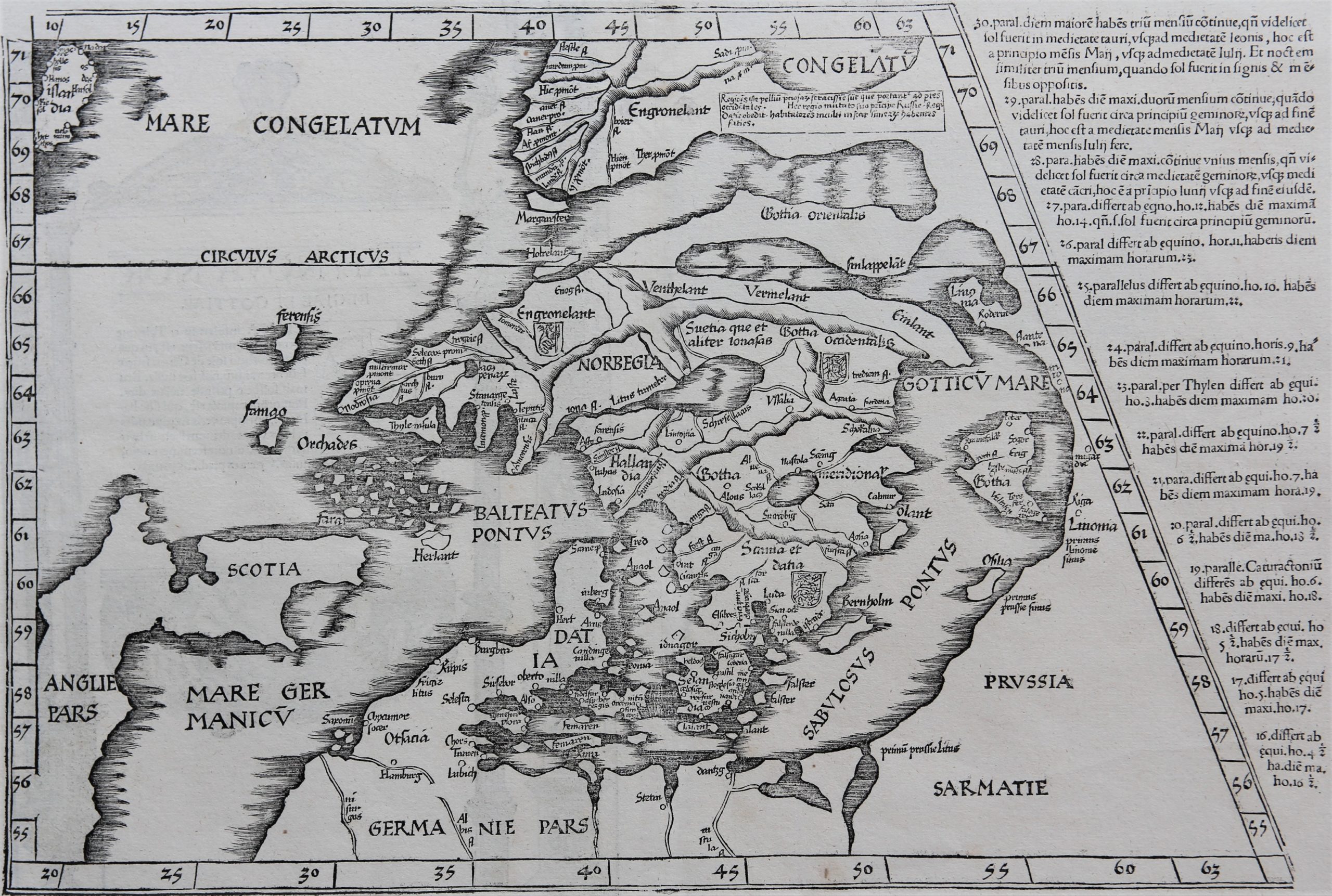
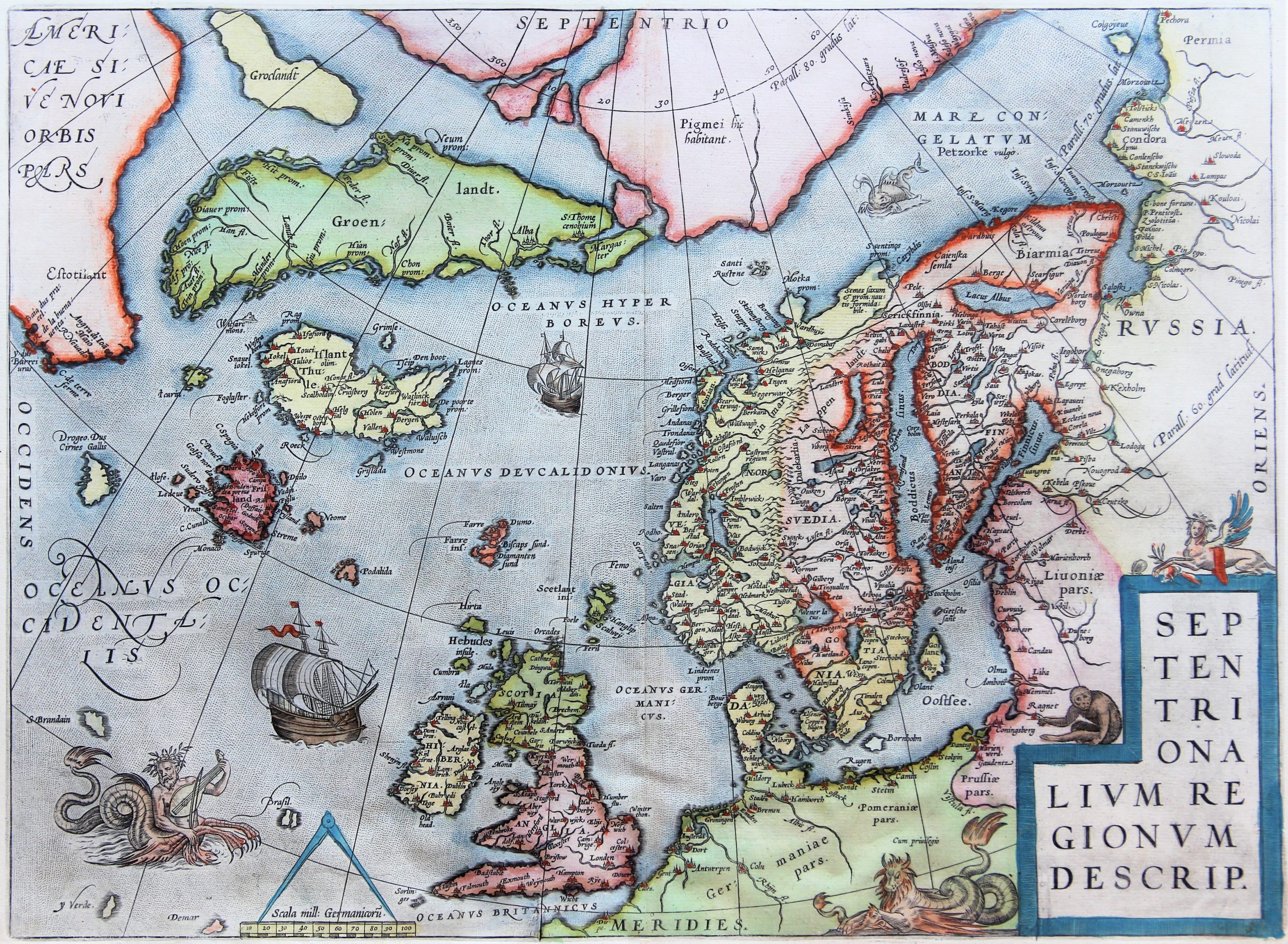
Of course, during the age of discoveries many inaccuracies have been drawn and taken up in maps: but these misunderstanding form part of a learning process from exploration and expedition to mapping. A long process of trial and error included many unwanted mistakes. So, the whimsical shape of the Scandinavian coastline took decades to correctly understand.
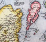
Or, the hostile attitude of the Japanese shoguns towards foreigners contributed to a long lasting imaginative mapping of the island group:
But, some of the mismatches resulted from pure fantasy, willful disinformation, even fraud. We discuss a few examples:
1. Prester John, Ortelius
In the sixteenth century, mapmakers started producing maps of Prester John, depicted as a seated and crowned king in Ethiopia (e.g. Diogo Homem or Gemma Frisius in 1522).
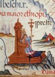
Ortelius describes Priest John in 1570 as one of the greatest monarchs of the world.
When the crusader kingdoms, in particular that of Raymond of Antioch, came under increasing pressure from the Saracens, one Hugh, bishop of Jabala (now in Syria) applied in 1145 to Pope Eugene III for help. The latter replied that a Nestorian priest and king would have recaptured the city of Ecbatana in Persia. This created the myth that a powerful Christian king, priest John, living in Central Asia. “If contacted” King John would come to the rescue of the Crusaders.
For several centuries thereafter repeated and fruitless searches (with participation of the Polo family) were conducted to localize the Christian Kingdom. misconceptions and deceptions continued. The Western world finally came to the conclusion that this kingdom was not in Asia. However and unfortunately, the myth continued to live, since the location of the priest (who, in the meantime, must have become very old) simply moved to Abyssinia during the fourteenth century. Portuguese Henry the Navigator even organized a search over land to the kingdom.
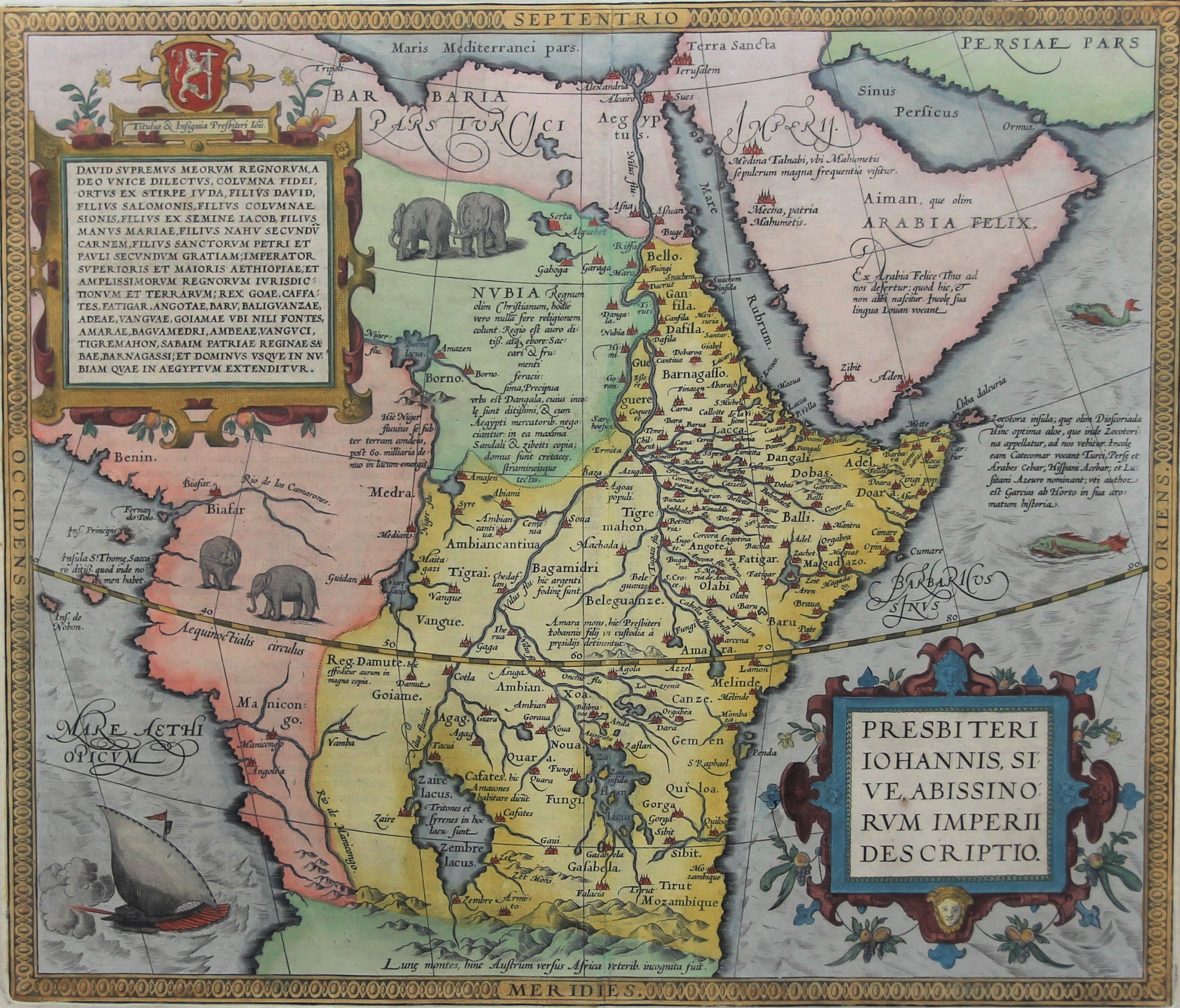
There is a lot of speculation around Prester John: see our 54008
2. Water pouring into the North Pole, Mercator
In 1595 Rumold Mercator published this first full map of the Arctic, an expansion of Gerard Mercator’s inset of the area in his world map of 1569, here showing recent Northwest and Northeast Passage discoveries.
A central position is taken by a whirl-pool in the midst of four landmasses. . . into which there empty these four indrawing Seas which divide the North. And the water rushes round and descends into the earth just as if one were pouring it through a filter funnel. It is four degrees wide on every side of the Pole, that is to say eight degrees altogether.
An account of this myth in Mercator’s own handwriting still exists in a letter from the cartographer to John Dee. It is based in part on a report by the traveler Jocobus Cnoyen van Herzogenbusch describing a lost fourteenth-century work, Inventio Fortunata. The Fortuna tells the story of an English friar who traveled to the northern regions. It also mentions pygmies, which Mercator places on one of the four islands. Although many believed the rock at the North Pole to be magnetic, Mercator preferred to place a magnetic rock near the Strait of Anian, possibly in an attempt to explain magnetic variation. The idea of a whirlpool was also seemingly supported by the recent voyages of Martin Frobisher and John Davis, who both reported strong currents pushing massive icebergs along with ease.
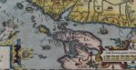
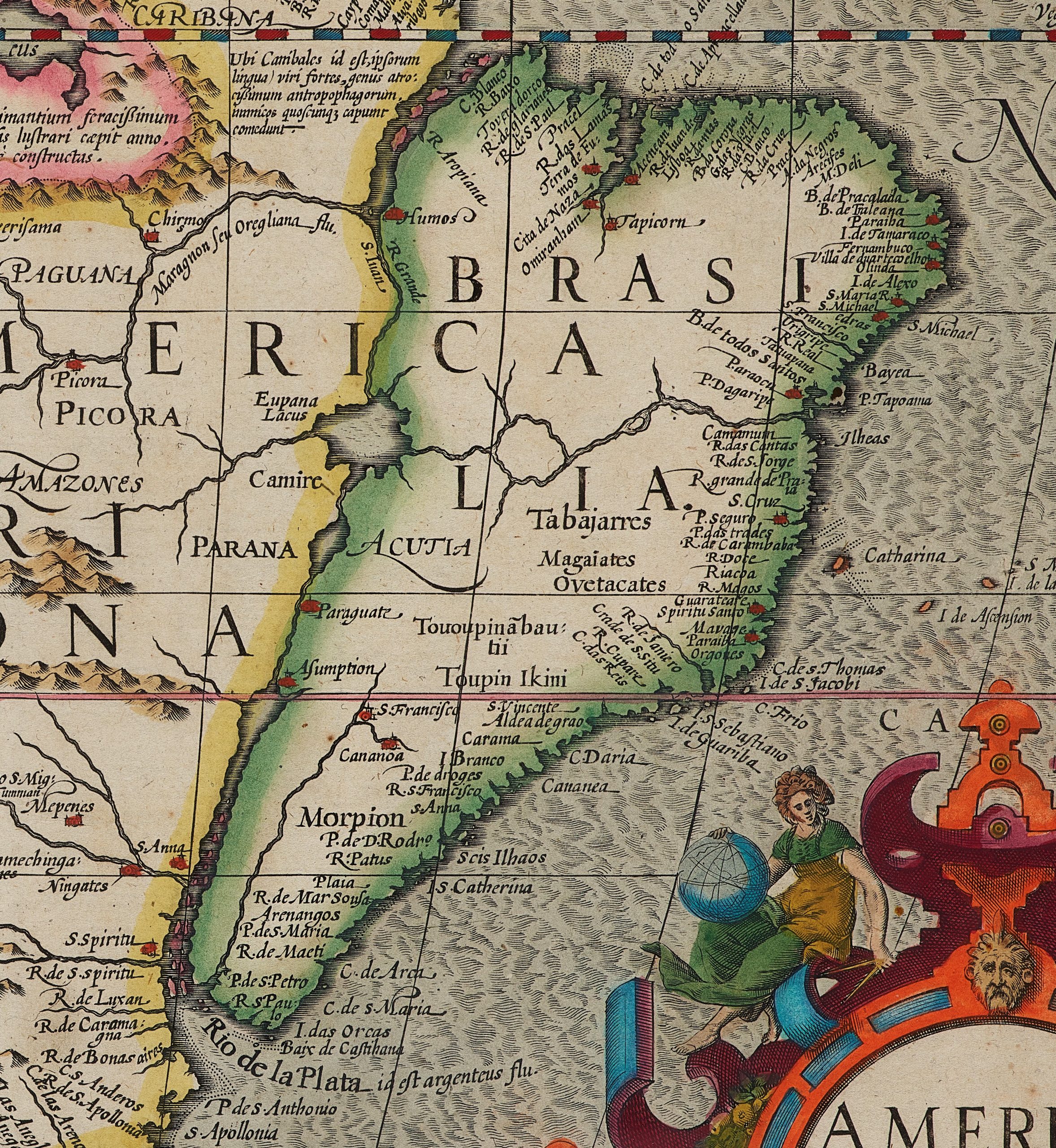
3. Brazil as a separate landmass, Hondius
A strange element on this map is the watershed of Brazil: the Rio Grande (a tributary of the Amazon river) runs southward up to a fictional lake which continues into another river culminating in the Rio de la Plata. So, Brazil is through waterways absolutely separated from the rest of South America. This is further emphasized by the placement of the name “Brasilia” (and its green coloring) which is completely disconnected from the rest of the continent. The origin of this special display is not known. Portuguese and Brazilian experts report in seminars that “this” is not a Portuguese concept. So, this implicitly suggests that the splitting of the continent was a Dutch idea. (But their scholars are in doubt. So, more cartographic investigation may be needed).
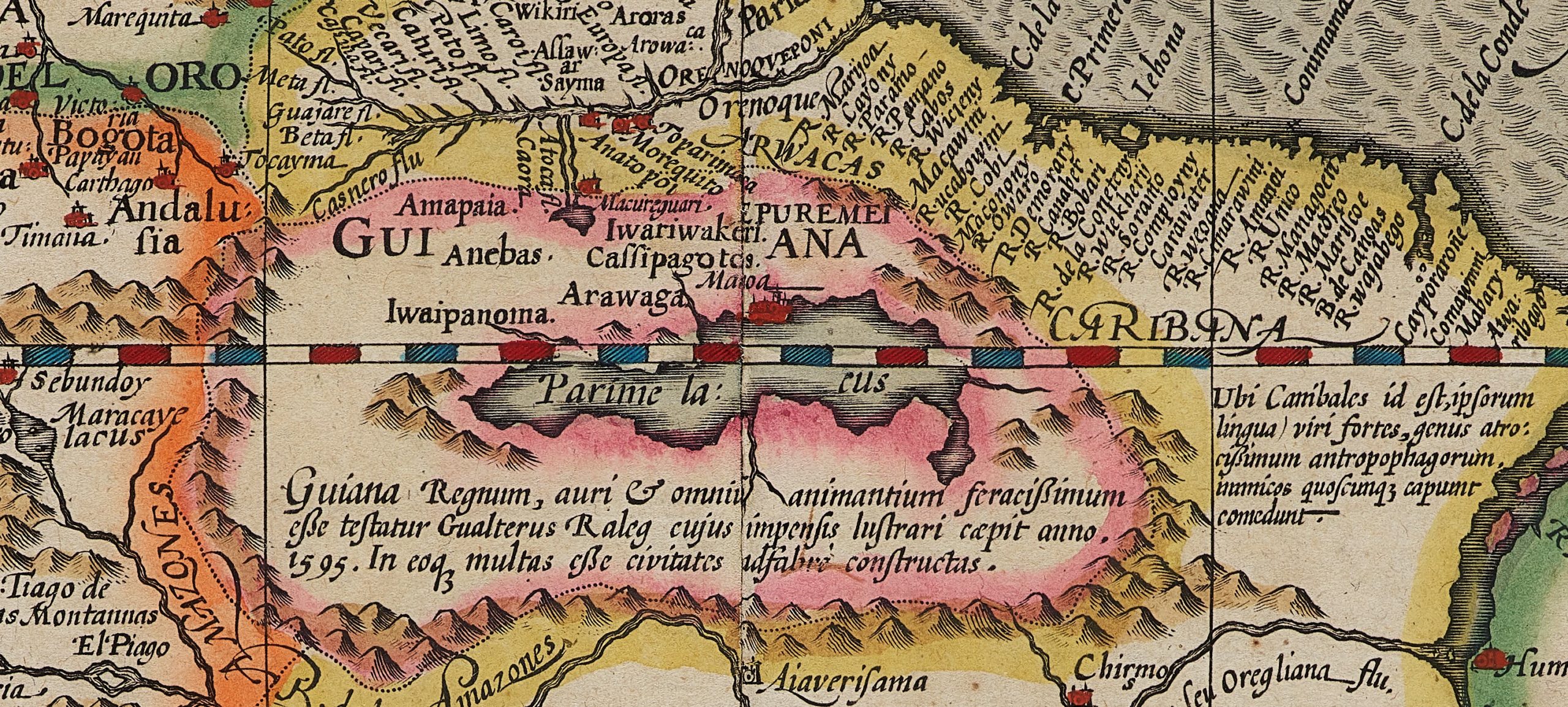
On the equator one discovers a large mythical more: “Parime lacus”. After his failed attempt at establishment of a colony in Roanoke (North Carolina) in 1585, Sir William Raleigh was attracted by the gold of the South. In 1595 he set up an expedition to Guiana and thereupon published his “The Discovery of Guiana” (in 1596) with an exaggerated story about the El Dorado. This English “discovery” even accelerated the already existing gold rush to these places. Moreover, Jodocus Hondius published this map a few years later with specific reference to Raleigh! The reference to this fictional Parime lake was part of Sir William Raleigh’s voyage as noted by Hondius.
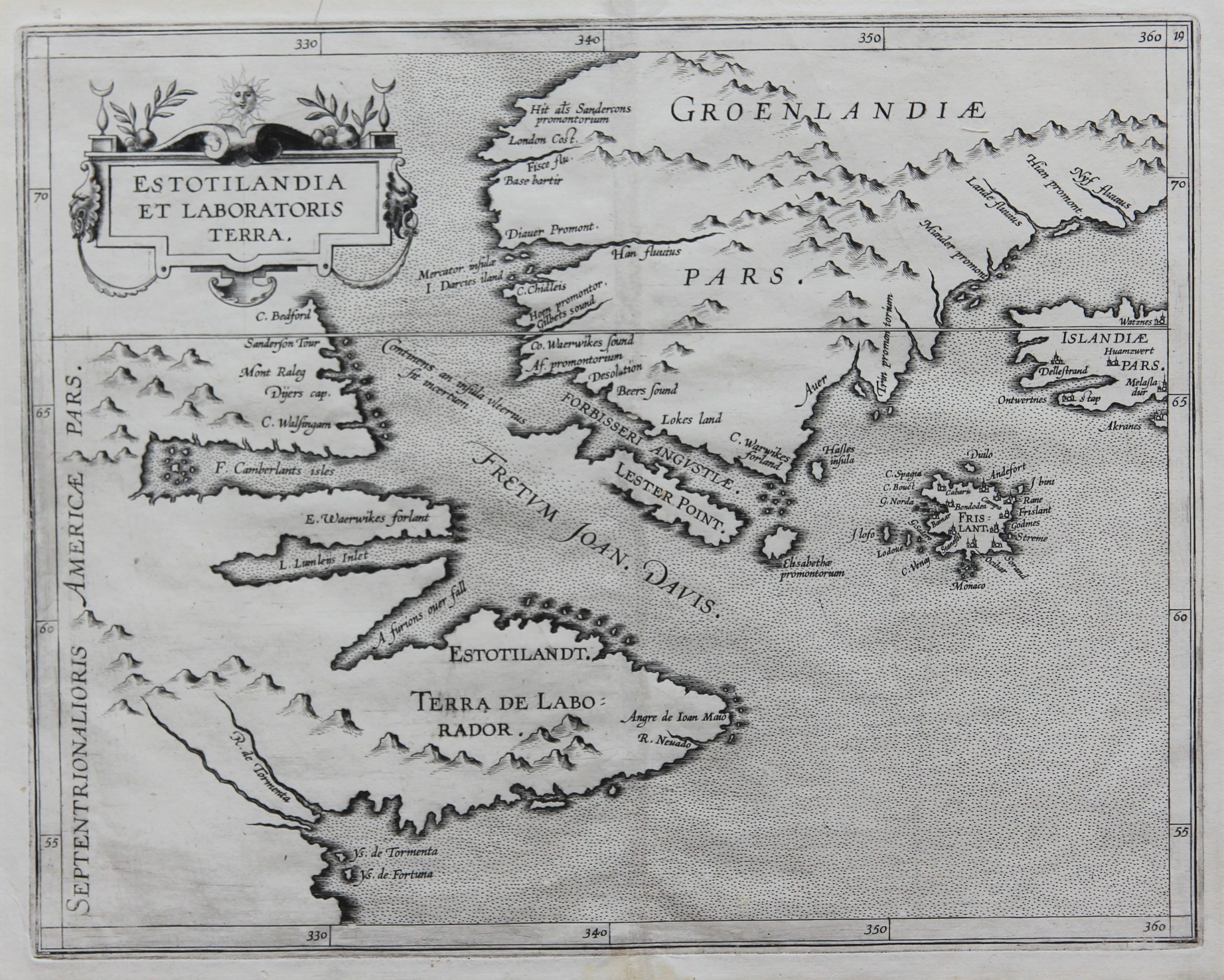
4. Frysland, a Venetian discovery
Note the imaginary Frysland that was depicted on almost all maps of this region between 1550 and 1650. The island was first depicted by Nicolo Zeno (1515-1565) in his map of 1558. He relied on forged letters and a map of his ancestors Antonie and Nicolai Zeno (alleged explorers in that area) around 1400, who thus claimed the Venetian claims to discoveries and thus on territory in North America for the Doge Republic against France and Spain. When Mercator showed this island on his world map, it was unfortunately followed slavishly for a long time.
Ortelius
Wytfliet
Henricus Hondius & Janssonius
Willem & Joan Blaeu
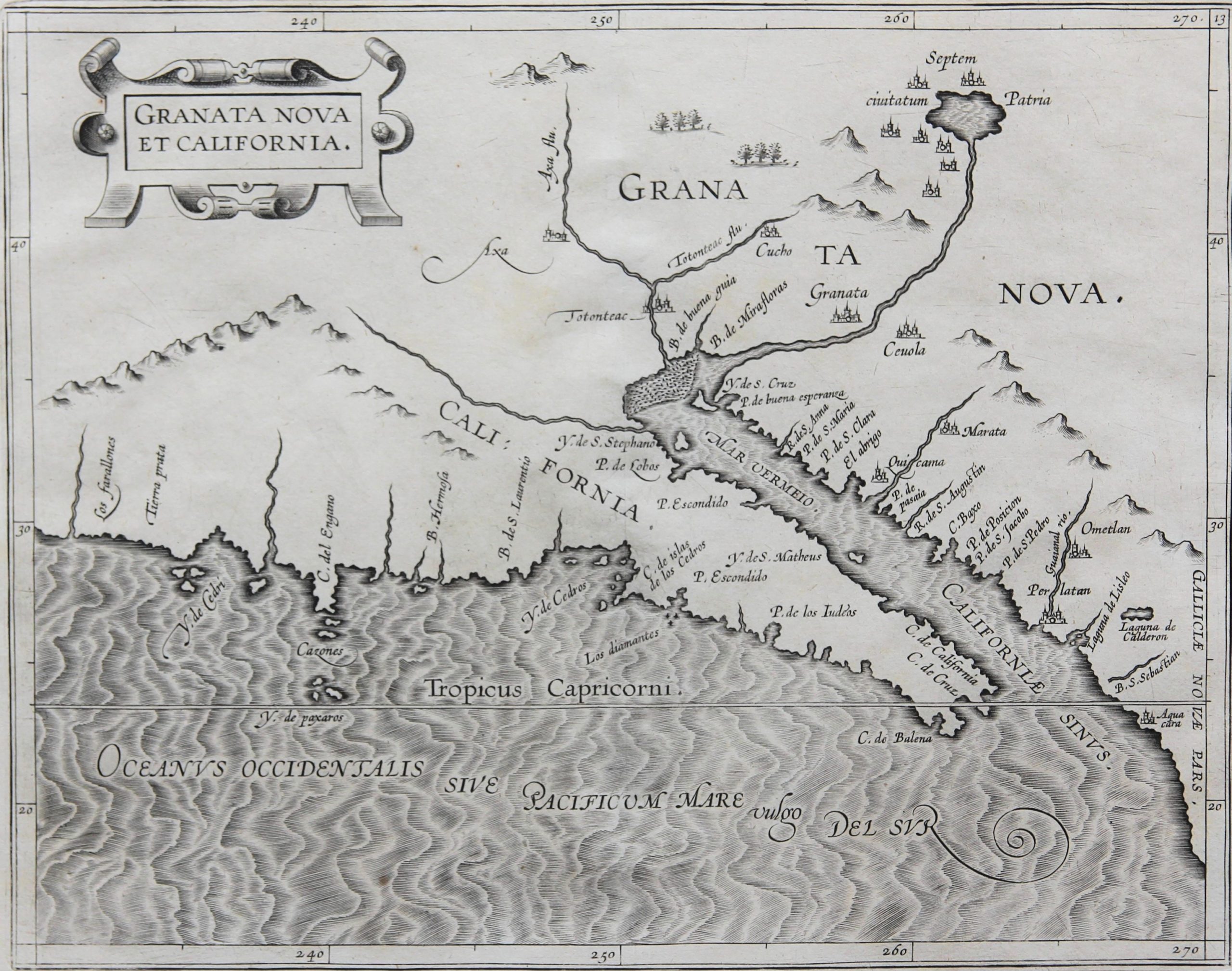
5. Seven Cities of Gold, Wytfliet
This map is interesting for the cartography of the American west coast and is one of the most important maps in the atlas. This is the second map of California and Northwest America. The oldest map is by the Jode from 1592. Wytfliet follows the region from the southern tip of Baja California to Los Farallones in the north and also shows the Colorado River. Wytfliet is not free from some misconceptions. For example, he lets the Rio Grande flow from an imaginary lake to the Gulf of California (instead of to the Gulf of Mexico). The large lake is surrounded by the legendary Septem civitatum Patria (the seven cities of Cibola), a mythical idea that originated in self-fulfilling wishful thinking. The origins of the myth date back to the conquest of Portugal by the Moors in the early eighth century. Seven bishops and their followers are said to have crossed the Atlantic Ocean in 714 to land in Antille (hence the name of the archipelago). Since these islands produced too little silver and gold, they were forced to seek their fortune in the Far West. The seven cities of El Dorado were born. It was Álvar Núñez Cabeza de Vaca, who had been shipwrecked off the Florida coast in 1528, who moved into the mainland towards Texas and Northern Mexico. On his return, he first reported on the alleged existence of these cities. Brother Marcos de Niza, on an expedition to Zuniland in 1539, added to the legend. So there could be no more doubt about the cities and their stocks of precious metal. A subsequent expedition in 1540-1542 under conquistador Francisco Vazquez de Coronado (1510-1554) was sent out specifically to collect a lot of gold there. Unfortunately, only a few poor little pueblo villages were found. This expedition did explore the southern Rocky Mountains and the Rio Grande and Grand Canyon walks.
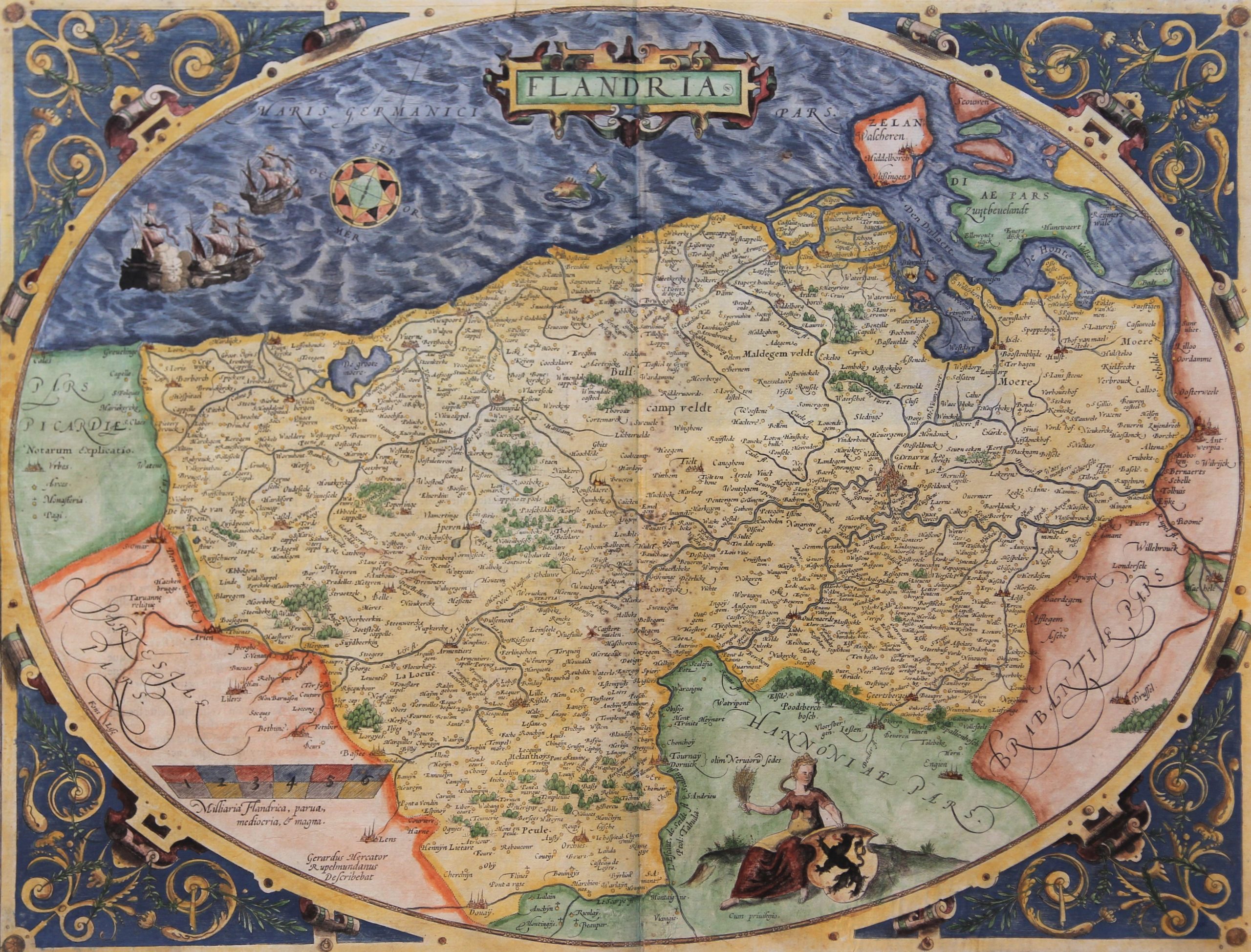
6. Vlassebroeck at the left bank of the River Scheldt, Mercator/Ortelius
The wrong location of the village Vlassenbroeck on the river Scheldt, on the 1540 Flanders map by Gerard Mercator – Jacob van Deventer, offers us an opportunity to trace the influence of G. Mercator on many Flanders’ maps by other cartographers. The village was always, and still is, definitely located on the right bank.
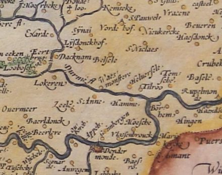
Whilst checking other old maps of Flanders, one notices that the three classical Mercator maps all contain the same mistake: the oval Flandria map, the Flandriae Comitatus Descriptio in Ortelius’ Atlas and the Flandriae Comitatus in the Mercator Hondius Atlas.
It appears, however that many Italians like Tramezini, Zenoï, Forlani, Duchetti as well as other cartographers copied this mistake up until the 18th century. Examples are De Jode, N. and C.J. Visscher, J. Hondius, R. and F. Hogenberg, M. Quad, P. van der Keere, P. Verbiest
It is such a notorious mistake that one can use the location of Vlassenbroeck on old Flanders’ maps as a plagiarism tracer. If an old Flanders map shows the location of the village on the left bank, one can conclude that the cartographer, directly or indirectly, got his inspiration from G. Mercator’s Flanders map. Other cartographers like W. and J. Blaeu, Sanson, Seutter, Delisle correctly located the village on the right bank.
Fake news, a phenomenon of all times in all sectors of life!