


Tab. Nova Norbegiae et Gottiae.
From the prehistory of cartography
Detail
Date of first edition: 1522 with title
Date of this edition: 1525 (title at verso)
Dimensions (not including margins): 30,7 x 35 cm
Dimensions (including margins): 38,8 x 51,6 cm
Condition: Very good. Sharp wood engraving on strong paper. Centre fold as published. Wide margins.
Condition rating: A+
Verso: text in Latin with title
Map reference: W.B. Ginsberg, Printed Maps of Scandinavia and the Arcic 1482-1601, map 6, page 31
From: Claudii Ptolemaei Alexandrini… opus Geographiae, edited by Willibald Pirkheimer and published by Johannes Koberger, Strasbourg, 1525
In stock
One of the Earliest Obtainable Modern Maps of Scandinavia
Nice example of the 1525 edition of Lorenz Fries’s map of Scandinavia and neighboring countries, extending to Iceland, Scotland, England, Finland and the Baltic Sea. Fries’s map is one of the earliest modern regional maps of Scandinavia and the first which was reasonably obtainable for most collectors. First published in Strasbourg by Johannes Gruninger in 1522, the Fries’s map is based upon Waldseemuller’s map of 1513, but with changes. As noted by Ginsburg:
Waldseemuller’s map of Scandinavia appeared in the supplement section of his modern maps. A faithful copy of the Ulm map published [in 1482] . . . Norway is shown as “norbega.” Most of the same cities are also included–“astro” (Oslo), “begensis ” (Bergen), “nodrosia (Nidranos or Trondheim) and “Stauargerensis.”
Regarding the changes, Ginsberg notes:
“The shape of the recut Scandinavia map differs noticeably from the 1513 version. The height and length along the top are basically identical, but the left-hand side is now almost vertical and the width along the lower border is about fourteen centimeters less. . . . [Fries] added four lines of descriptive text . . . these regions are very abundant in precious furs, which are brought to Western ports. This region, having overthrown its own leader, is subject to the Russian ruler. The savage inhabitants are similar in countenance to the Samoyeds.”
Later editions are 1535 and 1541. Compared to the Donis map (1482) the left-hand side of the Fries’ is almost vertical. The ornamental work verso is attributed to Hans Holbein.
Related items
-
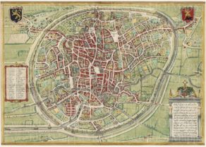
Brussels, 1593
by Georg Braun and Frans HogenbergPrice (without VAT, possibly to be added): €1 600,00 / $1 776,00 / £1 424,00An invitation to actively discover the city’s jewels
-
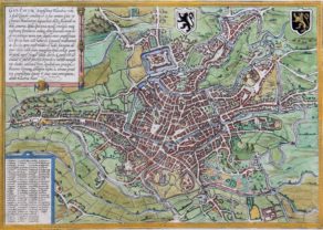
Ypres – Ieper
by Georg Braun and Frans HogenbergPrice (without VAT, possibly to be added): €500,00 / $555,00 / £445,00Ypres, where poppies blow…
-
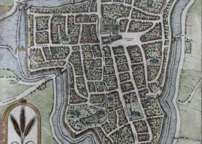
Gent – Gandavum
by Georg Braun and Frans HogenbergRare view of the city without any walls
-
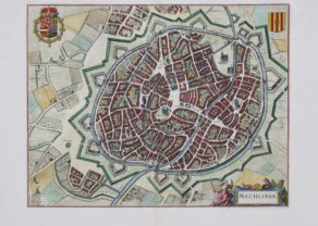
Mechelen (Malines) – Machlinia
by Joan BlaeuPrice (without VAT, possibly to be added): €1 200,00 / $1 332,00 / £1 068,00ON HOLD
You may also be interested in:

Algiers – Algerii Saracenaorum Urbis Fortissimae…

Edinburgh

Bristol – Brightstowe, Vulgo; Quondam Venta, Florentissimum

Lorenz Fries
Lorenz (Laurent) Fries (ca. 1485-1532) was born in Mulhouse, Alsace. He studied medicine, apparently spending time at the universities of Pavia, Piacenza, Montpellier and Vienna. After completing his education, Fries worked as a physician in several places before settling in Strasbourg in about 1519. While in Strasbourg, Fries met the Strasbourg printer and publisher Johann Grüninger, an associate of the St. Dié group of scholars formed by, among others, Walter Lud, Matthias Ringmann and Martin Waldseemüller.
From 1520 to 1525, Fries worked with Grüninger as a cartographic editor, exploiting the corpus of material that Waldseemüller had created. Fries’ first venture into mapmaking was in 1520, when he executed a reduction of Martin Waldseemüller’s wall map of the world, first published in 1507. While it would appear that Fries was the editor of the map, credit is actually given in the title to Peter Apian. The map, Tipus Orbis Universalis Iuxta Ptolomei Cosmographi Traditionem Et Americ Vespucii Aliorque Lustrationes A Petro Apiano Leysnico Elucubrat. An.o Dni MDXX, was issued in Caius Julius Solinus’ Enarrationes, edited by Camers, and published in Vienna in 1520.
Fries’ next project was a new edition of the Geographia of Claudius Ptolemy, which was published by Johann Grüninger in 1522. Fries evidently edited the maps, in most cases simply producing a reduction of the equivalent map from Waldseemüller’s 1513 edition of the Geographie Opus Novissima, printed by Johann Schott. Fries also prepared three new maps for the Geographia, of Southeast Asia and the East Indies, China, and the world, but the geography of these derives from Waldseemüller’s world map of 1507.
The 1522 edition of Fries’ work is very rare, suggesting that the work was not commercially successful. In 1525, an improved edition was issued, with a re-edit of the text by Willibald Pirkheimer, from the notes of Regiomontanus (Johannes Müller von Königsberg).
After Grüninger’s death in ca. 1531, the business was continued by his son Christoph, who seems to have sold the materials for the Ptolemy to two Lyon publishers, the brothers Melchior and Gaspar Trechsel, who published a joint edition in 1535, before Gaspar Trechsel published an edition in his own right in 1541.