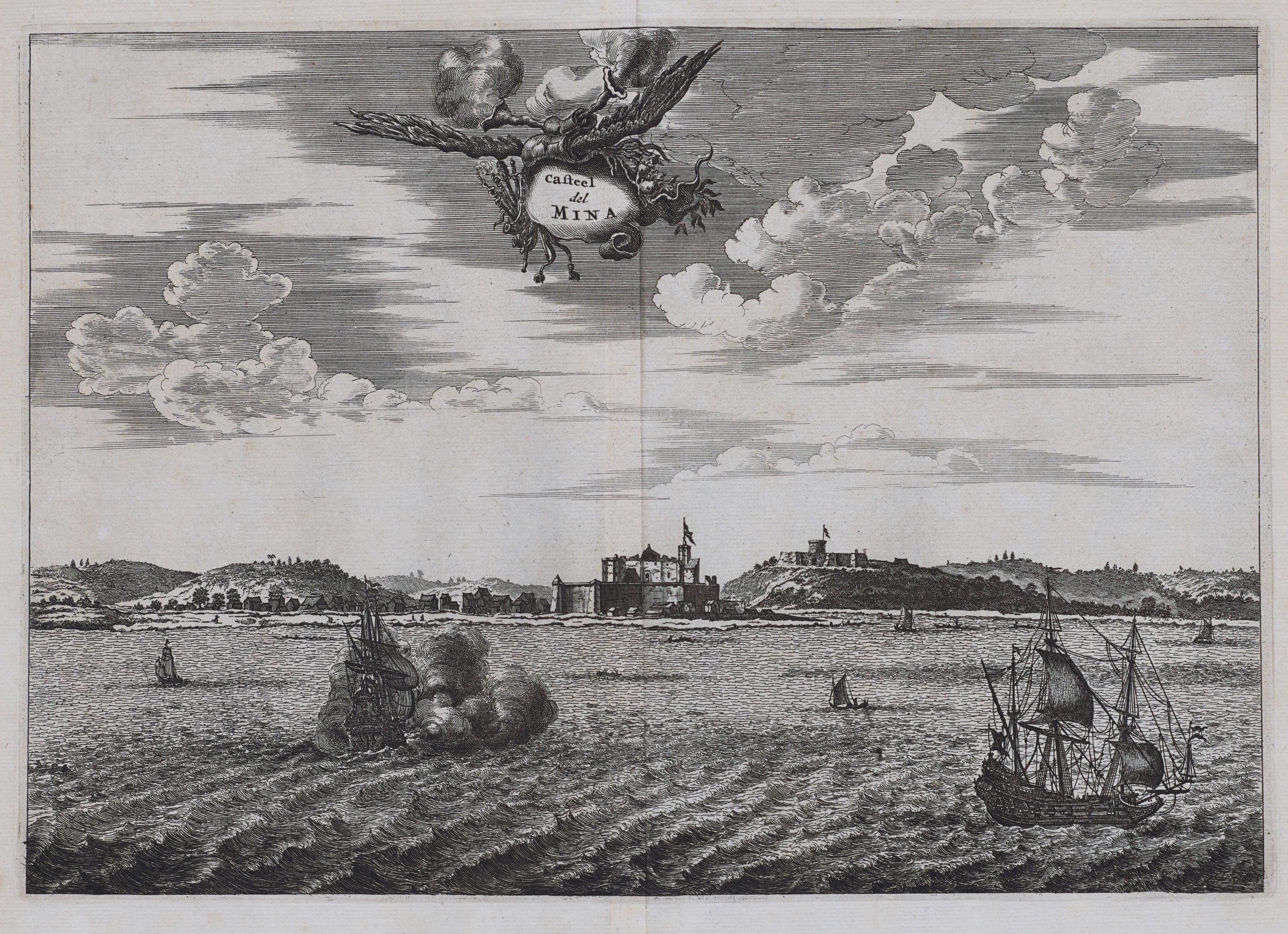
Elmina – Castel del Mina
by
Olfert Dapper and John Ogilby
Slave trade
Detail
Date of first edition: 1668 (by Olfert Dapper)
Date of this edition: 1670 (by John Ogilby)
Dimensions (not including margins): 23,5 x 32 cm
Condition: excellent. Sharp copper engraving printed on paper. Wide margins, good impression. The centre fold is as published. Hand coloured.
Condition rating: A
Verso: blank
Reference: Shirley, MABL, P. 765 T.Ogil-1a
From: Africa, 1670; translation of O. Dapper’s “Nauwkeurighe Beschrijvinghe er Afrikaensche Gewesten”, 1668
Price (without VAT, possibly to be added): €250,00 (FYI +/- $277,50 / £222,50)
Unless otherwise specifically stated on this map page, we charge the following expedition costs in euro (unfortunatelly, gone up with Covid, but still too low in reality!):
– Benelux: 40 euro
– Rest of Europe: 60 euro
– Rest of the World: 100 euro
In stock


Emina (Mina) and Ogilby
“Africa” was devised as a comprehensive guide to Africa – intended for a British readership – and includes maps, topographical engravings and narrative descriptions of the countries, provinces, peoples and customs of that continent. Very little of the information was original, as Ogilby compiled and translated it from a wide selection of pre-existing European sources.
As the fledgling British Empire developed in the 17th century, knowledge of foreign lands was becoming increasingly important to the nation. Ogilby was granted a royal warrant by King Charles II (1630 –1685) to publish “A Description of the Whole World”. Africa was the first volume in this series of ornate atlases; Atlas Japannensis (1670), America (1671), Atlas Chinensis (1671) and Asia (1673) followed.
Ogilby
John Ogilby’s work “Africa” is based on the Dutch publication of two years earlier, by Jacob Meurs of Olfert Dapper’s “Nauwkeurige Beschrijvinghe Der Afrikaensche…”. Using in main the same copperplate maps and views, this translation was the best English account of the continent at that time and was intended to be part of a series of atlases of all parts of the world, which, in fact, was never completed. The maps, with title cartouches supported by native figures, animals and so o, and the plates were finally engraved and represent evocative European perceptions of the regions as known during the seventeenth century.