


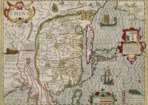
China, 1817
Detail
Date of first edition: 1817
Date of this map: 1817
Dimensions (not including margins): 36,5 x 50,2 cm
Dimensions (including margins): 54 x 71,5 cm
Condition: Very good. Strong paper. Good margins. Horizontal centre fold as published. Nice original colouring.
Condition rating: A+
Verso: blank
From: The New General Atlas, Edinburgh. Printed by George Ramsay and Company, for John Thomson and Company, Edinburgh; Baldwin, Cradock, and Joy, London; and John Cumming, Dublin. 1817.
In stock
John Thomson – The New General Atlas
John Thomson (1777-ca. 1840) was a commercial map publisher active in Edinburgh. He specialized in guide books and atlases and is primarily known for his Atlas of Scotland (1832) and the New General Atlas, first published in 1817 and reissued for the next quarter century. The New General Atlas was a commercial success—it was also published in Dublin and London—and it compiled existing geographic knowledge in compelling ways for a wide audience.
His Atlas of Scotland introduced new geographic information and was the first large-scale atlas of Scotland to be organized by county. It provided the most-accurate view of Scotland available before the Clearances. Work on the atlas began in 1820 and led to Thomson’s bankruptcy in 1830 due to the high costs of gathering the latest surveys and reviewing the required materials. Despite the publication of the atlas, Thomson declared bankruptcy again in 1835.
The New General Atlas, consisting of a series of geographical designs, on various projections, exhibiting the form and component parts of the globe; and a collection of maps and charts, delineating the natural and political divisions of the empires, kingdoms, and states in the World. Constructed from the best systematic works, and the most authentic voyages and travels. With a memoir of the progress of geography, a summary of physical geography, and a consulting index to facilitate the finding out of places.
The atlas consists of 74 maps; this China map is number 59. It is in a striking large format colored by provinces, showing towns, rivers, roads, the Grand Canal, islands, mountains, etc.
Related items
-
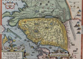
China Hondius/Janssonius
by Henricus Hondius, Johannes JanssoniusPrice (without VAT, possibly to be added): €3 000,00 / $3 330,00 / £2 670,00 -
China – China olim Sinarum regionis, nova descriptio
by Abraham OrteliusPrice (without VAT, possibly to be added): €4 500,00 / $4 995,00 / £4 005,00Ming China, the first Western map
You may also be interested in:

Bristol – Brightstowe, Vulgo; Quondam Venta, Florentissimum

Chart of the Gulf of Finland

Scotland – Nova Scotia
A nice map of Scotland
