Kyoto – Kioto
by
Kakuma Yamamoto
Detail
Date of first edition: 1873
Date of this map: probably after February 1877
Dimensions (not including margins): 30 x 41 cm
Condition: very good. some see-through
Condition rating: A+
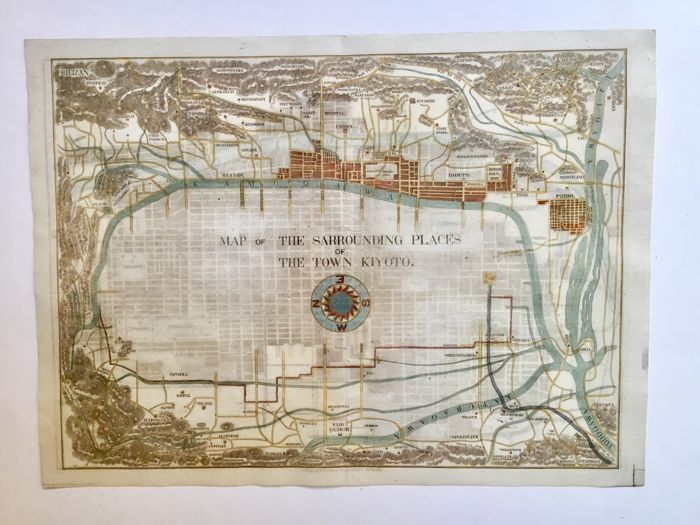
Verso: second map of Kyoto
Price (without VAT, possibly to be added): €800,00 (FYI +/- $888,00 / £712,00)
Unless otherwise specifically stated on this map page, we charge the following expedition costs in euro (unfortunatelly, gone up with Covid, but still too low in reality!):
– Benelux: 40 euro
– Rest of Europe: 60 euro
– Rest of the World: 100 euro
In stock

Emperor exile town
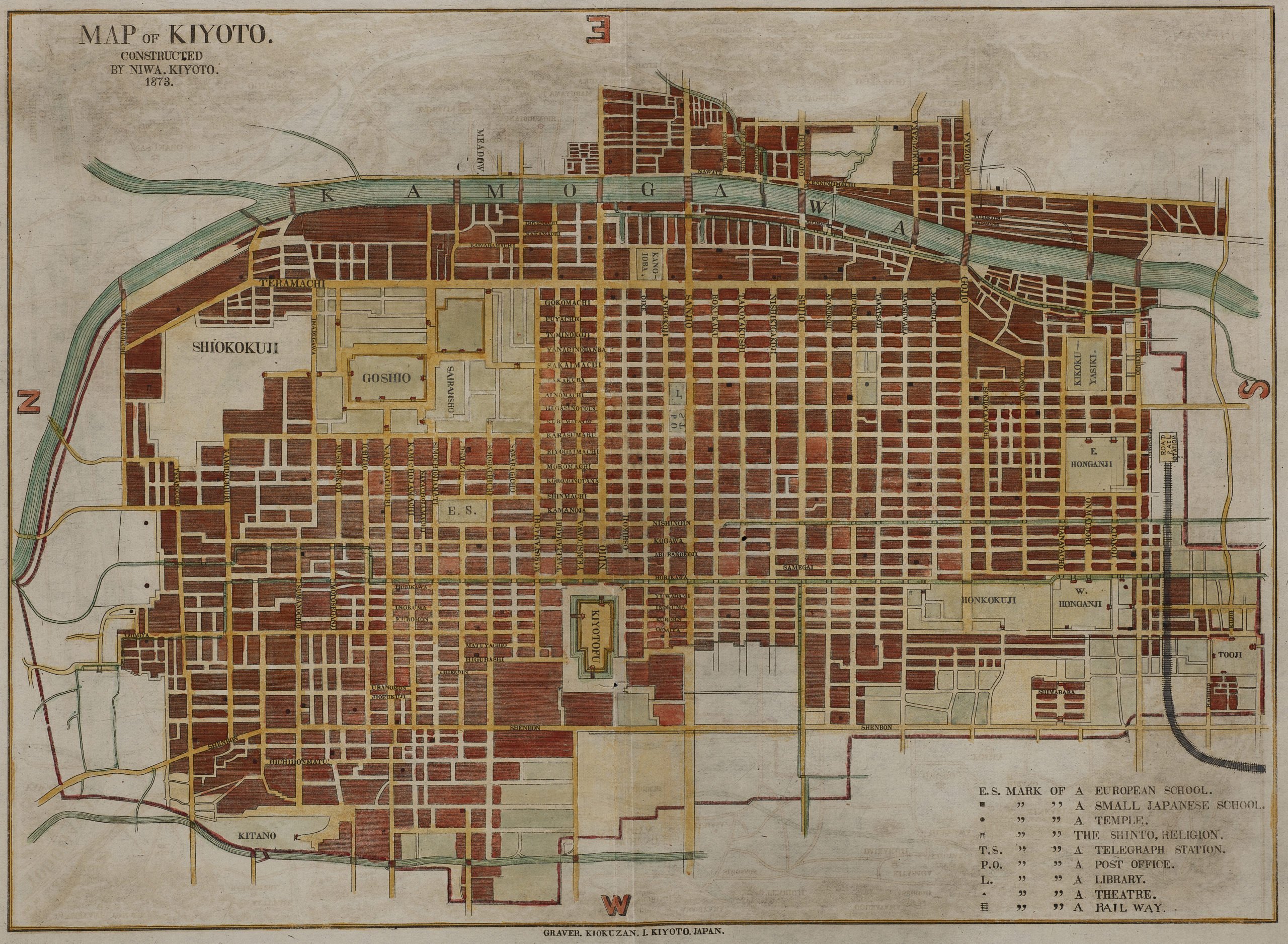
Rare 1st edition. One of the earliest known maps of Kyoto in English, published in Japan. This rare map provided one of the first views of the ancient Japanese capital of Kyoto to western travelers. Published by Niwa Publishing company, Japan in Meiji 6 – 1873.
Kakuma Yamamota (February 15, 1828 – December 28, 1892) was one of the last Japanese samurai of the late Edo period. After a period in imperial captivity he would become an important politician in the Meiji period. Meiji was the emperor who restored imperial power in Japan in 1867. In 1873 Yamamoto published gave an English-language work, entitled “Guide to the celebrated places in Kiyoto & the surrounding places for the foreign visitors”. This book contains one of the oldest western (since Japan was closed to foreign people!) maps of Kyoto. Kyoto was the exile refuge of the emperor for so many past centuries. Therefore, it currently is the most magnificent Japanese tourist site for western visitors. It contains so many temples, all in bicycling distance (the best vehicle to visit this superb city, with its narrow streets, where cars are not allowed). Moreover, for your car, you will not find any parking place close to any temple. As to its city metro: the stations are too wide spread out which makes the underground not an efficient means to admire its local holy places.
The green area (top left) marks the imperial garden and palace. Below you also find a picture of the world famous small stone garden of the Ryoan-Ji temple.By the time this map was made Mr. Kakuma Yamamoto was almost blind; therefore it is vely likely that his assistant Mr. Niwa had an important input in its production.
The date of the map must probably be after February 1877; as at that moment the railway station of the city was opened (middle right).