

Flandria, Brabantia and Holanda Nova – Low Countries – XVII Provinces
One of the oldest and rare maps of the region
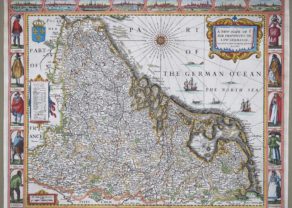
Detail
Date of the first edition: 1548
Date of this map: 1548
Dimensions (without margins): 17,5 x 13 cm
Dimensions (including margins): 21,5 x 16,5 cm
Condition: Good early copper engraving. Sufficient margins. Old professional restoration on right side.
Condition rating: A/B
Verso: text in Italian
From: Geografia di Claudio Ptolemeo Alexandrino
In stock
Gastaldi: Flandria, Brabant Holanda nova: the Low Countries
Nice example of Gastaldi’s modern map of the Low Countries and the East Coast of England (“Londra”), one of the earliest obtainable modern maps of the region, from Gastaldi’s Geografia di Claudio Ptolemeo Alexandrino . . . , published in Venice in 1548. One of the earliest maps of the region. Very detailed.
Giacomo Gastaldi is considered as the foremost Italian cartographer of the 16th century along with Paolo Forlani. From Piedmont, Gastaldi established his reputation in Venice and was cosmographer to the Republic of Venice. Gastaldi enjoyed a productive relationship with Giovanni Ramusio, Secretary of the Venice Senate, who used Gastaldi’s maps for his Navigationi et Viaggi. This map is from Gastaldi’s edition of Ptolemy, Ptolemeo. La Geografia…, begun as early as 1542 and published in Venice in 1548.
Later copied by Ruscelli.
Related items
You may also be interested in:

Chart of the Gulf of Finland

Antequera (Andalusia)

Scotland – Nova Scotia
A nice map of Scotland

Giacomo Gastaldi
Giacomo Gastaldi (1500-1566) is considered the foremost Italian cartographer of the sixteenth century, alongside Paolo Forlani. His skills of compilation are comparable to those of Mercator and Ortelius, yet much less is known of his life than of his two contemporaries. Gastaldi was born in Villafranca, Piedmont, but had established himself in Venice by 1539. He originally worked as an engineer, but turned to mapmaking from the 1540s onward.
It was in Venice where he made his reputation as an engraver, geographer, and cosmographer; for example, he was asked to fresco maps of Asia and Africa in the Palace of the Doge, or the Council of Ten, Venice’s governmental body. He also frequently consulted on projects for the Savi sopra la Laguna, drawing maps for this body which oversaw the regulation of fresh and salt water around Venice.
His contemporaries also recognized his skill, as he was named cosmographer to the Republic of Venice, was a member of the Accademia Veneziana, and was a major source for other geographers and mapmakers including Camocio, Bertelli, Cock, Luchini, and Ortelius. He even had his own distinct style of copper engraving that made him a pioneer in his day and makes his works iconic today.
Gastaldi enjoyed an especially productive relationship with Giovanni Battista Ramusio, Secretary of the Venetian Senate, who used Gastaldi’s maps for his famous travel account collection, Navigationi et Viaggi. Gastaldi also tutored Ramusio’s son in cosmography.