

South Scotland – Scotiae parts septentrionalis
by
Gerard Mercator, Jodocus Hondius Jr.
Detail
Date of first edition: 1595 (Gerard Mercator)
Date of this map: 1619 Jodocus Hondius II
Dimensions (without margins): 40,9 x 35,3 cm
Dimensions (including margins): 47 x 58 cm
Condition: Very good. Sharp copper impression. Original colouring. Professional repair to a minor separation long the centre fold. Wide margins.
Condition rating: A+
Verso: text in French
Map reference: Moir, p. 169; van der Krogt (Vol. I), 5802:1.1
From: Gerardi Mecatoris – Atlas sive Cosmographicae van der Krogt 1:113
Price (without VAT, possibly to be added): €500,00 (FYI +/- $555,00 / £445,00)
Unless otherwise specifically stated on this map page, we charge the following expedition costs in euro (unfortunatelly, gone up with Covid, but still too low in reality!):
– Benelux: 40 euro
– Rest of Europe: 60 euro
– Rest of the World: 100 euro
In stock
Related items


You may also be interested in:

Achaia, Attica and Gulf of Corinth
by
Johannes Janssonius
Price (without VAT, possibly to be added): €450,00 / $499,50 / £400,50

Lucca
by
Georg Braun and Frans Hogenberg
Price (without VAT, possibly to be added): €700,00 / $777,00 / £623,00

Jan Mayen – Insulae Johannis Mayen Cum universe situ Sinuum et Promontariorum
by
Johannes Janssonius, Joan Blaeu
Rare Spanish edition
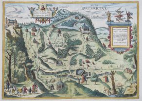
Kalwarya Zebrzydowska with Mons Calvariae (Krakow)
by
Georg Braun and Frans Hogenberg
Jodocus Hondius II and Scotland
This is the southern sheet of Hondius’ two sheet map of Scotland, which extends from the southern end of the Isle of Sky and the Hebrides down to the border of England. The map names Glasgow (Glasquo) and Edinburgh (Edyunburgh) and is filled with rivers, rugged mountains and many place names. Loch Ness is clearly indicated and left bottom lies Ireland. The Hebrides Islands are superbly delineated. Distances in Scottish miles.