


Provence – Provinciae Regionis Galliae
by
Abraham Ortelius
The prime tourist destination
Detail
Date of first edition: 1595
Date of this map: 1603
Dimensions (not including margins): 34,9 x 50,7 cm
Dimensions (including margins): 43,5 x 57,4 cm
Condition: Very good. Strong paper and wide margins. Original coloured.
Condition rating: A+
Verso: text in Latin
Map reference: Van den Broecke 47; Van der Krogt 3, 4700:31
From: Theatrum Orbis Terrarum; Van der Krogt 31:053, page 31 (verso)
Price (without VAT, possibly to be added): €800,00 (FYI +/- $888,00 / £712,00)
Unless otherwise specifically stated on this map page, we charge the following expedition costs in euro (unfortunatelly, gone up with Covid, but still too low in reality!):
– Benelux: 40 euro
– Rest of Europe: 60 euro
– Rest of the World: 100 euro
In stock
Related items

You may also be interested in:

Scotland – Nova Scotia
by
Willem and Joan Blaeu
Price (without VAT, possibly to be added): €1 000,00 / $1 110,00 / £890,00
A nice map of Scotland

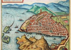
Antequera (Andalusia)
by
Georg Braun and Frans Hogenberg
Price (without VAT, possibly to be added): €475,00 / $527,25 / £422,75

China, Tartary and Japan
by
Lorenz Fries (after Martin Waldseemüller)
Price (without VAT, possibly to be added): €4 000,00 / $4 440,00 / £3 560,00
The first modern map of China printed in Europe

Chart of the Gulf of Finland
by
Lucas Janszoon Waghenaer
(Not) to understand a region’s history
The history and geography of the county Provence is a patchwork of constantly changing (close by or far away living) rulers of this region. Borders have been ever changing with the following persons in protagonist roles: the Count of Arles, the Count of Barcelona, the Duke of Toulouse, the King of Naples, the Duke of Anjou, and of course the king of France. Moreover, The western part of the region was temporarily under Papal authority (1309-1376), but constantly under treat was by Languedoc, with varying success.
Since 1486 the area was under the royal authority of Louis XI. But in the 16th century, the region became entangled in the Huguenot Wars. The area remained largely in Catholic hands. Prominently present are the Rhone Valley with delta and the River Durance cleaving through the county from the northeast. Just above Avignon in the east one notices “chasteu neuf”, giving its name to some delicious papal nectar.
The coastline, as shown here, runs from the Camargue in the west to the Var in the east. Further east lied the county of Nizza (Nice) which was between 1388 and 1860 connected to the Italian Piedmont-Sardinia.
Ortelius, who inserted this map in his Theatrum Orbis Terrarum from 1595, states Pierre-Jean Bompar as the cartographic source and alleged that he had published in 1591 a map of this region in 1591. One notices finally the scale bar indicates the distances in Provinçal, French and Italian miles.