


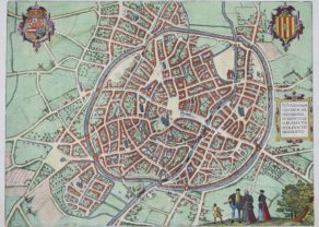
Gent – Gandavum
Rare view of the city without any walls
Detail
Date of first edition: 1572
Date of this map: 1577
Dimensions (not including margins): 33,5 x 41,2 cm
Condition: Excellent. Original colour. Strong print and clear image. Some browning and wear along margins. German text on verso.
Condition rating: A
Verso: text in German
Map reference: Taschen, Br. Hog., P. 72; Koeman (1967-70) B & H 1-5, NMM III, i, 459 (1573-1618 ed.), Introduction’, in: G. Braun and F. Hogenberg, Civitates orbis terrarum (Amsterdam: 1965) (2)
From: Civitates Orbis Terrarum, Liber primus
This item is sold
Gent commented in Taschen
Very desirable and early town-plan of Ghent. In lower left corner a numbered key (1-103). “The view of Ghent shows the city from the northwest in plan view from a great height. The historical core of the city occupies the peninsula between the two Rivers Schelde and Leie. The cathedral of Sint-Baafs (51) is almost at the very center of the map: it houses the famous Ghent Altarpiece painted by Hubert and Jan van Eyck. Together with the Gothic church of Sint-Niklaas (57) lower down and the nearby Sint-Jacobskerk (43), Sint-Baafs serves as one of the three main orientation points inside the city center. Within this triangle stands the 14th-century belfry (55), 118 m high, which forms part of the cloth hall. The former Sint-Baafs monastery lies somewhat outside the city center and is surrounded by fortifications and moats (103). Ghent, which is situated to the northwest of Brussels, derives its name from the Celtic ganda , meaning “confluence”. As a leading center of cloth production, in the High Middle Ages, Ghent rose to become a major power with a flourishing economy and together with Bruges was the most important center of commerce in Flanders. From the 13th to the middle of the 14th century Ghent was the second-largest city in northern Europe after Paris, with some 60,000 inhabitants, but in the second half of the 14th century these numbers began to decline. Flemish-speaking Ghent is today the third-largest city in Belgium, with a population of around 230,000.” (Taschen, Braun and Hogenberg, p.72.)
Related items
-
Mechelen – Nitidissimae Civitatis Mechlineensis…
by Georg Braun and Frans HogenbergPrice (without VAT, possibly to be added): €500,00 / $555,00 / £445,00 -
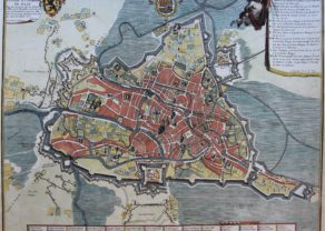
Gent – Plan de la ville et citadelle de Gand
by Eugène-Henri FricxPrice (without VAT, possibly to be added): €1 850,00 / $2 053,50 / £1 646,50 -
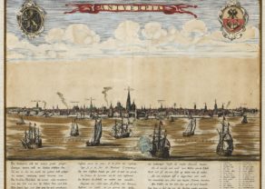
Antwerpen – Antverpia
by C(lement?) de JonghePrice (without VAT, possibly to be added): €2 000,00 / $2 220,00 / £1 780,00A unique view
-
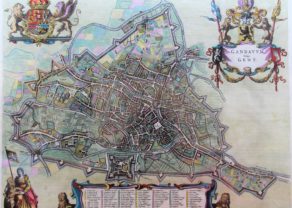
Gent – Gandavum vulgo Gent
by Joan BlaeuPrice (without VAT, possibly to be added): €2 500,00 / $2 775,00 / £2 225,00ON HOLD
You may also be interested in:

Map of the Moon – Tabula Selenographica in qua Lunarium
The unique and famous first comparative chart of the Moon (with double competing nomenclature) from which the names of many lunar features have been derived.

Cuzco (Inca capital)
Rare first edition (block destroyed by fire)

Algiers – Algerii Saracenaorum Urbis Fortissimae…

[Untitled] Japan
Very rare: oldest map of Japan, and … based on Polo’s description
Gent, a revolutionary city
In 1537 Ghent refused a petition by the regent Mary of Hungary (1530-1555) in support of the wars of Emperor Charles V against France. On February 14, 1540 the emperor came with a large army to Ghent to precipitate this revolt. After he succeeded, he forced the nobles of the city to walk barefoot in front him with a noose around their necks. Since then called Ghent sling carriers.
For this map it is interesting to notice that the ramparts of the town had also been demolished by the emperor as a sign of humiliation. The debris was reused for the construction of the so-called Spanjaardkasteel (castle of the Spanish; top center). This was a part of the former St Bavo’s Abbey and the so-called Saint Bavo Village. The castle was finished in 1545 and accommodated 2,000 men. This state of city is represented by Braun and Hogenberg without walls but with occupancy castle. It is a rare view in the Braun and Hogenberg atlas: a city of that size without any walls.
In the forthcoming war Ghent will repeatedly set the stage for events and battles: