


Hainaut – Nobilis Hannoniae Com Descriptio
With two inset views of the towns “Mons” and “Valenchiennes” and costumed figures: “Hannonii”.
Detail
Date of first edition: 1617
Date of this edition: 1617
Dimensions (not including margins): 36,5 x 47,5 cm
Dimensions (including margins): 39,5 x 53,7 cm
Condition: Very good. Sharp copper engraving printed on paper. Centre fold as published. Superb old colouring. Natural age-toning. Good margins.
Condition rating: A+
Verso: text in Latin
Map reference: van der Krogt III, 3320:364
From: Petri Kaerii Germania Inferior id est, XVII Provinciarum ejus novae et exactae Tabulae Geographicae, cum Luculentis Singularum descriptionibus additis. à Petro Montano. Amsterdam, Pieter van den Keere, 1617. Engraver was Jacques de Surhon. Koeman Kee1; van der Krogt III,364:01: verso ’51’ and ’52’
In stock
Related items
-
Valenciennes – Valentiana
by Joan BlaeuPrice (without VAT, possibly to be added): €380,00 / $421,80 / £338,20 -
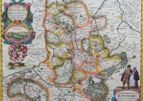
Limbourg (Limburg) – Limburgenses Ducatus…
by Petrus KaeriusPrice (without VAT, possibly to be added): €1 800,00 / $1 998,00 / £1 602,00With inset of the city of Limbourg
-
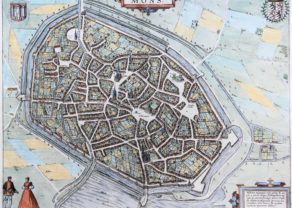
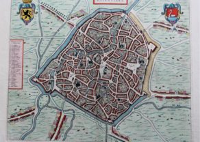
Mons
by Georg Braun and Frans HogenbergPrice (without VAT, possibly to be added): €420,00 / $466,20 / £373,80
You may also be interested in:

Avignon
Papal city²

The Eastern Hemisphere – Hemisphaerium Orbis Antiqui

Chester – Cestria vulgo Chester, Angliae Civitas

Van der Keere or Kaerius
Van der Keere’s atlas of the Low Countries (Germania Inferior) is one of the landmark regional atlases of the early 17th century, with the maps engraved by himself. The atlas contains the famous Leo Belgicus map.
He would go on to do significant work for John Speed and a number of other map makers in the first part of the 17th century.