


London
The only one and most exclusive (oldest) map of London
Detail
Date of first edition: 1572
Date of this map: 1575
Dimensions (not including margins): 32,5 x 48 cm
Condition: Very good. One in a kind: 25 years waited to finally purchase this map! Nice colouring. Natural age-toning. Previous small and professional repair at left edge of margin.
Condition rating: A+
Verso: text in Latin
Map reference: Van der Krogt, IV-2,1 2433
From Civitates Orbis Terrarum, volume I; Van der Krogt, IV-2,1 41:1, page A “té recensent”
This item is sold
Shakespearean London
A remarkable map thought to be the earliest surviving entire city plan of the Elizabethan capital, believed to have been first printed in 1572. It is a stunning decorative map, offering a glimpse of the then geography of the city of London. Notable features from the piece comprise the Tower of London, the Charterhouse monastery, the Old St. Paul’s Cathedral, a bear baiting arena and even local wildlife. Presenting the city in a way very similar to how Shakespeare would have known it, the plan is embellished with illustrations of costumes and coats of arms from the Elizabethan era. The map was originally part of a large collection of maps, an atlas edited by the Köln cleric George Braun and drafted by the Mechelen (in Flanders) cartographer Frans Hogenberg. Hogenberg had just fled the religious wars in the Netherlands and arrived in Köln.
A very desirable and early plan of London, shown from the Tower to Westminster, with the City already built-up and a ribbon development westwards along the Strand. On the south bank bull and bear-baiting rings are prominent. The rare intermediate state with Westmester changed to Westmunster and the Royal Exchange not inserted.
Full title: Londonium Ferracissimi Angliae Regn Metropolis
Related items
-
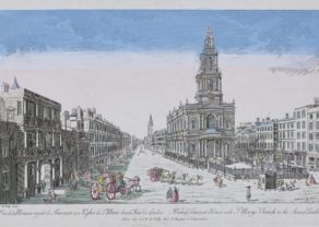
Sommerset Palace and Church of Saint Mary (Strand, London) – Vue de la Maison royale de Sommerset avec l’Eglise de S. Marie dans le Strand a Londres
by N.J.B. de PoillyPrice (without VAT, possibly to be added): €550,00 / $610,50 / £489,50 -
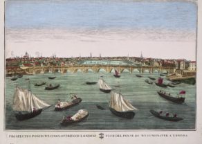
Westminster Bridge
by N.N.Price (without VAT, possibly to be added): €500,00 / $555,00 / £445,00 -
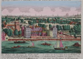
Lambeth Palace – Der Pallast oder Residenz des Erzbischoffs von Canterbury ganandt Lambeth, an der Themse zu London. . .
by Académie Impériale (Augsburg)Price (without VAT, possibly to be added): €650,00 / $721,50 / £578,50Rare in this condition
-
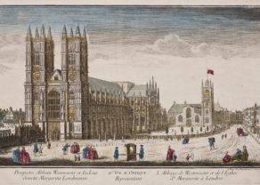
Westminster Abbey – Prospectus Abbatu Westminster
by François DaumontPrice (without VAT, possibly to be added): €500,00 / $555,00 / £445,00
You may also be interested in:

San Adrian (Navarre) – La Sierra de Sant Adrian en Biscaia

Michiel de Ruyter, a super collection by Stoopendaal
Maybe the greatest admiral of all times

Lisbon

The oldest map of town: the London of William Shakespeare
England, the newcomer to the 16th century superpowers.
This famous map was copied from a wall map with 15 sheets from 1559 which Georg Braun saw with his patron, Heinrich Suderman, head of the Hanseatic league, a group of northwestern European trading cities. German Hanseatic merchants in London could have ordered this map. Hence the text in the cartouche bottom left which is consecrated to them. Or maybe also to please Queen Mary in her support against the trade association the “London League” led by Thomas Gresham.
In the middle of the Thames one can admire the Royal Barge. The Roman walls of the city are clearly visible in the east leading to the castle of the Tower. The main road straight north is the current Bishopsgate. West outside the city dominates the white triangular square of Smithfield, known for its trade and slaughter of animals. St. Paul still has still its steeple, which was burned down in 1561 (so not through by the Great Fire of 2-5 September 1666). The bridge is London Bridge is also there: said to be a first river crossing in Roman times. It will remain the only bridge west of Kingston, until Putney Bridge was built in 1729. Crossing was made possible via several ferries. Strand linking the City to Charing Cross (now Trafalgar Square) is crammed with the London residences of the rural nobleness: from left to right the houses Suffolk, Savoy, Somerset and Arundel.
At the mouth of River Fleet shines palace Bridewell of Henry VIII which was also largely destroyed by the Great Fire. The second (northern) east-west connection in town is High Holborn. On Whitehall (between Charing Cross and Westminster Abbey) we still see the gates of the old St. James’s palace James.
South of the river lies Southwark district: full of fun with bars, theaters, brothels and two animal rings for playing and fighting with bears and dogs. The rings are not yet the Globe (of Shakespeare; this comes a few decades later). Far left and south of the river is Lambeth Palace, the London residence of the Archbishop of Canterbury. There are two states of this map: first in 1572 and second in 1574 with the name West Munster and the new Royal Exchange in 1571.