
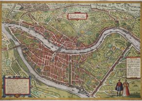
Lille – Lille Insula Ryssele
Detail
Date of first edition: 1581-1588
Date of this map: 1581-1588
Dimensions (not including margins): 33 x 43 cm
Condition: Excellent. Strong image with lovely soft original colours and wide margins. Centre fold as published.
Condition rating: A+
Verso: text in Latin
Map reference: Taschen, Br. Hog., p. 221; Van der Krogt 4, 2344
From: Civitates Orbis Terrarum, Liber tertius. Köln, G. Kempen, 1581-88. (Koeman, B&H3)
In stock
Description
COMMENTARY BY BRAUN: “A river with its source in Lens in Artois flows alongside the city wall, where the palace is also situated. […] Lille was founded in the year 1007 by Baudouin Barbatus, Count of Flanders, his son had the imposing church of St Peter erected. There is also a well-fortified castle in the city, which was formerly the seat of the magistrate and the mayor, and which was at the disposal of the lord who governed Flanders in the name of the king of France. Lille is effectively the capital and sovereign of all Welsch Flanders.”
Lille belonged to the French-speaking part of the County of Flanders, whose mayor was appointed directly by the king of France. In 1384 it passed to the House of Burgundy and became one of the primary residences of the Burgundian dukes, who commissioned the building of a new palace beside the River Deule. In 1477 Lille passed to the Habsburgs and in 1555 became part of the Spanish Netherlands. In the 17th century the face of the cloth-weaving city changed substantially as a result of wars and the citadel-like designs of Sébastien Le Prestre Marquis de Vauban. The present view therefore has an important documentary value, however, the churches of Saint-Maurice and Sainte-Cathérine continue to form part of the cityscape. (Taschen)
This very detailed plan shows accurately the town with its streets, places, churches and squares. Decorated with 2 coats of arms, figures in the foreground and a title cartouche. From Braun & Hogenberg’s Civitatus Orbis Terrarum, the most important book of town plans and views published in the 16th Century.
Related items
-
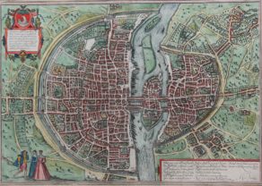
Paris – Lutetia
by Georg Braun and Frans HogenbergPrice (without VAT, possibly to be added): €2 800,00 / $3 108,00 / £2 492,00Paris s’éveille
-
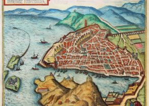
Marseille
by Georg Braun and Frans HogenbergPrice (without VAT, possibly to be added): €700,00 / $777,00 / £623,00 -
Lyon – Lugdunum
by Georg Braun and Frans HogenbergAt the confluence of Rosne and Saone
You may also be interested in:

Asia Secunda pars Terrae in Forma Pegasi

Jan Mayen – Insulae Johannis Mayen Cum universe situ Sinuum et Promontariorum
Rare Spanish edition

Avignon
Papal city²

Michiel de Ruyter, a super collection by Stoopendaal
Maybe the greatest admiral of all times