


Livonia
by
Jodocus Hondius Jr., Gerard Mercator
Detail
Date of first edition: 1595 (made by Gerard Mercator)
Date of this map: 1619 (published by Jodocus Hondius jr.)
Dimensions (not including margins): 36,5 x 46,5 cm
Dimensions (including margins): 46,7 x 56,9
Condition: Very good. Old colouring. Centre fold as published. Strong paper and wide margins.
Condition rating: A+
Verso: text in French
Map reference: Van der Krogt 1, 1710:1A.
From: Gerardi Mercatoris – Atlas sive Cosmographicae Meditationes de Fabrica Mundi et Fabricati Figura. Sumptibus & typis aeneis Iudoci Hondij, Amsterodami An. D. 1619. French edition. Van der Krogt 1, 113
Price (without VAT, possibly to be added): €800,00 (FYI +/- $888,00 / £712,00)
Unless otherwise specifically stated on this map page, we charge the following expedition costs in euro (unfortunatelly, gone up with Covid, but still too low in reality!):
– Benelux: 40 euro
– Rest of Europe: 60 euro
– Rest of the World: 100 euro
In stock
Related items
You may also be interested in:

Veere – Vere
by
Ludovico Guicciardini
Price (without VAT, possibly to be added): €420,00 / $466,20 / £373,80

[Untitled] Japan
by
Benedetto Bordone
Price (without VAT, possibly to be added): €2 800,00 / $3 108,00 / £2 492,00
Very rare: oldest map of Japan, and … based on Polo’s description

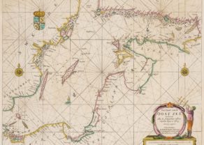
Chart of the Gulf of Finland
by
Lucas Janszoon Waghenaer

San Adrian (Navarre) – La Sierra de Sant Adrian en Biscaia
by
Georg Braun and Frans Hogenberg
Price (without VAT, possibly to be added): €700,00 / $777,00 / £623,00
Livonia: lost in history
“Lyflandt” refers to the Livonians who lived around the Gulf of Riga. Their territory, Livonia, more or less corresponds with Estonia and Latvia. This area was early 13th century violently Christianized by the Livonian Brothers of the Sword. The history of this region is marked by numerous wars, both internally and externally, with changing rulers. Between 1416 and 1561 Livonian Confederation was a loose confederation. After the Livonian War (1558-1582) which ended in Russian defeat, the area was divided among the victors: Estonia, the northern part became a Swedish duchy. Denmark kept the island Osel. The rest came under the Polish-Lithuanian Commonwealth. The coloring of this map incorrectly suggests a former administrative unit. The borders with Russia and Lithuania have remained stable over the centuries. The Livonians were gradually “absorbed” by the Latvians; the Livonian language also disappeared. The former major cities Revel (Tallinn) and Riga are the current capitals of Estonia and Latvia.
At the edges of the map one notices Stockholm (top left) and Memel (now Klaipeda; bottom of frame)). The large Lake Peipus to the east now forms the border between Estonia and Russia. Mercator included this map (scale 1: 700,000) to his atlas of 1595.
He based himself for information on David Chytraeus, a German historian.
This example comes from the French edition of Mercator-Hondius atlas from 1619 until 1628. Then Henricus Hondius will replace it by a newer version. Reduced maps of this region can be found in the Atlas minor by Hondius-Janssonius and in the Atlas of Cloppenburgh. Already in 1573 had Ortelius produced a smaller map of this area in his Theatrum Orbis Terrarum. Later Janssonius and Blaeu will issue a folio map of Livonia.