Menu
Cartes-à-figures, a short-lived fashion promoted by Blaeu and Hondius
Date: 10/06/2020
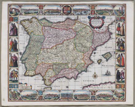
In the 17th century, maps became baroque inspired in line with the general “Zeitgeist”: embellishments on the edges or on small insets with people and animals became countless. After all, the wealthy bourgeoisie was the eager target clientele. The “cartes-à-figures” are a typical Dutch cartographic exponent of this new fashion: maps (depicting a wider region, continent or even the world) were decorated on all or more sides with small images, either of the main cities or of the local population in national costume. These maps satisfied the ultimate desire of the rich to obtain the finest of the finest.
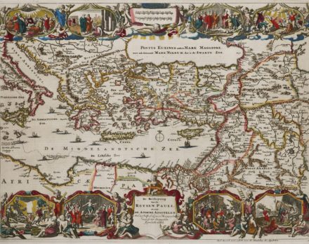
Ortelius already included border decoration in some of his maps. In 1579 he decorated the map of Paul’s travels with only illustrations at the top. Cartes-à-figures became very popular in bibles and religious works:
Soon thereafter, in 1590, he decorated all borders with mini sights of the life of Patriarch Abraham; the map showed the journeys of the Abraham. But it is only with Jodocus Hondius that this art form began to lead a life of its own. He took a timid start with miniature maps of England, France and the Netherlands from 1590 and 1591.
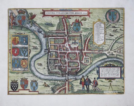
The map decoration was relegated to the map borders in order not to detract from the actual contents of the map. A more rigorous approach was developed, in which the decorative elements were related directly to the map area involved. Town plans and views, combined with costumed figures of natives characteristic for the map area, were the most sought after subject matter for the decorative borders. Many maps of Braun and Hogenberg’s Civitates Orbis Terrarum show local people not in a border framework, but on the foreground of a town view.
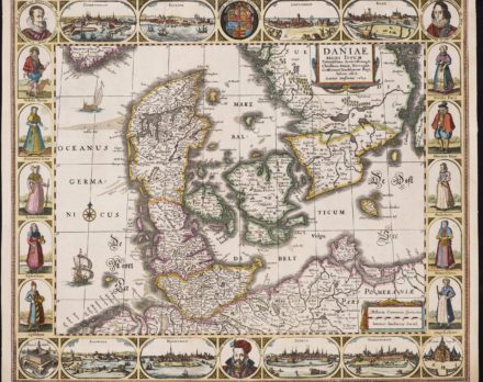
Figures are most often anonymous. Sometimes the local rules are depicted: on his carte-à-figures map of Denmark Janssonius inserted the portraits of King Christian IV, his son prince Frederick and the scientist Tycho Brahe:
However, probably the most famous example is the incorporation of Abraham Ortelius and Joris Hoegnagel by Hogenberg in some Italian city views. Both Flemish cartographers had visited Italy in 1578.
It is noteworthy that this cartographic expression was mainly practiced in Amsterdam between 1600 and 1630 and logically mainly by its top notch cartographers such as Hondius, Kaerius, Willem Blaeu or Claes Jansz Visscher. For the latter, to read more on the rare map of the Peloponnesus shown in the banner, click on the hyperlink. Even though that the map makers could call upon a large stock of their existing prints, they still commissioned well-known artists to produce more fashionable designs.
In terms of content, it is striking that, apart from the world and continent maps, the cartes-à-figures were rather limited to maps that represent European countries and regions.
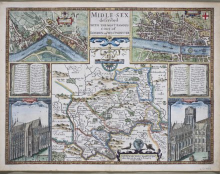
John Speed made Jodocus Hondius engrave his county maps. This resulted in a series of surprising beauties with coats of arms of the hundreds and insets of the key towns of each county. In this case the cities of Westminster and London are shown as well as their cathedrals: Saint Peter’s and Saint Paul’s.
Cartes-à-figures can be sober:
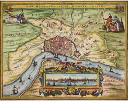
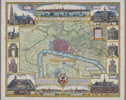
Or abundant, even baroque on the same area, the Marquisate of Antwerp
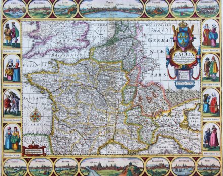
It is always interesting to find out which cities the cartographer selected to appear as “figures”. In this case Janssonus chose for: Cales, Poictiers, Lion, Paris (central position), Vienne, Orleans, Orleans, Montpelier, Tours, Bourges, Angiers, Roan (central position), Blaumont, Rochele, Bloys. And doing so he dismissed to picture Marseille, Toulouse, Bordeaux, Nantes and Rennes.
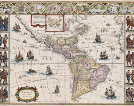
Most known, though, is the competition between the mapmaking families of Blaeu and Hondius to produce the ultimate cartes-à-figures. They made entire sets of maps including the world and the four continents:
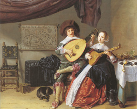
The genre was so popular that it was adopted in the production of large wall maps. Due to their artistic character, several wall maps with figure edges were included in several paintings. For example, Jan Miense Molenaer included in his painting “The Duet” a carte-a-figures by Petrus Kaerius of Italy from 1616. A large wall map by Jodocus Hondius of Holland from 1607 was included in the painting “A morning in Delft” by Cornelis de Man; and Dirck Hals’ “The Music Making Company” from 1633 contains carte-à-figures of Asia, produced by Jodocus Hondius.
The most complete reference work on folio-sized Dutch carte-à-figures maps is volume VI of “Monumenta Cartographica Neerlandica”, by Prof. Guenter Schilder and Prof. Klaus Stopp.
For some more fine examples, click:
- San Adrian (Navarre) by Braun and Hogenberg
- Toledo by Braun and Hogenberg
- Salzburg by Ortelius
- Franconia by Janssonius
- Constantinople by Braun and Hogenberg
- South America by Hondius
- Jerusalem by Stoopendaal
- Copenhagen, Kronborg, Oresund by Homann
- Jerusalem by van Adrichem
- Constellations of southern hemisphere by Doppelmayr