


Geografia dell’ Africa by Sanuto, facsimile with commentary
A nice working tool on the 16th century mapping of Africa
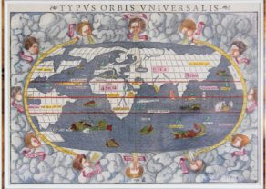
Detail
Geografia dell’ Africa, 1588
Date of original publication: 1588, Venice, D. Zenaro
Date of facsimile: 1965
Introduction in English R.A. Skelton
Reproduction of maps at courtesy Messers Francis Edwards Ltd, London
Publisher: nv Theatrum Orbis Terrarum, Amsterdam
Dimensions: 32,8 x 45 x 3,8 cm
B/W pictures of the maps
Condition: Very good, Imit. h.calf, gilt lettered on spine
Condition: A
12 b./w. double-page maps
Pages: 146 pp. (Italian text only)
Language: text of atlas maps in Italian
Original title: Geografia dell’ Africa
This item is sold
The Geografia dell ‘Africa and Livio Sanuto
Livio Sanuto (1520-1576) was the son of an eminent Venetian senator. At an early age he became interested in cosmography. His training is entirely unknown, but he became an eminent maker of scientific instruments and globes, working in association with his brother Giulio, before becoming interested in maps.
He had started to write a universal geography, his goal was to describe all the continents and map them, as well as to create an atlas of the world, but only a small part was done. When he died around 1576, only the part devoted to Africa was completed, and Giulio as well as Saraceni, his friend, were able to engrave all the maps and to publish the work at the end in 1588.
The atlas (Geografia dell ‘Africa) contained 12 maps (engravings) provided with numerous comments. Overall, it comprises 147 pages, which were in the same convenient format supported by publisher and map supplier Antonio Lafreri (1512-1577), applied for the first time since his publications. The accuracy of the Sanuto maps (for all the inaccuracies and errors of the time) also impresses, even after centuries the 12 large copper engraved maps can be considered masterpieces of 16th century Italian cartography.
The twelve full sheet maps comprise a general map of the continent, and eleven regional maps, numbered ‘I’ to ‘XII’ clockwise round Africa, starting at Cape Verde. An interesting feature of the maps us that many of the names are created using punch letters, stamped into the printing plate, as an alternative to individually engraving each letter by hand. Five sets of punches seem to have been used, for different sizes of letter. This is one of the last appearances of maps lettered in this way.
Related items
You may also be interested in:

San Adrian (Navarre) – La Sierra de Sant Adrian en Biscaia

Asia Secunda pars Terrae in Forma Pegasi

Antequera (Andalusia)

[Untitled] Japan
Very rare: oldest map of Japan, and … based on Polo’s description