Bethune, Aire-sur-Lys and Thérouanne – Bethune, Aire Belgice Arien and Teroana
by
Joan Blaeu
Detail
Date of first edition: 1764
Date of this map: 1649
Dimensions (not including margins): 53 x 42,3 cm
Dimensions (with margins): 61,4 x 51,4 cm
Condition: Very good copper engraving with original colouring on strong paper with wide margins.
Condition rating: A
Verso: text in Latin
From: Novum Ac Magnum Theatrum Urbium Belgicae. (= “Stedeboeck”) Amsterdam, J. Blaeu, 1649. Koeman, Bl63
Price (without VAT, possibly to be added): €400,00 (FYI +/- $444,00 / £356,00)
Unless otherwise specifically stated on this map page, we charge the following expedition costs in euro (unfortunatelly, gone up with Covid, but still too low in reality!):
– Benelux: 40 euro
– Rest of Europe: 60 euro
– Rest of the World: 100 euro
In stock
Related items
-

Watten – Plan du Fort de Watten
by Joan BlaeuPrice (without VAT, possibly to be added): €250,00 / $277,50 / £222,50 -

Valenciennes – Valentiana
by Joan BlaeuPrice (without VAT, possibly to be added): €380,00 / $421,80 / £338,20 -

Arras – Atrebatum, Gallis ARRAS Belgice ATRECHT dictu
by Joan BlaeuPrice (without VAT, possibly to be added): €370,00 / $410,70 / £329,30
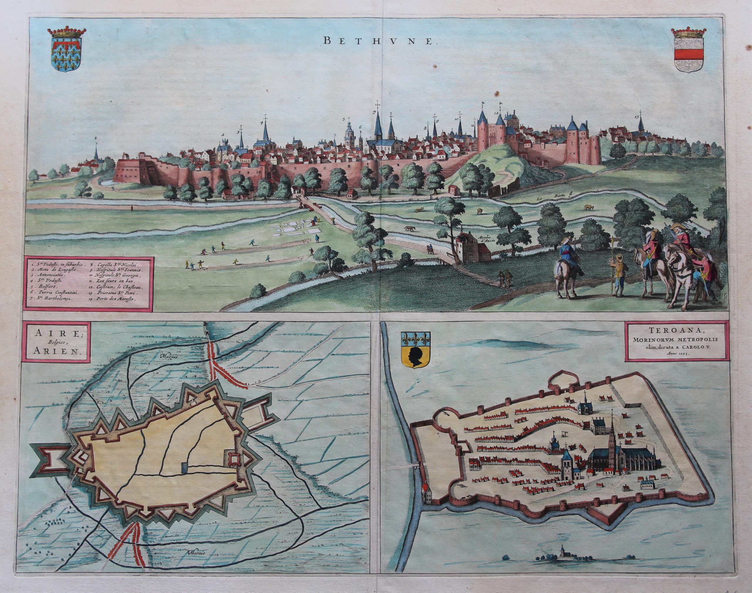

Béthune,with Belfry,constructed in 1346. On the map,n°5.
Aire-sur-la Lys was separated from the County of Flanders and attached to the County of Artois in 1196. Subsequently it was ruled by the Burgundians and then by the Spanish. The town was besieged in 1676 by Vauban (under King Louis XIV) and retaken for France, although it remained a Spanish possession until 14 April 1713, when, by the Treaty of Utrecht it finally became a part of France.
Thérouanne was at the time of the Gauls, Tarwanna or Tervanna was the capital of the Belgian tribe of the Morini. After the Romans conquered Gaul, they too made the city the capital of the Civitas Morinorum district. Around 639 Saint Audomar (Saint Omer) established the bishopric of Terwaan or Terenburg, the diocese of Thérouanne, which during the Middle Ages controlled a large part of the left bank of the river Scheldt. Territorially it was part of the county of Artois which belonged to the county of Flanders. Thanks to that ecclesiastical control of some of the most prosperous cities north of the Alps, like Arras and Ypres, the bishopric was able to build a cathedral which was at the time the largest in France. The town was captured by the Emperor Maximilian and Henry VIII from the French in 1513 after the battle of the Spurs. In 1553 Charles V besieged Thérouanne, then a French enclave in the Holy Roman Empire.