


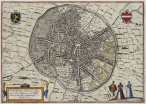
Brussels, 1575
Detail
Date of first map: 1572
Date of this map: 1575
Dimensions (without margins): 36,5 x 47,5 cm
Dimensions (including margins): 40,8 x 53,8 cm
Condition: Excellent copper engraving. Centre fold as published. Strong print and clear image.
Condition rating: A+
Verso: text in Latin [recto with Dutch key to the numbers]
Map reference: Van der Krogt 4, 670.2; Taschen, Braun and Hogenberg, p.70
From: Civitates Orbis Terrarum, Liber Primus, Van der Krogt [second state] 41,1 page 14; 1575 version has last line on verso: ‘natrix… est’
This item is sold
Brussels commented by Braun
“Brussels, the noblest city in all Brabant, was chosen by the kings as their seat because it has springs that always flow, uplifting hills and healthy air and is very splendid to behold. […] The royal palace, which lies on a hill with a chapel, was built by Emperor Charles V and is no small embellishment for the city, because there the lords of the Golden Fleece and the councillors meet for joint deliberations with the Governor. […] A waterway was dug from Brussels in a miraculous manner, at great expense and with a great deal of work, for the benefit of locals and strangers. […] The canal is over five German miles long. It was begun in 1550 and completed in 1561 to the great admiration of all.”
TRANSLATION OF CARTOUCHE TEXT: Brussels is a very well-known city due to its large number of courtiers, its copious springs, the magnificence of its princely court and its town hall and many other things. And as Ausonius says of his Burdegala: rich with a mild climate and well-irrigated soil. The inhabitants, particularly the women, display their riches through their dress. The most magnificent church is St Gudula’s, still distinguished by its college of canons (according to Ha. Barlandus).
Tachen on Brussels
This plan view from a bird’s-eye perspective shows an idealized, almost circular view of the city. The picture is dominated on the one hand by the wide streets and the city wall ringed by a moat, and on the other by the navigable River Senne, which enabled ships to dock inside the city using the canal network. Brussels received its charter in 1312 and as early as 1357 built an extensive city wall, enclosing fields and tracts of land within it. When the Dukes of Brabant chose Brussels as their seat of government in 1383, the population had apparently already reached 50,000. At the start of the 15th century the dukes constructed their palace (17). Brussels experienced its greatest flowering from 1430 under Philip the Good: the Hôtel de Ville (51) was built on the Grande Place and artists and craftsmen, manuscript illuminators, sculptors and goldsmiths settled in the city. Pieter Breughel the Elder lived and worked here and in 1569 was burried in Notre-Dame-de-la-Chapelle.
The engraving is made after a plan from Guicciardini (1567), some topographical details may derive from a sketch by Jacob van Deventer (c. 1550).
Related items
-
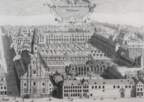
Brussels (Jesuit college)
by Antoon SanderusPrice (without VAT, possibly to be added): €450,00 / $499,50 / £400,50 -
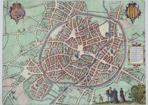
Leuven – Lovanium, Brabanticarum urbium caput…
by Georg Braun and Frans HogenbergPrice (without VAT, possibly to be added): €900,00 / $999,00 / £801,00 -
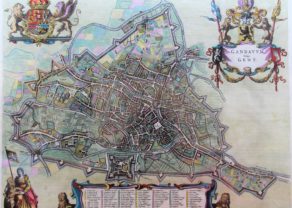
Gent – Gandavum vulgo Gent
by Joan BlaeuPrice (without VAT, possibly to be added): €2 500,00 / $2 775,00 / £2 225,00ON HOLD -
Mechelen – Nitidissimae Civitatis Mechlineensis…
by Georg Braun and Frans HogenbergPrice (without VAT, possibly to be added): €500,00 / $555,00 / £445,00
You may also be interested in:

Chart of the Gulf of Finland

San Adrian (Navarre) – La Sierra de Sant Adrian en Biscaia

Asia Secunda pars Terrae in Forma Pegasi

[Untitled] Japan
Very rare: oldest map of Japan, and … based on Polo’s description